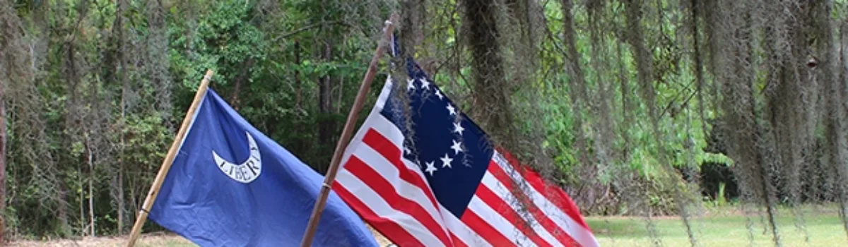
“Keep the World Humming” ~ Kazoo Museum & Factory

Who knew a small pocket-sized instrument that you hum, talk, or make noise into would make a huge impact on American culture. While it’s unclear how the Kazoo came to fruition in the 1800’s, they did precisely that. There are so many theories that they run amok, but you can learn all about this impactful instrument at the Kazoo Museum & Factory.


Photographed by Keelie Robinson


Located in Beaufort, SC The Kazoo Museum & Factory is one of two Kazoo factories still in existence in the United States. They are open Monday to Friday from 9:00am to 5:00pm with tours running at 10:00am, 11:00am, 1:00pm, and 2:00pm. The museum is free to the public and the tour price ranges.


Photographed by Keelie Robinson


Upon entering the museum, it is surprising to see so many Kazoos and displays which offer interesting facts, trivia, and history.


Photographed by Keelie Robinson


Here you will find one of the original 1884 Kazoos and a Kookie Kombo One band, Marx 1960.


Photographed by Keelie Robinson


A tour is a must when visiting. It begins with a video highlighting the kazoo and then moves onto a demonstration of kazoos through history, movies, and more.


Photograph from thekazoofactory.com

As the tour continues you go behind the scenes and catch a glimpse of their production line.


Photographed by Keelie Robinson


Fun fact: the factory produces 5,000 kazoos a day and 1,000,000 a year 😯.


Photographed by Keelie Robinson


As you complete the tour you get a shot at making your very own kazoo! There are 14 enticing body and cap colors. So, you get to choose the correct combination for you! Then you will be given the resonator, the third and final assembly piece. Without this your kazoo would not make that trademark sound we are all accustomed to. After using one of their pneumatic capping machines, you will have a fully built kazoo that will last you a lifetime!


Video by Keelie Robinson


Also, their gift shop has any accessory needed to turn your kazoo into a Wazoo, Kazoogle, Wazoogle, or an electric kazoo. The possibilities are endless!


Photographed by Keelie Robinson


Visit this nostalgic museum and factory to see what makes it NATURALLY AMAZING!


Historic Port Royal Foundation Museum

Tucked away in a tiny corner of Port Royal is the Historic Port Royal Foundation and Museum. This quaint little place is full of history and wonder.

Historic Port Royal Foundation and Museum
Photography by Keelie Robinson

The museum structure has resided in its current location since 2017. It was once located in Yemassee, SC and operated as a feed store. Previous museum locations include the Scheper Store, Jernigan House, and Union Church.

Historic Port Royal Foundation and Museum
Photography by Keelie Robinson

The Port Royal Historic Foundation started out as the Port Royal Bicentennial Historical Committee (PRBHC) in 1976. The PRBHC was charged with planning and implementing the 1976 Bicentennial celebration of Port Royal. They also set about establishing how to preserve Port Royal’s historical data. Once the Bicentennial celebration was over, the PRBHC transformed into the Port Royal Historic Foundation in 1977.


Port Royal Bicentennial Historical Committee
Photography by Keelie Robinson

As you step inside don’t be fooled by its size. There is a lot to learn and explore and you will find all things Port Royal.


Historic Port Royal Foundation and Museum
Photography by Keelie Robinson

Their exhibits range from the history of Port Royal to the natural ecology of the area. And, there are many new and exciting exhibits to come.


Historic Port Royal Foundation and Museum
Photography by Keelie Robinson

You will find history centered around seafood harvesting in the surrounding creeks and rivers.


Historic Port Royal Foundation and Museum
Photography by Keelie Robinson


On display are fossils and artifacts that were found in and around Port Royal. You’ll find Megalodon teeth, projectile points, and even fossilized whale ear drums!

Fossils and Artifacts at Historic Port Royal Foundation and Museum
Photography by Keelie Robinson

The Port Royal Foundation and Museum has big plans for upcoming exhibits. In November 2022 they will have an Indigenous exhibit and a mini exhibit about the Marine Corp. In February 2023 they will have a lecture series with geologist Will Doar, from Charleston, who will discuss the Port Royal sinkholes and how they create the Cypress Wetlands.


Historic Port Royal Foundation and Museum
Photography by Keelie Robinson

The Port Royal Foundation and Museum has a very extensive photo and document collection and they are working hard to get it all digitized.  Also, here’s good news teachers!  They welcome field trips!

Historic Port Royal Foundation and Museum
Photography by Keelie Robinson

Come discover this NATURALLY AMAZING museum in Port Royal.


Get Away from the Everyday: Little Hunting Island

Hunting Island State Park is the perfect get away from the everyday. No matter if you go there to camp, stay in their cabin, or visit for a day.  All your cares will disappear.


Hunting Island State Park
Photography: Keelie Robinson

I recently did just that! I spent an afternoon walking a small portion of their Little Hunting Island and it did not disappoint!

As I trekked this amazing landscape, I found myself not knowing where to look.

I was dropped off by boat from Fripp inlet and started my expedition. Immediately, I was astonished by the sand rippling over the beach and it abruptly transported me to another realm. Watching the wind and sand renewed my spirit and made me think “What else does this island have in store for me?”


rippling sand on Hunting Island
Video: Keelie Robinson

I looked up from the sandy phenomenon and spotted a Loggerhead sea turtle nest. I slowly meandered over and marveled at the care that is taken to protect our state reptile. Precautions were put in place in 1978 as Loggerhead sea turtles became classified as threatened, and thus were protected under the Endangered Species Act of 1973.


loggerhead sea turtle nest
Photography: Keelie Robinson

Continuing my expedition, I headed north. In the distance I could see the “Boneyard”. The once mighty but now sun and wind bleached trees stand as sentinels of times long ago.


boneyard hunting island
Photography: Keelie Robinson

I looked around as Mother Ocean nonchalantly creeped in to reclaim what is hers.


hunting island boneyard
Video: Keelie Robinson

The mighty sentinels standing in her way entertained a waltz as her waves crash into them.


Photography: Keelie Robinson

I walked a little further and heard a chirping melody. As I looked up I spotted, in a lonely tree, a distinctive stick nest being tended by a mating pair of Ospreys.


mating ospreys on hunting island
Photography: Keelie Robinson

I turned and spied a squadron of pelicans flying in formation like the Marine Corps Air Station pilots of nearby Beaufort.


squadron of pelicans on hunting island
Video: Keelie Robinson

I started walking back and was surprised even more by the setting sun over the lagoon and the maze of trees I had to traverse.

sunset over lagoon on hunting island
Photography: Keelie Robinson

Again, Mother Ocean dazzled me as she continued her leisurely traipse inland.


Photography: Keelie Robinson

Another sea turtle nest caught my eye.


sea turtle nest on hunting island
Photography: Keelie Robinson

Alas, my boat awaits.


fripp inlet on hunting island
Photography: Keelie Robinson

Anchors away.


Photography: Keelie Robinson

Little Hunting Island was created naturally by hurricanes Matthew and Irma. The breach of the ocean caused this section to be cut off from the main island. It is accessible by the Nature Center Scenic Trail (0.7 miles) that connects with the Little Hunting Island Loop Trail (0.5 miles) or Breach Trail (0.2 miles).


South carolina state parks map
Image: South Carolina State Parks

This Lowcountry island’s beauty and serenity is NATURALLY AMAZING.


Read More

South Carolina Lowcountry: What is it all about?

What is the meaning of Lowcountry? Merriam Webster defines it as “a low-lying country or region especiallythe part of a southern state extending from the seacoast inland to the fall line.” South Carolinians define it as a geographical location and cultural mindset.  But for me… It is more than that!

It’s Beaufort, Colleton, Hampton, and Jasper, the four counties that make up the SC Lowcountry Tourism area. These four counties offer a myriad of unbelievable experiences for all.

On any given day in lowcountry you can:


Take a walk under the old oak trees covered in Spanish moss.

oak trees covered in spanish moss
(Photography: Lowcountry Tourism Commission)


Feel the sand between your toes as you enjoy our gorgeous beaches.

child playing on beach with bubbles
(Photography: Lowcountry Tourism Commission)


Pedal your way around our lush naturescapes.

bike through sc lowcountry
(Photography: Lowcountry Tourism Commission)


Soak up some history at one of our many museums, former plantations, or historical churches and structures.

historical churches of sc lowcountry
(Photography: Keelie Robinson)


Become one with nature as you spy an alligator, deer, or Great Blue Heron paddling down a lazy Lowcountry river.

kayaker on lowcountry river
(Photography: Lowcountry Tourism Commission)


Stroll along our beaches as you scavenge for shark teeth.

shark teeth found in sc lowcountry
(Photography: Lowcountry Tourism Commission)


Immerse yourself in the hunt for the next big fish.

fisherman in sc lowcountry
(Photography: Lowcountry Tourism Commission)


Step off the beaten path to find our numerous hidden gems.

sunset in sc lowcountry
(Photography: Lowcountry Tourism Commission)


Window shop our local boutiques and stores.

shopping in boutiques of sc lowcountry
(Photography: Lowcountry Tourism Commission)


Spy an array of birds in our Wildlife Refuges and Wildlife Management Areas

bird watchers in sc lowcountry
(Photography: Lowcountry Tourism Commission)

Meander along our waterfront parks.

water front park in sc lowcountry
(Photography: Lowcountry Tourism Commission)


Savor a bounty of renowned local cuisine fresh from the sea and our nearby farms.

fresh local food in sc lowcountry
(Photography: Lowcountry Tourism Commission)


Unwind and relax as you revel in a lowcountry sunset.

couple relaxing sc lowcountry
(Photography: Lowcountry Tourism Commission)


Welcome our lowcountry culture into your heart and mind as you are transported back in time.

culture of sc lowcountry
(Photography: Lowcountry Tourism Commission)

Come along and we’ll explore this region, south of Charleston and north of Savannah, to find what makes the SC Lowcountry NATURALLY AMAZING!


Read More

Lowcountry Tabby Construction

Beaufort and its surrounding sea islands are home to the largest number of tabby structures in America. Early settlers in this coastal region built structures from materials that were readily available. Oyster shells were abundant along the shorelines. Wood was available in the forests. They were both put to good use.

Tabby is a type of early concrete that is made from mixing lime, sand, and oyster shells. The oyster shells were burned and mixed with sand and lime, then poured into forms to create walls and foundations that can still be seen in Beaufort today. Bricks were also formed from tabby and used for all manners of construction.

Beaufort’s sea wall was made from tabby. The exact date of the sea wall is undetermined. It was built to protect the low-lying area from high tides.

Fort Frederick was built by the British in 1730 to protect Beaufort’s Port Royal Sound. It was constructed of tabby. This is the oldest example of tabby in the country.  The fort is preserved as the Fort Frederick Heritage Preserve and can be visited.

Tabby Manse, located on Bay Street is made from tabby walls that are two-feet thick. The Beaufort Arsenal is also made of tabby, but it is protected under layers of stucco. Originally built in 1795, the arsenal was rebuilt in 1852 and renovated in 1934. It is now the Beaufort Visitor Center and Museum.

St Helena’s Episcopal Church cemetery is surrounded by tabby walls. Many of the family plots are surrounded by smaller tabby enclosures. The church was constructed in 1842.

Many of the buildings along Bay Street were constructed using tabby. The foundation of the John Mark Verdier House is one example. Built in 1804, tabby construction can be seen on the first floor. The house is open as a museum. There’s an example of exposed tabby between two buildings in an alley on Bay Street that gives a close-up view of the materials that are combined to create the structure around 1760.

Beaufort County’s Old Sheldon Church Ruins show an example of tabby used as stucco to cover bricks. Built in 1751, the church was burned during the Revolutionary War, rebuilt, then dismantled after the Civil War.

Located on St. Helena Island, the Chapel of Ease is an excellent example of exposed tabby construction. Built in the mid 1700s, the tabby and brick is all that remains of a church that served the families of the island plantations. After the Civil War the church was used to educate freedmen. The church was destroyed by fire in 1886.

Edisto Island’s Botany Bay Wildlife Management Area is the home to the tabby ruins of Bleak Hall Plantation. Three Gothic Revival buildings are all that exist of the once sprawling plantation. A white, wooden ice house was constructed on a tabby foundation. A gardener’s shed and tabby barn also remain. Botany Bay WMA is open to the public.

Daufuskie Island’s Haig Point tabby ruins are among some of the best examples of tabby constructed slave quarters remaining in Beaufort County. Built around 1826, three of the best-preserved tabby walled, single slave dwellings are protected in the Haig Point development.

The Stoney-Baynard Plantation Ruins can be found in Sea Pines Plantation. Ruins of the tabby plantation house and the foundations of two slave cabins can be visited, along with the kitchen chimney. The house was built around 1840 and destroyed by fire in 1867.

All that remains of Fish Hall Plantation is three standing chimneys from slave cabins. This tabby is a little different. It contains clam shells in addition to oyster shells. Fish haul Plantation was built in 1762. The property was captured by Union forces during the Civil War and a portion was given to former c=slaves to develop the town of Mitchelville, the nation’s first freedmen’s village.

Sea Wall – Bay Street between Carteret and New Streets
Ft. Frederick – 601 Old Fort Road, Beaufort
Tabby Manse – Bay Street, Beaufort
Beaufort Arsenal – 713 Craven Street, Beaufort
St. Helena’s Episcopal Church 505 Church Street, Beaufort
John Mark Verdier House – 801 Bay Street, Beaufort
Alley Tabby – 715 Bay Street, Beaufort
Old Sheldon Church Ruins – Old Sheldon Road, Yemassee
St. Helena Chapel of Ease – 17 Lands End Road, St. Helena Island
Bleak Hall Plantation Tabby Ruins – 1066 Botany Bay Rd, Botany Bay WMA, Edisto Island
Haig Point – Daufuskie Island
Stoney-Baynard Plantation Ruins – 87 Plantation Drive, Sea Pines Plantation, Hilton Head Island
Fish Haul Plantation Ruins – 70 Baygall Road, Hilton Head Island

Read More

Beaufort’s Reconstruction Era National Historical Park

Park rangers share their knowledge at the park’s visitor center. Photo by the Post & Courier.

Did you know Beaufort was home to the Reconstruction Era National Historical Park? It is only fitting that it is found in Beaufort, because that is where freedom from slavery began in the south! The Emancipation Proclamation was first read in the South on January 1, 1863, at Camp Saxton, just a stone’s throw away from Beaufort in Port Royal. During the Civil War the US military occupied Beaufort as a command center for east coast operations. Many of the historic homes and churches were used as offices, hospitals, and quarters. Many churches were converted into schools for the newly freed. Some of these homes were bought by former slaves at tax auctions.

Park rangers lead tours at the Penn Center’s Darrah Hall. Photo by Jenny Kendrick.

The Reconstruction Era lasted from 1861 to 1877. During this important time four million newly freed African Americans sought to integrate themselves into a free society. They contributed to the educational, economic, and political life of Beaufort. This process began as the Port Royal Experiment. After the Battle of Port Royal more than 10,000 slaves were left behind when the white population fled the area. Schools were established to leach reading, writing, and other life skills. Many joined the US Army and trained at Camp Saxton, the very place where they heard the Emancipation Proclamation.

The Reconstruction Era National Historical Park is comprised of three main locations, along with three park partners that aid in telling the story of the Port Royal Experiment, which helped formerly enslaved people become self-sufficient. In addition to being a group of historic sites in and around Beaufort, it tells the story of what happened after the Civil War as newly freed African Americans and the nation struggled toward reconciliation. The park consists of historic sites that were instrumental in the Reconstruction Era of Beaufort. Penn Center’s Darrah Hall and Brick Baptist Church on St. Helena Island, Camp Saxton and the Pinckney-Porters Chapel in Port Royal join the Old Beaufort Firehouse to tell the story of Reconstruction.

The Reconstruction Era National Historical Park Visitor Center can be found in the Old Beaufort Firehouse, 706 Craven Street. The visitor center contains displays and artwork that depict the struggle of the formerly enslaved people and their and ascension to citizenship. The center also houses information about the other sites and their importance in the history.

Darrah Hall and the Brick Baptist Church can be found on the grounds of St. Helena Island’s Penn Center. The Penn School was established in 1862 as the first school in the south for former slaves. Quaker and Unitarian missionaries from Pennsylvania founded the school and taught classes. Early classes were held in the Brick Baptist Church, which was built in 1855 by the very slaves that would later learn to read and write within its walls. Careful examination of the bricks reveals handprints from the enslaved artists who formed the bricks from clay.

Darrah Hall image by Charleston Currents.

Darrah Hall is the oldest building on the campus of the Penn Center. It was built by Penn School specifically for community use. It has been a gathering place for the community for over 100 years. This building, along with others on the property represents the development of the center through the 19th and 20th centuries. The hall is used for interpretive purposes by the park, as well as for community events.

Camp Saxton was founded on the site of Fort Frederick, a pre-Revolutionary War fort that was abandoned and absorbed into Smith Plantation. On New Year’s Day in 1863, the Emancipation Proclamation was read aloud here to 10,000 former slaves. After the Proclamation was read, the 1st South Carolina Volunteers was formed. This all-black regiment trained at Camp Saxton from 1862 to 1863. The site is preserved as the Fort Frederick Heritage Preserve. The tabby fort was originally built by the British in the 1730s. During the Civil War a bridge was built across its walls to serve as a dock to welcome former slaves to the reading of the Emancipation Proclamation.

Pinckney Porter Chapel is a Reconstruction-Era Freedman’s Chapel that was restored and moved to Port Royal’s Naval Heritage Park. The chapel houses temporary exhibits and Camp Saxton programs begin at the site. The chapel is, in part, named for Senator Clemente Pinckney who served as pastor to the church from 1996-1998. Senator Pinckney was gunned down while serving as a pastor for Charleston’s Mother Emanuel AME Church in 2015. Pinckney was a beloved native of Ridgeland and served as a South Carolina state senator for Beaufort County. The chapel is open on Saturday mornings and park rangers are available to answer questions.

Reconstruction Era National Historical Park Visitor Center – 706 Craven Street, Beaufort
Brick Baptist Church – 85 Martin Luther King Drive, St Helena Island
Darrah Hall & Penn Center – 16 Penn Center Cir E, St Helena Island
Camp Saxton – 601 Old Fort Road, Port Royal
Pinckney-Porters Chapel – Naval Heritage Park, Pinckney Street, Port Royal

Read More

Beaufort & the Port Royal Experiment

A new beginning

This image celebrated Emancipation Day as it was seen at Beaufort’s Ft. Frederick, also known as Camp Saxton.

The Port Royal Experiment started just seven months after the first shots of the Civil War were heard. Beaufort and its sea islands were occupied by the Union Army by November 7, 1861, thus freeing its slaves.  Beaufort quickly became the epicenter for Reconstruction after Confederate soldiers and plantation owners fled the area, leaving 200 sea island plantations and 10,000 slaves abandoned. Having no resources or direction, former slaves looked to the Union Army for support. Union officials oversaw the harvesting of approximately 90,000 pounds of cotton by the newly freed men and women. Workers were paid $1 for every 400 pounds harvested. This was the first time newly freed slaves earned wages for their hard work. Frederick Law Olmstead was the executive secretary of the US Sanitary Commission. He felt it was necessary for the Union to, “Train or educate them in a few simple, essential, and fundamental social duties of free men in civilized life.” Olmstead was a famous landscape architect who would go on to design Central Park, Niagara Reservation at Niagara Falls, Biltmore Estate, and many other prestigious grounds. The Port Royal Experiment was an essential plan that offered newly freed slaves an education and a chance to work and live independently of white control. The freedmen’s Bureau was established to help former slaves succeed in their new way of life.

At the suggestion of General Sherman, the US Congress confiscated a strip of coastal land from Charleston to Florida. President Abraham Lincoln issued new land distribution policies that saw 40,000 acres of this land divided between freed families. They were allowed to purchase up to 40 acres of land for $1.25 per acre. Excess army mules were redistributed to the new property owners. It is thought that this was the origin of the slogan “40 acres and a mule.” White northerners were also allowed to buy land, creating tenant farming.

Hilton Head Island’s Fish Hall Plantation became the site of Mitchelville. This image was taken in 1862 by Henry Moore.

By January of 1862 Union General Thomas W. Sherman requested teachers to instruct the freed men, women, and children. Later that year, the Port Royal Experiment began. This radical program created schools and hospitals for the freedmen. It also allowed them to purchase and run abandoned plantations. 53 missionaries from the New England Freedmen’s Aid Society volunteered during this humanitarian crisis. Skilled teachers, ministers and doctors travelled south to teach life skills and religious studies. Two pivotal initiatives that paved the way for Reconstruction were begun in the Lowcountry – Mitchelville and Penn School.

Freedmen gather at Penn School to learn to read and write along with other skills.

Laura Towne was dispatched from Pennsylvania with funds to create the Penn School, one of the largest schools created during the experiment. She and fellow educator Ellen Murray established an educational mission on St. Helena Island called Penn School. This was the first school for former slaves of the sea islands. The first classes were held at Oak Plantation, then when enrollment increased, they moved to Brick Church. A school was built adjacent to the church and a complex developed around it which served as a center for the St. Helena Island Gullah community. Along with teaching literacy, the school provided training for midwives, a health care clinic, and the state’s first day care center for black children.

Rev. Jesse Jackson; Joan Baez; Ira Sandperl; Dr. Martin Luther King, Jr.; and Dora McDonald on the Penn Center campus in 1964. Photo credit: Bob Fitch

The Penn Center took on a new role during the Civil Rights Movement of the 1960s. In those days there were only a handful of safe havens for black leaders to gather. Civil Rights activists, including Martin Luther King, Jr. spent a significant amount of time on the Penn Center campus. Dr. King and other influential civil rights activists were able to meet and strategize on the beautiful campus. The spot also served as a retreat for the Southern Christian Leadership Conference. The Penn Center campus was designated a National Historic Monument in 1974. The center is still a vital part of the community. History and culture are preserved in the center’s museum, outreach programs and educational experiences.

The community of Mitchelville was planned and built in 1862.

The wartime Department of the South was headquartered on Hilton Head Island. Union General Ormsby Mitchel granted Hilton Head freedmen permission to develop the town of Mitchelville in 1862. This was the creation of the first all-black, self-governing community in the country. Government and missionary efforts provided blacks of Mitchelville with education, religion and promoted self-reliance. While learning new skills, the citizens of Mitchelville were able to thrive and continue their Gullah customs and culture.  By 1865 Mitchelville had 1,500 inhabitants. They built the First African Baptist Church. Homes were built on quarter-acre lots, where the new inhabitants could grow produce in their own gardens.  General Mitchel died from yellow fever, just six weeks after arriving in Mitchelville.

Freedwomen and children began a new way of life in Mitchelville.

Mitchelville became a fully functioning town, complete with a mayor, councilmen, a treasurer, and other officers who oversaw every aspect of the town. The town boasted three churches, two schools, a store, cotton gin and grist mill. Mitchelville also passed the first compulsory education law in the state, requiring all children between 6 and 15 to be educated in school. The town stretched over 200 acres along the shore of the Atlantic. The major source of employment was the US Army Headquarters. After the war, jobs disappeared with the withdrawal of the US Army. This sent freedmen away from Mitchelville in pursuit of employment. The property that Mitchelville occupied was returned to the previous owners during the Johnson administration. They chose to sell the land to anyone that was interested in purchasing, including former Mitchelville citizens. Most of the land was bought by Freedman March Gardner. The land was later divided amongst heirs and the town no longer appeared on maps by the early 20th century. Most of the land was eventually sold to the Hilton Head Company and placed on the National Register of Historic Places in 1988. The site is preserved as the Historic Mitchelville Freedom Park. The park serves as a Reconstruction Era heritage site. The park features exhibits, signature events and guided tours.

Freedmen harvest cotton.

The death of Abraham Lincoln on April 15,1865 ended the momentum for the Port Royal Experiment. President Andrew Johnson worked to restore all lands to their previous owners. Many freedmen that bought land witnessed it returned to its former owners. Sharecropping quickly began to creep onto the scene. Not all black landowners lost their land. Many were able to retain ownership of their purchased properties because they were not reclaimed by the previous owners. By 1868, the Freedmen’s Bureau was completely dismantled. Momentum for the Port Royal Experiment began to diminish with the new administration. The Reconstruction Era ended in 1877. Although it was a brief period in American history, it marked a significant chapter in the history of civil rights in the United States.

Read More

Fort Frederick Heritage Preserve

The date was January 1, 1863, when former enslaved Beaufortonians crossed over into Fort Frederick from Port Royal, Beaufort, and the surrounding sea islands to hear the first reading of the Emancipation Proclamation in the southern states. This event marked the most dynamic occurrence in the fort’s 289-year history.

Fort Frederick was built by the British colonial government between 1733 and 1735. It is the oldest surviving tabby fort in South Carolina and the oldest tabby structure in Beaufort County. Tabby was a building material used in the early days of the coastal south. Sand, lime, oyster shells and water were burned and mixed to form an early version of concrete. Tabby was poured into molds to form foundations, walls, columns, and blocks. Examples of tabby can still be seen all throughout the historic district of Beaufort. Even the city’s sea wall is made from tabby.

Fort Frederick was established after the Yemassee War in Port Royal to protect against possible attacks by the Spanish. It also served as an outpost to signal “Beaufort Town” of approaching ships. The fort remained active until 1758. The small 75-ft by 125 ft fort contained barracks, a powder magazine and gun platforms. It was located along the Beaufort River behind a parapet with a battery of guns protecting the river and town of Beaufort.

British Regulars were posted at the fort, but luckily never saw attack. A larger, stronger fort was established just upriver, and Fort Frederick was abandoned.  The deserted fort fell into disrepair and wouldn’t see use again until 1861. Union Colonel Thomas Wentworth Higginson brought activity back to the fort site after the Battle of Port Royal. After the historic reading of the Emancipation Proclamation, newly freed citizens were given the opportunity to enlist in the Union Army. He and his new regiment of black soldiers used the property as headquarters. The site was named Camp Saxon, after General Rufus Saxon, commander of the Beaufort District.

Before the start of the Civil War, Fort Frederick was absorbed into the Smith Plantation. Parts of the tabby structure were used as a dock for boats serving the plantation. During Beaufort’s “Great Skedaddle” Smith’s Plantation was abandoned, and the Union troops moved in. Colonel Higginson and his new soldiers would become the African American 1st South Carolina Regiment of Volunteers. Together they listened to the first reading of the Emancipation in the center of a crowd which was estimated well into the thousands. In 1863 the fort and its surrounding plantation land were sold for non-payment of $93.40 in back taxes. The US government purchased the property for $1,000.00. Part of this site was developed into the US Naval Hospital in 1949.

Image from the SC Department of Natural Resources.

Archaeologists with the South Carolina Department of Natural Resources and the Institute of Anthropology and Archaeology at the University of South Carolina excavated the site in 2014 to inventory the grounds. They also rebuilt the remaining tabby walls to give visitors a more complete image of what the fort once looked like. This work also protected the remaining tabby material. A portion of the structure is underwater today due to the river changing course.

The South Carolina Department of Natural Resources and Beaufort County now maintain the area as the Fort Frederick Heritage Preserve. The six-acre park is a mix of hardwood forest, maritime forest, and salt marshes on the Beaufort River. Located at 601 Old Fort Road in Port Royal, the preserve is open to the public daily, from dawn to dusk. The preserve includes a public access point, parking area and picnic pavilion, as well as the tabby fort ruins.

Read More

Auldbrass Plantation

Auldbrass view toward the pool. Image by Anthony Peres.

Nestled amongst the live oaks and cypress swamps of the Combahee River sits a unique treasure. Hidden from passersby, this lovely jewel is only open for tours one weekend, every other year. The legendary architect Frank Lloyd Wright designed only one plantation during his legendary career. Luckily for us, it sits just outside the town of Yemassee.

Image by CBS Sunday Morning.

“Auldbrass” was established in 1938. Over 4,000 acres from Old Brass, Mount Alexander, Richfield, Old Combahee, and Charlton plantations were combined and given to C. Leigh Stevens (from Michigan) for reorganizing the Savannah River Lumber Company. In 1939 Stevens commissioned Wright to envision and design a self-sufficient, modern plantation for farming, hunting and entertaining. Wright called on his principles of organic architecture to design a complex that would exist in harmony with its surrounding Lowcountry landscape. Wright, not being a fan of the more traditional right angle, designed walls to slope at an 80 degree, to mimic the live oaks on the property. He also looked to the property’s cypress trees for inspiration for exterior siding. Wright named this complex Auldbrass.

Image found on Pinterest.

Initial drawings and plans of the house and complex were finished by 1940. Hexagonal shapes and inward sloping walls, with low lying ceilings were the theme. By 1941 the farm buildings were nearly completed, and the main house was in the beginning stages. Work was halted in 1942 due to World War II and shortages of supplies.

An example of the copper Spanish moss-inspired downspout can be found near the pool.
Image by Ed Forgotson.

Wright’s plans included a low-lying complex of geometric pavilions, outbuildings, stables and kennels. The main house was supplemented with multiple guest cottages and service quarters. Plans also included a swimming pool, laundry, and bath houses for the staff. Decorative motifs inspired by local flora compliment the design. A great example of this can be seen in the down spouts designed to resemble Spanish moss. The downspouts were not realized until the 1980s because WWII caused a shortage of building materials. By 1946 Stevens was ready to resume construction. He moved into the completed caretaker’s cottage to oversee construction. Very little was done between 1946-1948 because Stevens began guest lecturing at Harvard Business School. Frank Lloyd Wright died in 1959, the Stevens followed in 1962. Neither saw the project completed.

Image found on the Island Packet.

Stevens’ daughter Jessica Loring took over ownership of Auldbrass in 1971. She and her husband managed the estate and produced corn and soybeans. They made extensive repairs to the buildings with their profits. They also replaced the roof, upgraded the mechanical systems and eliminated changes made to Wright’s original designs. By this time visitors became curious about the plantation. Jessica and her husband welcomed them in and gave tours. The Lorings also did something very important for the property. They nominated Auldbrass for the National Register of Historic Places. By 1979 the Lorings were ready to sell the property.

Image by Anthony Peres.

The cost of upkeep was more than they were able to accomplish. The Boise Cascade Timber Company purchased the property, except the Old Combahee tract, which they retained for themselves. Westvaco quickly bought the property, selling the buildings and a small tract of land to local hunters. Unfortunately, they could not manage the buildings and they quickly fell into disrepair. Beaufort County Open Land Trust became involved with the property. It was decided to place an easement on the property and sell at a drastically reduced price.

Bluebird Cottage image by Ed Forgotson.

Hollywood producer Joel Silver purchased the property in 1987. Silver had long been a fan of Wright’s architecture. He lives in the Storer House in Los Angeles, which was designed by Wright and built in 1923. Silver enlisted the help of Eric Lloyd Wright, grandson of the designer. Together they set out to restore the buildings on the property and complete Wright’s vision. His plan has four stages: restore all original buildings as designed, rebuild destroyed buildings, complete unbuilt projects, and add structures needed by Silver, mimicking Wright’s style. Silver and his team have spent the last 35 years realizing this dream.

Shades of rust and brown help the structures blend in naturally with their surroundings. The low-lying, rambling main house feels like a hunting lodge, complete with all the trappings of comfort. The symmetry that is so prevalent in traditional plantation homes has been cast aside for this one-story, sprawling home. In fact, all buildings on the property are one level and no single grand drive leads to the house.  

Even the windows join in on the geometric fun! Image by Ed Forgotson.

Visitors to Auldbrass will have to look hard to find a right angle in Wright’s buildings. Staff quarters, barn, guest cottages, and even the pool and hot tub all have an abundance of obtuse and acute angles. While the windows are squared, their panes are not.

Interior image by Anthony Peres.

Geometry is at play in the interior of Auldbrass as well. The wall angles and windowpane designs are much more visible inside. Even the furniture was designed by Wright, with the same design principles. Much of the furniture had to be replaced when Silver restored the plantation, but as luck would have it, the purchase came complete with Wright’s original blueprints for the plantation structures and furniture designs. The home is currently furnished as Wright envisioned it.

Beaufort Open Land Trust image of the livingroom.

There’s only one way visitors can tour this beautiful plantation. Every two years the Beaufort Open Land Trust schedules tours for one weekend. For more information visit BeaufortOpenLandTrust for more information. For more information about other sights to see in the Yemassee area visit YemasseeDrivingTour.

Location: Combahee River, 7 River Road in Yemassee East of Yemassee on River Road, Beaufort County.

A special thank you to Gayle Kovach for suggesting we share a story on this iconic Lowcountry treasure, and for enjoying the Driving Detour Through Yemassee blog.

Even the Auldbrass dock on the Combahee River shares the same design principles. Photo by Carmen Pinckney
Map from Beaufort Open Land Trust tour program.
Read More

Good Morning Lowcountry!

Good Morning America Comes to the Lowcountry!

Image from Rise and Shine, Only On Good Morning America.

The morning crew of Good Morning America spent some time in the South Carolina Lowcountry focusing their attention on the rich Gullah culture of the Beaufort sea islands. According to the Gullah Geechie Corridor website, “The Gullah Geechee people are descendants of Africans who were enslaved on the rice, indigo and Sea Island cotton plantations of the lower Atlantic coast.  Many came from the rice-growing region of West Africa.  The nature of their enslavement on isolated island and coastal plantations created a unique culture with deep African retentions that are clearly visible in the Gullah Geechee people’s distinctive arts, crafts, foodways, music, and language.”  The ancestors of the Gullah Geechie people of the Lowcountry continue the traditions of their forefathers and celebrate their rich heritage on a daily basis.

Image of Kenneth Moton and Mary LeGree from GMA3.

University of South Carolina graduate and Good Morning America reporter Kenneth Moton spent time with Beaufort natives Mary Rivers LeGree, Victoria Smalls and Anita Singleton Prather. Mary Rivers LeGree is a native of St Helena Island. She lives on land purchased by her ancestors during Reconstruction. Her roots are deep in the Gullah community. She is protector of the Coffin Point Praise House, which sits not too far from her home. She is also the voice for Gullah Culture at the Beaufort Visitors Center, where she educates tourists about her rich heritage. Concerned Gullah Geechie traditions will fade away with the younger generations, Mary LeGree wants places like the Coffin Point Community Praise House to be a source of inspiration to educate and preserve a culture that helped build a nation.

Image of Victoria Smalls and Kenneth Moton from GMA3.

Victoria Smalls is the executive director of the Gullah Geechie Cultural Heritage Corridor. This area spans the Atlantic coastline from North Carolina to Florida. She shared the story of Beaufort hero Robert Smalls. He was one of the first African Americans to serve in congress. After the Civil War, this Gullah statesman purchased the property where he was formerly a slave. He advocated for black land ownership. Victoria Smalls shared her ancestors purchased 20 acres after the war and it has been handed down over the years.

Image of Gullah Gullah Island from GMA3.

Gullah culture became well known during the 1990s with the production of Nickelodeon’s Gullah Gullah Island, starring St. Helena Island’s own Ron and Natalie Daise, along with their children. The tv show explained the rich and pure culture. Since then, many shows have aired that show the rich heritage of the Gullah Geechie culture, including a recent Netflix episode of “High on the Hog: How African American Cuisine Transformed America”.

Image of Anita Singleton Prather from Rise and Shine, Only On Good Morning America.

From the sanctuary of the Beaufort Tabernacle Baptist Church, Gullah storyteller Anita Singleton Prather spoke of the importance of the Gullah culture as a culture of survival. She spoke of it “…as a trophy of perseverance…of people that went through horrible things, and could have been completely wiped out, but not only die we survive, but we continued to thrive…We’re still here.”

For more information about other Gullah landmarks in the Lowcountry visit southcarolinalowcountry.com/african-american-cultural-sites-across-the-lowcountry/

https://www.youtube.com/watch?v=krbSa9vk2AA&t=97s
https://www.youtube.com/watch?v=oe12ebnQoak&t=23s
Read More

See what our visitors love about the
SOUTH CAROLINA LOWCOUNTRY

Use the #hashtag #sclowcountry to get your image featured!

The Lowcountry & Resort Islands Region of South Carolina includes the four, southern-most counties in the state, Beaufort, Jasper, Hampton, and Colleton, which are bordered on the east by the Atlantic Ocean and on the west by the Savannah River and the state of Georgia.

simplysoutherncottage keeps us in awe with each her projects. This bed swing refresh is one of our favorites!
⠀⠀
⠀
📸: simplysoutherncottage⠀
.⠀
.⠀
.⠀
.⠀
.⠀
⠀
⠀
#bedswing #prettyinpink #backporchliving #backporch #porchdecor #cottagestyle #bhgprojectjoy #bhghome #slhomes #southernstyle #bohostyle #bohodecor #bohochic #lowcountryliving #summervillesc #realestate #summervillerealestate #visitsummerville #sclowcountry #explorechs #mysouthernliving #charlestonrealtor #charlestonsc #summervillerealtor #72soldsc #jimbrantleyrealtor ⠀
⠀
Headed down the road....Edisto Island.  #edisto #sclowcountry #trees #endofday  #beauty #islandsofsc
#southcarolinaliving #southcarolina #edistobeach #edistosc #southcarolinanature #bestofthepalmettostate #onlyinsouthcarolina #treesofinstagram #treeporn #lowcountry #lowcountryliving #sclowcountry #southcarolinabeaches #charleston #charlestonsc #ig_naturelovers #ig_southcarolina #viewsofthesouth #charlestonlife
Sunset sizzle. 🔥#lowcountrysc #lowcountryliving #lowcountry #lowcountrylife #chs #sclowcountry #lowcountrysunset #lowcountryphotographer #creeklife #boatlife #beresfordcreek #scmarsh #saltwatermarsh #lifeonthewater #charlestonsc #chslove #chucktown #socharleston #southcarolina #sc #danielisland #danielislandsc #di #viewsofthesouth #bestofcharleston #coastalliving #clpicks #sltravels
The shore gently recedes beneath the stunning Pawleys Island Pier. The unique island town, located about 25 miles south of Myrtle Beach and 70 miles north of Charleston, exudes laid-back, beachy vibes. Locals have definitely adopted an island state of mind and encourage visitors to as well. When you go, make sure to relax on the beach, explore the famous sand dunes, or fish in one of the many adjacent creeks.⏰ Best time of the day to visit: We guarantee that you’re going to want to spend a whole day here. We recommend getting to the beach at around 10am.🗓️ Best time of the year: Pawleys Island has the best weather during the spring and early summer months.🏖️ Things to do while there: Pawleys Island Nature Park, Pawleys Island Chapel, Hopsewee Plantation.🐠 Things to visit in the area: Brookgreen Gardens (brookgreen_gardens), take a walking ghost tour, Myrtle Beach (mymyrtlebeach), Harborwalk Marina, South Carolina Maritime Museum (southcarolinamaritimemuseum).🏨 Where to stay: The Oceanfront Litchfield Inn (oceanfrontlitchfieldinn), Litchfield Beach and Golf Resort (litchfieldbeachandgolf), Sea View Inn (seaviewinn), 620 Prince (620prince).Photo by qcphotographer
Come explore the Beaufort Arsenal, an iconic landmark that has stood the test of time since the 1700s. Located in the heart of downtown Beaufort, South Carolina, this historic site is a testament to the city's rich cultural heritage and architectural legacy. It is a must-visit destination for history buffs, architecture enthusiasts, and anyone who wants to experience the charm and character of this southern city.#thatsmylowcountry #naturallyamazing #sclowcountry #beaufortarsenal #beaufortsc #discoversc #sctourism
“Cypress Sentinel”
24”x30” oil on canvas#art #kunst #oilpainting #allaprima #crane #cypress #sesquicentennialstatepark #southcarolina #sclowcountry #charlestonartist #charlestonartistcollective #grandbohemiangallery #americanimpressionism #southernartist #wildlifepainting
Beacon of hope
.
.
.#instagood #picoftheday #lighthousephotography #sunrise #seaside #seascape #travelgram #canon #lighthouse #lighthousesofinstagram  #southcarolinaliving #charlestonlife #charleston #follybeachsc #lighandshadow #BnW #Monochrome #BnW_Captures #BnW_Mood #BWLovers #BnW_OfTheWorld #greyscale #beachphotography #oceanside #lowcountryliving #sclowcountry
At the beach…lock.latch#lockandlatch #lockandlatchinstalls #windowinstallation #doorinstallation #customhome #newbuild #southcarolina #sclowcountry #architecture #craftmanshipdetail
Discover at your own leisure at the coastaldiscoverymuseum 🌳  From century-old buildings with storied pasts, to wooden boardwalks that stretch into the Jarvis Creek salt marsh, there's always something to explore!
Built in 1790, The Cuthbert House is a historic mansion turned Bed and Breakfast with stunning water views  in Beaufort, SC
.
#beaufortcounty #beaufortcountysc #beaufortsc #explorebeaufortsc #explorebeaufortcounty #explorebeaufort #landscapescapture #beautifulscenery #boatsatsunset #marinabeauty #sclowcountry #sclowcountryliving #beautifulsouthcarolina  #discover_carolinas #explorebft  #bestofthepalmettostate #onlyinsouthcarolina #onlyinsouthcarolina❤️#scnaturelovers #southcarolinabest #bestofsouthcarolina #southcarolinacollectives #viewsofthesouth #carolinacollectives #historicmansion #historicbedandbreakfast #bedandbreakfasts #oldsouth #cuthbert #cuthbertmansion
Come on in. The pool water - and the comfy beds upstairs - are juuuuuust right. 😉​​​​​​​​​
#bedandbreakfast #georgetownsc #southernliving #620prince #historichomes #travelsc #southernhospitality #southerncharm #southcarolina #southcarolinaliving #sclowcountry #visitsc #lowcountry #historicgeorgetownsc #YesHammockCoast #exploresc #bedandbreakfasts #weekendgetaways #bedandbreakfast #georgetownsc #southernliving #620prince #historichomes #southernhospitality #southerncharm #lowcountry #historicgeorgetownsc #YesHammockCoast
I ♥️ this picture, and every time I come across it, I get in my feelings. This is a very young me standing barefoot in front of my Papa Franklin’s store (JH Rivers & Sons) on Main Street in Hampton, SC, sucking my thumb, no less. There has been a lot of talk about little ole Hampton recently and in the past few weeks especially. A little community most people had never heard of much less stepped foot in. Well, my roots run deep in Hampton County, going back generations and at the very least more than 130 years! And let me tell you this, just like my mama, my kids, etc. I can say whatever I want about this place, but if you’re not from here, you should probably keep your mouth shut. I’m getting really tired of people who probably couldn’t even point to Hampton on a map talking trash about it and putting our people down. Most of the people in Hampton are some of the most down to earth, genuine, good hearted people you’ll ever meet…black, white, rich, poor…doesn’t matter. Not to mention, being in the heart of the SC lowcountry, it is a beautiful place, too…God’s Country! My heart is filled with pride when I hear someone from Hampton speaking. I would recognize that accent and vernacular anywhere! A lot of these folks are pretty funny too! Additionally, family runs deep here. It seems that some people don’t understand folks standing by their family for better or worse. It doesn’t necessarily mean you always agree with or support what a loved one has done, but you stand in support of the rest of your family as well as those loved ones who have passed on. Also, you shouldn’t demonize an entire family based on the sins of one. Maybe  instead of passing judgement, you should pray for the family…most of us will never know what they are going through. In any event, I am proud of my Hampton County roots and the mostly good people who make up this community.♥️🍉
#hamptoncounty #hamptoncountyproud #sclowcountry #godscountry #familyovereverything #whhsreddevils
Beautiful historic resting place for those before us....these birds have found a piece of heaven to call their own!
#littleblueheron #snowyegret #egretsofinstagram #heronsofinstagram #wildlifephotography #SCwildlife #SC #southcarolina #fishingbirds #sclowcountry #magnoliacemetery #charlestonsc #charlestontourism #SCtoursim #bestofthepalmettostate #discover_carolinas #southcarolinasbest #historic #schistory
#amateurphotography
#acebasin
#southcarolina
#sclowcountry
#edistoisland
#ernestfhollingsnationalwildliferefuge
#acebasinnationalwildliferefuge
#wildliferefuge
#nature
#naturephotography
#nikon
#nikonphotography
#nikonz6ii
#familytime
#naturephotography
#naturelovers
#travelphotography
#travel
#photography
#familyadventures
#alligator
Life’s a party, always be ready to host 🍾.
.
.
.
.#realestate #realtor #realestateagent #realestateinvesting #realestategoals #realestatelife #realestatebroker #realestatesales #realestateexpert #realestatesales #sold #closedsale #charlestonsc #charlestonrealestate #charlestonrealtor #charlestonrealestateagent #charlestonrealtors #socharleston #realestateclosing #charleston #homesweethome #sclowcountry #lowcountry #charlestonlife #charlestonphotographer #dinner #diningroom #diningroomdecor #diningroomdesign #interiordesign #interiordecor
Beautiful night on the sunset river cruise with coastalexpeditions_beaufort#southcarolinaliving #southcarolina #southcarolinaphotographer #southcarolinalowcountry #sclowcountry #exploresouthcarolina #visitsouthcarolina #sunsets_captures #summernights #sunsetphotography #summervibes #southcarolinaphotography #beaufortsc #beaufort
“July”, 10x15,  oil on linen.  hortonhayesfineart hortonhayesfineartstudio markkelvinhortonstudio #sky #skydrama #skypainters #marsh #marshpainting #southcarolina #sclowcountry #charlestonsc #charlestonartists #landscapepaintingnow #landscapeartist #waterways #contemporarypainting #sunsets #sunsetpaintings #studiopainting
#atalayacastle #huntingtonbeachstatepark #murrellsinlet #murrellsinletsc#letsmakeplans #discoversc #southcarolina #discover_carolinas #hunningtonbeach #photography #beautiful #moody #history #takemeback #gorgeous #explore #adventure #castle #corridor#huntingtonbeachstateparksc#scstateparks #southcarolinabeaches #optoutside #castles #lowcountrysc #myrtlebeach #sclowcountry #atalaya #coastalstyle #shesellsseashells

The South Carolina Lowcountry Guidebook is filled with many things to see and do in the beautiful Lowcountry of South Carolina. Please fill out the information and we will send you a FREE GUIDE BOOK.

    Stay Up To Date

    Sign up for our newsletter!