The Cypress Wetlands Rookery is located off Paris Avenue in Port Royal. This beautiful section of coastal wetlands is surrounded by a 0.6-mile paved trail loop that is wheelchair accessible. Birds that call the wetlands home include snowy egrets, great blue herons, hawks, eagles, owls, falcons, geese, ducks and other migratory shorebirds.
Cypress Wetlands Rookers boardwalk image by Lewis Martin.
If you like to bird-watch, this is the place for you. Visitors can also spot alligators, turtles, snakes and other woodland creatures. The best time to see bird activity is between April and October. Dogs are welcome on the trail, but for their safety, they must always remain on a leash.
This egret family was photographed by Trover.
If you’re looking for a spot to enjoy birdwatching, this is the place for you. The rookery is a birdwatcher’s paradise. You should easily spot snowy egrets, especially if they have breeding plumage. The trail is full of cypress trees covered in Spanish moss.
This alligator was photographed from the rookery boardwalk by Jean Dupre.
The Cypress Wetlands Rookery is open during daylight hours. Public restrooms are located next-door in the Port Royal Police Station.
1700 Paris Ave, Port Royal, SC 29935
Sunrises are spectacular from the boardwalk.
Sands Beach and Henry Robinson Boardwalk is just down the street. Located at the end of Sands Beach Road, this is the spot where Battery Creek flows into the Beaufort River. The boardwalk stretches for a ½ mile along Battery Creek. The panoramic views offered here are outstanding. Fishermen, photographers and wildlife enthusiasts enjoy this attraction.
A four-story observation tower can be found at one end of the boardwalk. Climb to the top to see amazing 360-degree views. Sunrise and sunset vistas are spectacular. Fishing and crabbing are excellent from the boardwalk. Bring your gear and catch dinner!
The Sands Beach image found on Trip Advisor.
Sit in the sun and enjoy the views from the beach. This is also a great spot to search for shark’s teeth and shells. This is one of the few beaches where you can drive straight onto the beach and park your car. Pack a picnic, enjoy the water and hunt for treasures in the surf. If you enjoy kayaking, this is a great spot for you also.
Image by Miles Sanders.
Sit in the sun and enjoy the views from the beach. This is also a great spot to search for shark’s teeth and shells. This is one of the few beaches where you can drive straight onto the beach and park your car. Pack a picnic, enjoy the water and hunt for treasures in the surf. If you enjoy kayaking, this is a great spot for you also.
Looking for a fun place to hike with a pretty view? The Savannah NWR is the perfect spot!
Former rice field trunk system image by Allyson Jones.
Jasper County’s Savannah National Wildlife Refuge consists of 31,551 acres of freshwater marshes, tidal rivers and creeks, and bottomland hardwoods. Well-maintained hiking trails wind throughout the refuge, giving hikers and bikers access to these former rice fields. Explore the nearly 40 miles of trails that are built on dikes that contained rice fields dating back to the early 1700’s.
Little Black River Trail image by Varnana Beuria
The freshwater impoundments of the wildlife refuge are managed for migratory waterfowl and provide excellent wildlife observation points. All dikes are open to foot and bicycle travel during daylight hours, unless otherwise posted. Waterfowl are most abundant from November through February, while alligators and other reptiles are frequently seen from March through October.
Bird watching opportunities are good all year but are best from October through April when temperatures are mild, and many species of waterfowl and other wintering birds are present. The trails are primarily used for hiking, walking, nature trips, and bird watching. The trails offer several activity options and are accessible year-round.
Laurel Hill Wildlife Drive image by Allyson Jones.
Motorists are welcome on the Laurel Hill Wildlife Drive, off S.C. 170, which meanders along four miles of earthen dikes through managed freshwater pools and hardwood hammocks. Many hiking and biking trails are accessible from this drive.
Kingfisher Loop and Tupelo Trail image by Ezrom Signim.
The Kingfisher Loop and Tupelo Trail is a 7.1 mile moderately trafficked loop trail that features beautiful wildflowers and is good for all skill levels.
Little Black River Trail image by Justin DeBaker.
The Little Back River Trail is a 6.2 mile moderately trafficked loop trail features a lake and is good for all skill levels.
Recess Plantation Trail image by Jessica Robateau.
Recess Plantation Trail is a 3.2 mile moderately trafficked loop trail featuring beautiful wildflowers and is good for all skill levels.
photo by Allyson Jones.
The Cistern Trail/Photo Blind is located along the Lauren Hill Wildlife Drive. It is a great spot to capture wildlife photos.
Plantation Island Trail and Cistern image by Allyson Jones.
Plantation Island Trail is a 2.8 mile moderately trafficked loop trail featuring beautiful wildflowers and is good for all skill levels. This small island of trees was formerly a slave community. It was once surrounded by rice fields. The cistern is still visible. It was used to collect drinking water and store perishable foods.
Image by Carlo Emanuel Barbi.
Raccoon Trail is a 2.6 mile moderately trafficked loop trail that features a river and is good for all skill levels.
Savannah NWR Visitor Center image by Mark Haskell.
The Savannah NWR Visitor Center is located on U.S. 17, seven miles north of downtown Savannah, Georgia or seven miles south of I-95 at Hardeeville, South Carolina.
Beech Hill Trail image by Alan Bourne.
Beech Hill Trail is a 0.3 mile lightly trafficked out and back trail located near the Visitor’s Center that features beautiful wildflowers and is good for all skill levels.
The Savannah National Wildlife Refuge Visitor Center is located at 694 Beech Hill Lane, just outside Hardeeville. The Laurel Hill Wildlife Drive is located on GA-25/SC-170. (843) 784-2468
Sunrise at Hunting Island is second to none. Photo from SC State Parks website.
Hunting Island State Park is the most popular park in the state. Over one million visitors visit each year. The Lowcountry barrier island contains five miles of beautiful beaches, a saltwater lagoon along with 5,000 acres of maritime forest and marsh.
Image from marinas.com.
Hunting Island is also home to the state’s only publicly accessible lighthouse. Visitors are encouraged to climb the 167 steps to the top and observe the breath-taking views of the maritime forest and beach from 130 feet above.
Campsite 167 image from SC State Parks website.
Hunting Island State park also has a 100-site campground that sits directly on the beach. Amenities include water and electrical hookups, shower and restroom facilities, beach walkways and a playground. There is also one cabin near the lighthouse.
Image from HuntingIsland.com.
Visiting the park’s nature center should be on your list of things to do. There you can see interesting creatures and regularly scheduled programs for you to enjoy.
Photo from Trip Advisor.
Every time you visit Hunting Island, visitors notice change. This barrier island is a temporary stop for many migrating birds as well as those who stick around all year. The ocean forces have been known to wreak havoc on the coastline, which is ever-changing.
The saltwater lagoon was created by sand dredging in 1968. This beautiful waterway is a great area for kayaking, crabbing and fishing. Seahorses and barracuda have also been spotted in the lagoon. This area is also a great backdrop for a picnic on a sunny day.
Higher inland areas of the park contain some of the state’s best examples of semi-tropical maritime forest and ancient sand dunes. The dunes are now covered in slash pines, cabbage palmetto and live oaks. Nature trails are interwoven throughout this area for closer inspection. Look for deer and raccoons when traveling through the forest. Alligators can be spotted in the freshwater ponds.
Photo from Trip Advisor.
The island is also a great spot for bird watching. Painted buntings, tanagers and orioles can be spotted in the trees. Pelicans, oystercatchers, skimmers, terns, herons, egrets and wood storks can be seen along the shores and in the sky.
Hundreds of different species of birds can be found at Hunting Island throughout the year. Photo from SC Parks website.
The beaches on Hunting Island are important habitat for shorebirds and sea birds. They use the beach to feed, and nest. Migrating birds use the beach as well. Some areas of the beach designated for birds only. Guests are always encouraged to keep out of posted areas and keep dogs on a leash to protect these important birding grounds. The beaches of Hunting Island are also important nesting areas for loggerhead sea turtles during the summer months.
Lagoon Trail image from Trip Advisor.
The park has several hiking trails that make their way across the island. These trails are easy and can be combined to lengthen the experience. The trails wind along the lagoon and through the maritime forest through various wildlife habitats. They can also take you deep into the interior of the maritime forest where the habitat supports a population of deer, raccoon, owls, hawks and squirrels.
Marsh Boardwalk image by Will McConnell.
The Marsh Boardwalk Trail is a designated National Recreational Trail. It is a wooden boardwalk that leads to a dock that provides a great area for viewing life in the salt marsh. The dock is also the perfect spot for observing beautiful sunsets.
Lighthouse image from the Island Packet.
There is even a hiking trail from the campground to the lighthouse so campers can walk to the iconic landmark without getting into traffic or dealing with the effects of high tide. More experienced hikers will enjoy the Diamondback Rattlesnake Trail. This moderately strenuous trail is for experienced hikers and mountain bikers only.
Lighthouse images from Trip Advisor.
Climbing to the top of the historic Hunting Island Lighthouse should be on the bucket list of anyone visiting the island. Anyone over the height of 44” can climb the 167 steps to the top where the views are worth the trip. From the top you can see a panoramic view of the maritime forest and Atlantic Ocean. The lighthouse is open daily, except for Christmas day and in the event of inclement weather.
Images from US Coast Guard and USLHS Digital Archive.
The original lighthouse was built in 1859. It was destroyed during the Civil War, then rebuilt in 1875. It was built of interchangeable cast-iron sections so it could be dismantled if it ever needs to be moved. This proved beneficial because that is exactly what happened in 1889. The lighthouse was moved 1.3 miles inland due to beach erosion. In 2003 cracks were discovered in several of the cast iron steps leading up. A crew spent more than 18 months making repairs and installing steel braces beneath the stairs for reinforcement. The braces were left unpainted, which creates a contrast with the original structure which protects the lighthouse’s historic integrity.
Photos from Trip Advisor.
If you haven’t already, make plans to visit Hunting Island
State Park. Climb to the top of the lighthouse. Enjoy the sunrise as you walk
along the beach. Search for shells and shark’s teeth along the surf. Stop at
the nature center and view the alligators. Experience the sunset from the Marsh
Boardwalk and explore the eight miles of walking and biking trails. Come to the
place where time stands still, and memories last a lifetime.
The Lowcountry town of Jacksonboro (between Point South and Charleston) is the perfect spot to get out and stretch your legs on the Edisto Nature Trail. The trail is located on Highway 17, adjacent to the Edisto River. Jacksonboro is in the area known as the ACE Basin. This low-lying part of the state is full of former rice plantations with beautiful marsh and river views, and teeming with wildlife.
The boardwalk trail meanders through the woods that change from pineland and maritime forests to cypress and tupelo swamp. The trail follows the old Westvaco timber road.
Before and after the Revolutionary War, this area was rich in rice production. After the Civil War, phosphate was mined here. A wooden sign can be spotted near the parking lot that points out an overgrown section of the old “Kings Highway” roadbed that eventually was replaced by Highway 17.
Evidence of phosphate mining can still be seen at the Edisto Nature Trail. Phosphate mining became commonplace in the area after the Civil War. This rich limestone deposit contained substances that were particularly good for fertilizer production. The long, shallow pits that were dug to remove the phosphate are still visible.
A 15-minute walk along the boardwalk will take you to a dock overlooking the Edisto River. You can also press on and take the 1.5-mile loop trail that can be completed in about an hour. It will transport you from the wetlands to higher upland forest area. Make sure to wear appropriate shoes. The trail may be muddy, and the roots can make the trek challenging. Also, the boardwalk narrows when traveling through the old phosphate pits. Be sure to bring bug spray if you come in the spring or summer.
Bring a picnic and blanket if you want to enjoy lunch on the dock overlooking the Edisto River. Bring along the camera so you can capture the beauty of the area’s flora and fauna. Relax and watch the river flowing gracefully. Look carefully and you just might see an alligator or two.
The Penn School was founded in 1862 as a part of the Port Royal Experiment. It was one of the first schools in the south to educate former slaves. 80 students were enrolled in the first year, and classes were held in the brick church. Just two years later, the school started acquiring more land, and by 1865, a three-room schoolhouse was built. This school building made history as the first schoolhouse built for the instruction of former slaves.
Between 1865 and 1877 Penn School was supported
by a private charity started by Quaker abolitionists in Philadelphia. The
school started experiencing financial difficulties and the Hampton Institute of
Virginia provided sponsorship from 1901-1917.
The academic school reorganized in 1901 as the Penn Normal, Agricultural
and Industrial School. For eighty-six
years the school educated African Americans of St Helena Island.
The Great Depression sunk the school into further
financial hardship and by 1931 enrollment dropped from 600 to 262. By 1948 Penn
School closed when the school was removed to the Beaufort County School
District. The facility became Penn Community Services, focusing on social
justice and the Civil Rights Movement. The center trained midwives, opened the
first daycare for African Americans, started a Teen Canteen and developed a
community health care clinic.
Penn Center was a very important retreat during the Civil rights Movement. Dr. Martin Luther King, Jr and other human rights advocates spent valuable time here. The center was used for religious and organizational retreats, Peace Corps training and the study of black history and culture during the 1970s.
The Penn School for Preservation was started in the 1980s with the establishment of the Land Use and Environmental Education Program. This promoted sustainability and economic development. Sierra Leone’s President Joseph Momoh even made a trip to Penn Center in 1988. The following year a group of Gullah community members traveled to his country for a reunion with ancestral families.
The first classes were held in the Brick Baptist Church.
By 1990 the center was placed on the National Trust for
Historic Preservation “Most Endangered Historic Places” list. The mission of
this list was to focus on promoting and preserving Gullah cultural assets. Then
in 2006 Congress created The Gullah Geechee Cultural Heritage Corridor along
the coastal areas from Florida to North Carolina.
Many important buildings make up the Penn Center campus. Visit
the Courtney P. Siceloff Welcome Center and Gift Shop to purchase your
admission to the museum and self-guided walking tour map. The gift shop has
Penn Center memorabilia and books such as the Letters and Diary of Laura M.
Towne, Penn Center: A History Preserved by Orville Vernon
Burton and De Nyew Testament (Gullah Bible)
The York W. Bailey Museum began life
as the Cope Industrial Shop. Built in 1912, this facility was used to teach
harness-making, wheel-righting, blacksmith, basketry, carpentry and cobbling
classes. The building was named after Philadelphia Quaker Francis Cope, who
served as a trustee to the school for many years. African American Civil War
hero General Robert Smalls spoke at the 1912 dedication. The building was
rededicated in 1999 and repurposed as the York W. Bailey Museum. The museum was
named for a prominent Penn School graduate who attended Howard University
medical school, then returned to St. Helena to bring medical services to his
community.
View the Education for Freedom exhibition in the museum,
which interprets the 86-year history of Penn School beginning in 1862, Penn
School during the Reconstruction Era, Penn Normal Industrial and Agricultural
School, and the Civil Rights Movement at Penn Community Services. The museum
also showcases many other temporary and traveling exhibitions. The museum is
open Monday – Saturday 9 am – 4 pm.
Discover and learn how all 25 historic buildings and
structures were utilized during the history of Penn School and Penn Center.
Enjoy a self-guided walking tour of the 50-acre Penn School National Historic
Landmark District. Maps are available in the welcome center. Groups can also
enjoy a more engaging experience with a Penn School Guided Walking Tour.
The Garvin House is located in the heart of Old Town Bluffton. The 1870 cottage is a great example of late 19th century Carolina Lowcountry architecture. The house was constructed during the Reconstruction Era of hand-hewn timbers and other materials found in the area.
Photo by Carmen Pinckney.
According to their website, “The Garvin House is believed to be one of the earliest known freedmen owned houses still extant on the May River. The residence remained in the Garvin family for three generations until 1961. The structure remained in private hands until 2001, when the Beaufort County Land Trust acquired the house and property. In 2004, Beaufort County and the Town of Bluffton entered into a partnership to share the responsibility of maintaining the Oyster Factory Park, which includes the Garvin House. The house has the potential to become a centerpiece of interpretation for the park due to its extreme rarity as a home constructed and owned by African-Americans in Bluffton during the Reconstruction Era.”
Photo by Carmen Pinckney.
The house was built by Cyrus Garvin on the bluff of the May River. Garvin purchased the 54-acre property in 1878 for $239.70. The land formerly belonged to Joseph Baynard. Garvin was a freedman who was likely once a slave on this property. This home is the only example of the freedmen’s cottages that sprang up around the May River as slaves staked their claims to land they’d been born into while in bondage. Joseph Baynard sold Garvey the land and employed Garvey to run the Baynard farm. Garvey also passed on his good fortune to the community. He helped purchase land to build St. Matthew’s Church.
Photo by Carmen Pinckney.
Recent documentation indicates the Garvin family hosted social events at their house during the early 20th century. This information shows the importance of the Garvin family in Bluffton society.
Photo by Carmen Pinckney.
Cyrus Garvin died in 1891. The property passed to his son Isaac. He lived here with his wife Jenny and their son Paul. After Isaac’s death, Jenny continued to live in the house until her death in the 1950’s.
Restoration photo found on the Garvin-Garvey website.
The house then passed through several hands including the Bluffton Oyster Company. In 2001 Beaufort County Land Trust acquired the badly dilapidated house and the surrounding land to create Oyster Factory Park. Beaufort County and the Town of Bluffton then began stabilizing the Garvin House. The restoration was completed in 2017.
Restoration photo found on the Garvin-Garvey website.
The Garvin House stands today as a fine example of an architectural style that is often overlooked. It gives a clear insight into building methods that were used during this important time in American history. It is a testament to the freedmen and what they could accomplish.
Photo by Carmen Pinckney.
The Garvin House is now open to the public for tours on Tuesdays and Thursdays from 10 am – 4 pm. It is located at the intersection of Bridge and Wharf Streets in Old Town Bluffton. For more information call (843) 757-6293 or visit https://www.townofbluffton.sc.gov/324/Garvin-Garvey-House.
The Colleton State Park is a paddlers paradise. The 35-acre park is conveniently located off I-95 at Exit 68. The park provides easy access to the Edisto River, one of the longest free-flowing, blackwater rivers in the country, and serves as the headquarters for the Edisto River Canoe and Kayak Trail. Although it is the smallest of South Carolina’s state parks, it connects to Givhans Ferry State Park 23 miles away via the Edisto River.
Photo from Colleton State Park website.
If you are interested in camping, fishing, picnicking, boating, canoeing, kayaking, swimming, bird-watching, geocaching or biking, this park is perfect for you.
Photo by Jason P.
Other amenities at Colleton include an easy nature trail, a campground, picnic shelters and ballfields. There is also an air-conditioned cabin that is available that overlooks the Edisto River. This rustic cabin sleeps six and includes two sets of bunk beds, heating and air conditioning, a fireplace, indoor lights, electrical outlets small refrigerator and microwave. The 25 campsites come complete with water and electricity.
Photo by Maryann F.
The Cypress Swamp Nature Trail runs along the bank of the Edisto River. This easy trail has a self-guided nature brochure and the trail has numbered signs to help identify a variety of trees and plants including cypress, poplar, hickory, sweetgum, maple, dogwood, birch, and magnolia. You can follow the canoe dock boardwalk spur trail to the dark water of Edisto River. Watch for a variety of birds, deer, turtles, snakes and other wildlife.
Photo by Jessica S.
Pets are allowed in most outdoor areas provided they are kept under physical restraint or on a leash not longer than six feet. Owners will be asked to remove noisy or dangerous pets or pets that threaten or harass wildlife. Pets are not allowed in or around lodging facilities.
Photo by Maryann F.
Whether it’s boating, fresh-water fishing or just sharing stories around the campfire, you’ll find everything you need to at Colleton State Park.
Photo from Colleton State Park website.
For reservations call (866)345-7275. Colleton State Park is located at 147 Wayside Lane, Walterboro, Sc 29488. Admission is free.
Driving Directions: From I-95: Take exit 68. go east. toward Charleston/Canadys on Hwy 61. Go 3 miles to Hwy 15. Take Hwy 15 North (left) for .5 miles. The park is on the left.
The entrance to Edisto Island’s Botany Bay is just a sneak peek of the natural beauty found inside this wildlife management area.
Edisto Island is widely known for its unspoiled beaches and yesteryear way of life. Did you know it’s also a great place to hike? The flat ground and moderate winters make it a great location for a short stroll or a day-long hike.
The ancient live oaks along the Botany Bay tour route are breathtaking. Photo credit:Brooke Sheree
Botany Bay Plantation Heritage Preserve/Wildlife Management Area is managed by the South Carolina Department of Natural Resources. Botany Bay has over 4,600 acres of maritime forest, beach, freshwater ponds, and historical buildings to explore. This land was once two cotton plantations: Sea Cloud and Bleak Hall plantations. Once combined they formed one of the largest long staple cotton plantations on the east coast.
Bring your horses for a day of fun trail riding.
Now you can drive, hike, bike, kayak or ride horses on this property. Be sure to pick up a day pass and MAP at the kiosk. The staff is very helpful and knowledgeable. They will point you in the right direction for your chosen excursion. The map is useful for the driving tour. All historical locations are pointed out and explained in detail. The trails are also marked for exploration. There are many places to park while you explore each site.
Boneyard Beach trees are spectacular.
The Boneyard Beach walk is particularly interesting because the shore is loaded with weather-worn trees and seashells. While you can pick them up to examine them, be sure to leave anything you find behind. Seashell and shark tooth removal is strictly forbidden.
Using the map as a guide, locate any of the secondary lanes and fire breaks. Park well off the road and start exploring. The trails behind the icehouse are exceptionally nice, as well as the Westcoat Road trails. Botany Bay is open from one half hour before sunrise to one half hour after sunset. It is closed Tuesdays and for scheduled hunts. For closing dates check their WEBSITE.
The plantation is located off Highway 174 on Botany Bay Road. Follow signage along Botany Bay Road to the park.
Edisto Beach State Park trails are shorter but just as beautiful.
Just down the road on Highway 174 you’ll find Edisto Beach State Park. This beach-front park has several trails for hiking and biking. While the trails are shorter in distance, they can be combined for a longer 4.2-mile hike. These trails are well maintained and easy to follow. Use this MAP to plan your route. Benches are placed along the trails for rest and relaxation. They are also bike friendly.
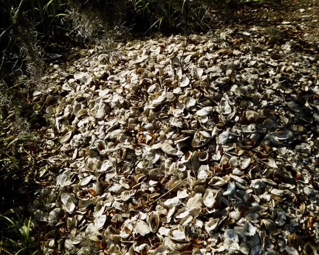
Shell mound photo by Michael B.
The trails are marked with information along the paths. Explore historic monuments and a Native American shell mound while you travel through the maritime forest and beach areas of the park. Bring the camera to capture shore birds and the beautiful scenery.
The Edisto Beach State Park trail. Image by Michael B.
The Bedon Lucas House porch is a great place to visit. Photo credit: Christan Spires
The beautiful historic city of Walterboro sits right on I-95 at exits 53 and 57. If you’re traveling, this is the perfect spot to get out and stretch your legs. There are many interesting attractions for you to chose from. You just might decide to make this historic city a part of your itinerary.
The C. G. Padgett House. Photo Credit: City of Walterboro Facebook Page
Walterboro was founded in 1783 as a summer retreat for local planters. Plantations were sources of malaria during the summer months so towns like Walterboro were started on higher elevations away from bodies of water. The original settlement was started on a hilly area covered with pine and hickory trees. It was named Hickory Valley.
Nature comes indoors at the Walterboro Wildlife Center.
The Walterboro Wildlife Center is in the heart of downtown Walterboro. It is an interpretive exhibit hall showcasing the plant and animal life that is present in the Walterboro Wildlife Sanctuary and throughout the Lowcountry.
Specimens of native Colleton County wildlife are on display in aquariums throughout the center. The Wildlife Center features snakes, turtles, frogs, fish and alligators!
Boardwalks cross through the lowlands of the Walterboro Wildlife Sanctuary.
Just three minutes from I-95, the Walterboro Wildlife Sanctuary combines history, culture, recreation, and education into a southern lowland setting. The 600 plus acre sanctuary features what may be the only “braided creek” swamp accessible to the public.
A completed network of boardwalks, hiking, biking and canoe trails provide a perfect vantage point to observe the diversity of wildlife inhabiting the black water bottomland. Native populations of wild turkey, deer, raccoons, beaver, otter, mink, opossum, squirrels, fox and wildcats have been spotted along the trail. The sanctuary’s Washington Street entrance is located only steps from Walterboro’s main historic district.
The Colleton County Museum and Farmers Market are conveniently located together. Photo Credit: City of Walterboro Facebook Page.
TheColleton County Museum & Farmers Market is located just down the road at the end of historic Washington Street. This museum features exhibits represent the county’s history, culture, natural resources, plantations, as well as Revolutionary and Civil War. There’s also a children’s play area.
Baked goods are popular at the Marketplace Cafe. Photo credit: Barry McRoy.
The farmers market offers local produce on Tuesdays and Saturdays. The site also has a Marketplace Café and a gift shop that sells local produce, crafts and home goods.
Bedon Lucas House. Photo credit: Christan Spires.
Located in Walterboro’s first settlement of Hickory Valley, the Bedon Lucas House is the location of the Colleton County Historic & Preservation Society. The house was constructed in 1820. For tours please visit the Colleton County Historical & Preservation Society website.
Fripp Fishbourne House.
The streets of the Hickory Valley District are laden with beautiful homes. A walk is the best way to appreciate these lovely homes. Take a nice, leisure stroll to photograph your favorites. Hampton Street is a favorite walking destination. Start here and let your feet guide you through the neighborhood.
The SC Artisans Center is loaded with locally made works of art. Photo Credit: Borys Kusyk.
The South Carolina Artisans Centeris another must-see destination in Walterboro. The center is housed in a restored eight-room Victorian cottage downtown, which showcases over 300 local artists. Artwork ranges from traditional and indigenous folk art to contemporary. There are educational exhibits, craft demonstrations and live performances as well. Each piece is truly unique. Pieces range from glass work, jewelry, paintings and sweet grass baskets.
The Lowcountry Regional Airport is the home of the Tuskegee Airmen Monument. Photo credit: Mike O.
A visit to the Tuskegee Airmen Memorial is a great way to honor these brave men who fought for our country. Located on the grounds of the Lowcountry Regional Airport, the monument commemorates the heroism of the valiant young men who enlisted during WWII to become America’s first African American military airmen. These men spent the final three months of combat training at this airport, which was then called the Walterboro Army Airfield. Here airmen learned to fly the Air Cobra, Thunderbolt and Kitty Hawk airplanes.
Washington Street is the destination for antique shopping.
The city of Walterboro is known for its antique shopping. Washington Street has a vast assortment of antiques stores loaded with interesting finds.
Hiott’s Pharmacy has been serving sodas and shakes since 1969. Photo Credit: City of Walterboro Facebook Page.
While antiquing, head to the end of Washington Street and right into a Walterboro landmark. Hiott’s Pharmacy Soda Fountain. This icon is a great spot to wet your whistle and step back in time. The pharmacy fountain has been operational since 1969.
Slow down and catch your breath in Walterboro, the front porch of the Lowcountry!
Frampton Plantation House awaits your visit today. Conveniently located on Highway 17, just off I-95, Exit 33. Photo by Carmen Pinckney.
Historically speaking, the “Frampton House” property was part of an original King’s Grant to the Frampton family in the 1700s. The family oversaw the production of 4,000 acres, which were used for growing cotton, rice, and other crops. During the 1865 Campaign of the Carolinas, General Sherman’s troops marched from Savannah to Columbia. Along the way, they burned the plantation house and all the farm buildings that stood on this site.
The magnificent live oak as seen in 1993. Photo by Jim Wescott.
As a delegate of the 1860 SC Convention John Frampton
signed the Ordinance of Succession, pulling the state out of the Union.
In 1868, just after the war, he built the current farmhouse on the
property and continued to work the land. It is probable that the farm operated
with sharecropping and tenant farming.
The mighty oak was dated to between 250 and 300 years old in 1993. Photo by Carmen Pinckney.
Major renovations were made to the old house around 1930, including adding indoor plumbing and electrical wiring. At the same time sheetrock replaced the old lath and plaster walls. The property remained in the Frampton family until the 1940s.
Frampton House during the Campbell years. Photo loaned by Kate Campbell.
The house was sold to the Campbell family, who lived here for many years. They renovated the house and removed the second story porch which was unsafe. A room and bathroom were added to the back of the second story.
The second story addition can be seen in this 1993 image taken by Jim Wescott.
According to Arthur Campbell, “My family and I lived in this house during the time hurricane Gracie hit in September 1959 – one of only three category 4 hurricanes to hit in one hundred and sixty-five years.
The old house shook on her foundation with doors and windows rattling, wind howling but alas she held true.
My father had the shutters closed but we could still see well enough out to see a huge cedar tree being thrown across the yard and past the house.
It was a direct hit and I remember being allowed to walk out in the yard and see the blue skies above during the eye of the hurricane. Myself and four siblings were hustled back in the house when the backside of the hurricane struck with enormous intensity.
I was just six years old and I shall never forget…”
Damaged live oaks were removed after Hurricane Gracie. Photo loaned by Kate Campbell.
Charles Frazer and the Sea Pines Company purchased the house in 1970 and used it as a point of sale for his Hilton Head development. More renovations were made at this time. New wiring and central heat and air were installed. In 1974 the house was once again sold to Wyman Boozer, a Columbia developer. It fell into disrepair and was slated to be demolished. There was even talk of bulldozing the house and surrounding oaks to make way for an interstate truck stop.
The back of the house had a porch which is now restrooms for the visitors center. Photo by Jim Wescott
In December of 1993, the house and four acres were kindly donated to the Lowcountry Tourism Commission for the creation of the Lowcountry Visitor’s Center and Museum. This assured the restoration of the old farmhouse.
The central hall decorated for Christmas during the 1950s. Photo loaned by Kate Campbell.
The downstairs central hallway before the addition of restrooms in 1993. Photo by Jim Wescott.
The preservation of the magnificent old oaks that frame the building and the Civil War earthworks in the backyard (erected by Robert E. Lee’s troops in defense of the important railroad supply line for the Confederacy from Savannah to Charleston) were also guaranteed.
The house as it looked after the 1993 renovations were underway. Photo by Jim Wescott.
Major renovations were done to the Frampton House which prepared it for a new life. The Lowcountry & Resort Islands Tourism Commission offices are upstairs, and the downstairs serves as the Lowcountry Visitor’s Center and Museum. The rooms also contain historic displays and representations from Lowcountry museums.
The original back porch was enclosed to contain restrooms. A new porch now extends across the rear of the house.
Frampton House has been preserved for visitors to explore and enjoy. Photo by Carmen Pinckney.
Frampton Plantation House is open to the public seven days a week, from 8:30 a.m. – 5:00 p.m. Come see us for all your travel questions and SC Lowcountry information.
See what our visitors love about the
SOUTH CAROLINA LOWCOUNTRY
Use the #hashtag #sclowcountry to get your image featured!
The Lowcountry & Resort Islands Region of South Carolina includes the four, southern-most counties in the state, Beaufort, Jasper, Hampton, and Colleton, which are bordered on the east by the Atlantic Ocean and on the west by the Savannah River and the state of Georgia.
So happy that “Clouds Gather” has found its forever home. 💖 I hope this painting brings joy and memories of happy times to the new owners. #partagergallerygiftsandhome #acrylicpainting #SCLowcountry #southcarolina
This painting conveys a moment I captured of our son during one of our family beach walks, as we looked for nature’s treasures at low tide. He had broken his arm at the beginning of summer and wasn’t able to participate in his favorite summer activities such as sports and jumping waves in the ocean. As a parent, it was difficult watching him miss out, but I was constantly amazed at his positivity and resilience. Watching him in this moment made me think about how we are always searching and the many places our life’s journey takes us.
Discover at your own leisure at the coastaldiscoverymuseum 🌳 From century-old buildings with storied pasts, to wooden boardwalks that stretch into the Jarvis Creek salt marsh, there`s always something to explore!
Details ✨ • I love the perspective of this first shot. I know the angle isn’t a normal view, if you had this hung in your house, but I just think it’s so badass and cool and it’s my account so I can post it and y’all will just have to deal 😆😜. But really, thanks for all the love you’ve shown me on this piece so far. I’m really proud of it and can’t wait to make more versions of this design. 💙🌾 • Fiber sources tagged 🌊
Spanish moss drapes the live oak trees that are ubiquitous to the Edisto Island area. Did you know that Edisto gets its name from the native Edistow people? The Edistow Native Americans were a sub tribe of the Cusabo indians, a group of Native Americans who lived along the Atlantic coast in South Carolina.
⏰ Best time of the day to visit: Stop by mid-morning. That way you can explore the island, grab lunch, and stay for the amazing sunset if you choose.
🏖️ Things to do while there: Edisto Environmental Learning Center, Boneyard Beach, Scott Creek Inlet, Big Bay Creek, SeaCow Eatery.
☀️ Things to visit in the area: Jungle Road Park, Bay Creek Park, Otter Islands, Spanish Mount Point.
📆 Best time of the year to visit: For warmer weather come anywhere from March-August.
🏨 Where to stay: Fripp Island Golf & Beach Resort (frippislandrsrt), Seabrook Island Club (seabrook_sc), The Sanctuary at Kiawah Island Golf Resort (kiawahresort), Charleston Kiawah Island/Andell Inn (andellinn).
A visitor takes a leisurely stroke under a canopy of live oaks draped with Spanish moss in the Palmetto Bluff (palmettobluff) neighborhood of Bluffton, South Carolina. Palmetto Bluff is a picturesque community that sits in the heart of Lowcountry. Nestled along the May River, it’s abundant with beautiful walking trails, historic sites, and stunning views.
⏰ Best time of the day to visit: There is no wrong time to visit Palmetto Bluff. However, we highly recommend sticking around for one of their spectacular sunsets.
🛶 Things to do while there: Stop by Cole’s for some regionally inspired Southern fare, paddle board, kayak, or canoe along the May River, go saltwater fishing, take a tour at Bluffton Jack`s Old Town Tours.
🌊 Things to visit in the area: Palmetto Bluff Conservancy, Old Town Bluffton, Bluffton Oyster Factory Park, May River Sandbar, Heyward House Museum and Welcome Center (heywardhouse).
📆 Best time of the year to visit: For the best weather, we recommend visiting between March and May or from September to November.
🏨 Where to stay: The Montage Palmetto Bluff Resort (montagepalmettobluff) is the only resort in Palmetto Bluff. However, there are plenty of places to stay in the surrounding areas including: Old Town Bluffton Inn (oldtownblufftoninn), The Inn & Club at Harbour Town (theinnandclubatharbourtown), Sonesta Resort Hilton Head Island (sonestahhi).
Isn`t this live oak tree tunnel beautiful? Live oak, draped in Spanish moss, is emblematic of South Carolina and many of the Southern states. We love these iconic trees, not only for their beauty, but their history as well. The average lifespan of a live oak is 300 years!
The shore gently recedes beneath the stunning Pawleys Island Pier. The unique island town, located about 25 miles south of Myrtle Beach and 70 miles north of Charleston, exudes laid-back, beachy vibes. Locals have definitely adopted an island state of mind and encourage visitors to as well. When you go, make sure to relax on the beach, explore the famous sand dunes, or fish in one of the many adjacent creeks.
⏰ Best time of the day to visit: We guarantee that you’re going to want to spend a whole day here. We recommend getting to the beach at around 10am.
🗓️ Best time of the year: Pawleys Island has the best weather during the spring and early summer months.
🏖️ Things to do while there: Pawleys Island Nature Park, Pawleys Island Chapel, Hopsewee Plantation.
🐠 Things to visit in the area: Brookgreen Gardens (brookgreen_gardens), take a walking ghost tour, Myrtle Beach (mymyrtlebeach), Harborwalk Marina, South Carolina Maritime Museum (southcarolinamaritimemuseum).
🏨 Where to stay: The Oceanfront Litchfield Inn (oceanfrontlitchfieldinn), Litchfield Beach and Golf Resort (litchfieldbeachandgolf), Sea View Inn (seaviewinn), 620 Prince (620prince).
Pregnancy sleep = 😫. Silver lining, a sunrise walk with Sullie and Zoey. _ Anyone else deal with terrible sleep in the third trimester? It`s been brutal. Combo of overall anxiety/mind racing, digestion discomfort and having to pee all the time! 😐 _ #sunrise #follybeach #sclowcountry #scbeaches #goldenretrievers #goldensofinstagram #charleston #29weekspregnant #thirdtrimester #pregnancylife #pregnancyproblems #beach #beachsunrise
Angel Oak, Johns Island, South Carolina. ⠀ ⠀ The Angel Oak Tree is a Southern live oak (Quercus virginiana) located in Angel Oak Park on Johns Island near Charleston, South Carolina. The Angel Oak Tree is estimated to be at least 400 and possibly up to 1400 years old It stands 66.5 ft (20 m) tall, measures 28 ft (8.5 m) in circumference, and produces shade that covers 17,200 square feet (1,600 m2). Its longest branch distance is 187 ft. in length. ⠀ ⠀ #angeloak #angeloaktree #southcarolina #johnsisland #charleston #DiscoverSC #lowcountry #SCLowcountry #lowcountrylife #igerssouthcarolina #blackandwhite #b&w #oaktree #legacyoak #blackandwhite #blackandwhitephotography #totravelistolive #travel_captures #travellove #travelpics #travelpic #travelbug #travelandlife #lifeisajourney #adventuroussoul
The South Carolina Lowcountry Guidebook is filled with many things to see and do in the beautiful Lowcountry of South Carolina. Please fill out the information and we will send you a FREE GUIDE BOOK.


