Spend the night in a converted shuttle or train car at the Point South KOA. Photos By Paul Griffin, Sr.
Looking for a fun place to camp this fall? Look no further than the Point South KOA Campground. Don’t have a camper? No problem! They have cabins as well as camp sites. The pool is available and wine is sold by the glass.
There are many cabin options. Photos by Jade Coleman and Jan T.
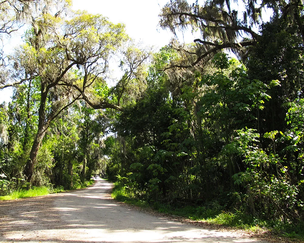
The Point South KOA is located in the heart of the SC Lowcountry, just off I-95, Exit 33. It is a great hub for visiting Beaufort, Bluffton, Hilton Head, Walterboro, Hampton, and Ridgeland. There are plenty of spaces for campers, or “glamp” in one of the cabins located on site. There’s even a cabin inspired by Frank Lloyd Wright.
Walk your dog to the lake or play in the dog park. Photos by Gail Hampel and Christine K.
Point South KOA Campground is pet friendly. The large dog park and Camp K-9 make travelling with your pup more fun.
Spoonbills and bald eagles are just a couple of examples of birds that can be found in the SC Lowcountry. Photos by Jim Killian.
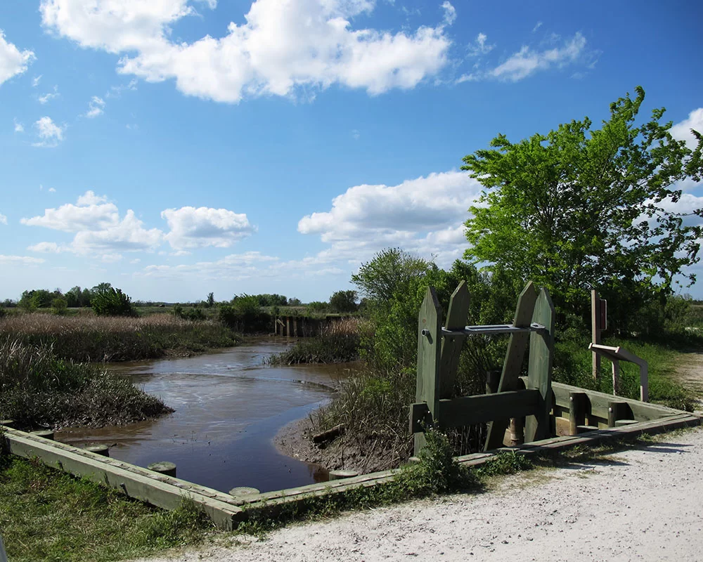
Spend the day at the campground. Photos by Christine K, Edith Martin and Point South KOA.
For old fashioned family fun, spend the day playing at the campground. Mine for gems at the playground. Play tether ball, corn hole, horseshoes, life-size chess or Jenga. Adults can unwind with a glass of local wine, craft beer or specialty coffee from the Swimming Mermaid Coffee House located at the campground. Leave the cooking to the staff, relax, and enjoy made-to-order pizza, wings and breadsticks around a campfire.
Cabin interiors are kept immaculately clean. Photos by A. Robert, Diane Nordstrom and Point South KOA.
Camping is an experience that can be enjoyed by everyone, especially in these difficult times when families are reconnecting and spending more time together. Since most schools are operating remotely this fall, why not take a trip to explore nature, disconnect from technology and reconnect with those you love most.
Photos by J Hof, Jade Coleman, Point South KOA, Louisa Maaser, Gail Molina, Rhonda Griffin, Christine K, Timothy Alston and Wolfgang Hanko.
Point South KOA is excited to announce they have won the Trip Advisor Traveler’s Choice Award for the sixth year in a row! Make your reservations and plan a trip to the Point South KOA.
Beaufort’s Shrimp Festival celebrates the fall shrimp season and highlights the region’s culinary traditions. We invite locals and Southeastern visitors to restaurants, shops, and outdoor venues across the Beaufort region to enjoy the best of Lowcountry food and lifestyle.
Throughout Shrimp Festival season, participating restaurants region-wide feature a specially priced fresh shrimp dishes and local shops feature seafood themed promotions.
Visit our website link below for the latest information and up-to-date list of participating restaurants to sample the bounty of our Lowcountry waters and celebrate the long tradition of the shrimping industry right here in Beaufort!
Participating Restaurants:
Fat Patties – 831 Parris Island Gateway, Beaufort
Fishcamp on 11th Street – 1699 11th St, Port Royal
Madison’s – 925 10th St, Port Royal
Morgan River Grill – 100 Marina Dr, St Helena Island
Mr Seafood – 1281 Ribaut Rd, Beaufort
Old Bull Tavern – 205 West St, Beaufort
Plums – 904 Bay St, Beaufort
Salt Marsh Brewing – 831 Parris Island Gateway, Beaufort
Francis Jones taught African American children on Daufuskie Island for 39 years. She lived in this house on the island.
Daufuskie Island has a very rich Gullah history. “Gullah” refers to descendants of Africans who were enslaved on the rice, indigo and Sea Island cotton plantations of the lower Atlantic coast. After emancipation and the Civil War, the Gullah of Daufuskie Island were able to live an isolated life creating a unique culture with deep African retentions. They have distinct arts, crafts, food, music and language. According to the GullahGeecheeCorridor.org “The Gullah language is the only distinctly, African creole language in the United States and it has influenced traditional Southern vocabulary and speech patterns.”
This 1939 image shows Gullah men working on an oyster bed. The 1937 image of Jane Hamilton School shows how it looked before restoration. Today it is the home of the Gullah Learning Center. Images found on NOAA Fisheries and national Register websites.
After the Civil War plantation owners abandoned Daufuskie Island. Former slaves that returned to the island bought parcels of land and built cottages. They worked in farming, logging and oyster canning. By the mid-1900s, these industries dried up and work had to be sought off the island. Many of their homes fell into disrepair. Through a grant from Palmetto Trust for Historic Preservation’s “Daufuskie Island Endangered Places Program”, many of these homes and other structures have been restored. A tour on the island is like walking back in time.
To experience the Gullah history of Daufuskie Island, follow the Robert Kennedy Trail. The trail maps out 20 historic landmarks that depict the Daufuskie Gullah way of life that has been present for so many generations. Download the map or pick up a copy at the Billie Burn Museum, then set out and see history come to life.
The Billie Burns Museum is located in the former Mt. Carmel Baptist Church No. 2. Photos by Troy Farren.
The first stop is the Billie Burns Museum. Housed in the former Mt. Carmel Baptist Church No. 2, the museum contains artifacts illustrating periods of island history. This is the second church built on the site by the Cooper River residents. The first was destroyed by hurricane. The current structure was built in the 1940s. The church was abandoned when island population declined. It was restored in 2001 and repurposed as the island’s museum.
Jane Hamilton School has been restored and now serves as the Gullah Learning Center. Photos by Troy Farren.
The Jane Hamilton School Gullah Learning Center is just next door. Cooper River children attended school at the first Mt. Carmel Baptist Church No. 1 until the hurricane destroyed it in 1940. The one-room Jane Hamilton School was built and used for ten years. When the students outgrew the school, they were transported to the southern end of the island to attend the two-room Mary Fields School. The building was restored in 2008 and now holds the Gullah Learning Center and community library.
Tabby ruins can be seen on the island and across the Lowcountry.
2. Tabby ruins can be seen at the second stop of the tour. Oyster shells were ground, mixed with sand and water and used to construct the foundations of Haig Point Plantation. This very durable building material predated concrete and can be found throughout the Lowcountry.
Cooper River Cemetery images by Dawna Larsson.
3. The Cooper River Cemetery is a very important stop when learning about Daufuskie history. Gullah tradition places cemeteries near moving water so souls could travel home to Africa. Situated beside the Cooper River, the cemetery has grave markers dating back to 1917, but the hallowed grounds have been in use for burials since plantation days.
Haig Point Lighthouse photo by Dawna Moore. Golf course photo found on Golf Advisor.
4. Haig Point is a developed community today. Access is for owners and guests only. The Haig Point lighthouse can be seen from Calibogue Sound at the northern tip of the island. This lighthouse was built in 1873 and remained operational until 1924.
Melrose tabby ruins and Island Club images from melrosepoa.com.
5. Melrose was once a large self-sustaining plantation. After Union occupation of the island, the Gullah people either worked for the landowners or bought land of their own. They lived in former slave cabins or built cottages on their own land. Several examples of these cottages a have been restored and still stand strong today.
6. From the late 1800s to the 1950s, the primary economy of the island was oyster harvesting and shucking. The Oyster Union Society Hall was established in this 1893 building. The union society was a benevolent and burial society that held meetings and social events. Members joined by way of an initiation ceremony. Pollution from the Savannah River ruined the oyster beds and the oyster industry on Daufuskie came to a close. The society dissolved after the oyster beds were closed. The building still stands as a reminder of a bygone way of life.
The Hinson White House is available for short term rentals through Airbnb.
7. The next stop on the tour is the Hinson White House. This 1926 house represents Daufuskie Island Gullah architecture. Large screened porches provide cooling shade in the hot summer months. The house was restored by the Palmetto Trust for Historic Preservation in 2015. While the residence is private, it is listed on Airbnb for short-term rentals.
8. The Mary Field Cemetery is the largest Gullah cemetery on the island. The earliest wooden tombstones have disintegrated from age. The earliest date visible in the cemetery is 1926. The cemetery is still in use today.
The Sarah Grant House is also available for short term rentals.
9. Sarah Grant bought her home in 1910 for $15 and had it moved to its present location for an additional $25. She was a midwife, Sunday school president and PTA president. She was married to the island undertaker. When he died in 1962, she stepped in and took his place, making her the one who saw islanders come into the world and go out! This is a private residence, but is available for short-term rentals on Airbnb.
The oyster industry was a major source of income across the coastal south.
10. A Beaufort County public dock is located at the end of Haig Point Road. This is the former location of the Maggioni & Company Oyster Cannery. This facility opened in 1883, employing many of the islanders. The cannery closed in 1903, but the locals continued to harvest and shuck oysters, transporting them to nearby canneries. This continued until the 1959 pollution of the Savannah River closed the oyster beds.
White School House images by the National Register and Dawna Moore.
11. White School House was built in 1913 for the white children of the island. It closed in 1962. The structure has since been used as fire department headquarters, island library and thrift store. It is now home of the Daufuskie Island Historical Foundation’s archives.
Council Tree image by Carol210. Perhaps a tree similar to the tree on the right is the sister tree?
12. Many islanders found themselves under live oaks after Sunday church service. Not wanting to discuss everyday problems on church grounds, men would move off church grounds and gather under the shade of a nearby live oak. Rumor has it, there was also a sister tree for the ladies.
First Union Baptist Church images by Airbnb and Sea Pines Real Estate.
13. First Union African Baptist Church was built in 1881 near the 1881 church that was previously destroyed by fire. This church has stood the test of time, serving the island since it was built. The church was restored in the 1990s. A replica of a traditional praise house is located behind the church.
Photos from Rami Michaels, the National Register and the University of South Carolina Archives.
14. Mary Field School was the biggest school on the island. This two-room facility was built in the early 1930s to educate the black children of the island. Leftover wood from construction was used to build student desks. Pat Conroy briefly taught school here. He was the first white and the first male to teach in the school. He used his experiences on the island as the backdrop for his book The Water is Wide, which was made into the motion picture Conrack. Miss Francis Jones was the first teacher when the school opened in 1933. Her house is next on the tour. The school was integrated in 1962 and continued to educate island children until 1997. Currently it houses the School House Coffee Shop and Daufuskie Blues Indigo Textile Studio.
The Francis Jones House before restoration image is by the Island Packet. The restoration image is by Dawna Moore.
15. The most iconic house on Daufuskie is the Francis Jones Home. This Gullah home was built in the late 1860s. Additions were made over the years. Francis Jones was a much-loved teacher of the African American children of the island from 1930 – 1969. At times she was the only teacher, working with as many as 96 children in two daily sessions. The Palmetto Trust for Historic Preservation restored the house in 2014. It is available for short term rentals through Daufuskie Island Accommodations.
Moses Fickling House images by Dawna Moore and the Coastal South.
16. The Moses Fickling Cottage sits beneath an ancient live oak tree, which is covered in resurrection fern and dripping with Spanish moss. It is reported that this tree is so old it greeted the Spanish when they first came to the island in the 1500s. This classic Gullah cottage was built around 1925 for Mr. Fickling and his wife Grace. He was the island undertaker and a deacon at the First Union African Baptist Church. The old carriage that he used as a hearse has been restored and is on display outside the Billie Burn Museum. This beautifully preserved home is a private residence.
Mary Dunn Cemetery images found on Flickr.
17. The Mary Dunn Cemetery is not too far away on Prospect Road. This is the only historic cemetery for white residents of Daufuskie Island. It dates to the 1700s. The cemetery borders the Mongin Creek and was donated by Mary Dunn. It is privately owned and still in use today.
Bloody Point Golf Club and Resort images.
18. Bloody Point is at the southern tip of the island. It got the name during 1715 when three different bloody skirmishes with the Yemassee Indians caused the water to run red. Bloody Point is the southernmost inhabited point of South Carolina.
Bloody Point Cemetery lies beside the water at the southern end of the island. Images by Dawna Larsson.
19. The Bloody Point Cemetery is located near the beach. This Gullah cemetery was placed along the Mongin Creek and used for slave burials during the plantation era.
Bloody Point Lighthouse as seen in 1883 and today. Images found on the National Register and Daufuskie Island websites.
20. The Bloody Point Lighthouse and Silver Dew Winery are the last stops on the tour. This is not a typical lighthouse. In fact, it is similar to the lighthouse keeper’s cottage on Tybee Island. A large second-story dormer houses the light that guided ships into the Savannah River channel from 1883-1922. This well-preserved historic structure contains a collection of artifacts and documents telling the story of Daufuskie. There is also an interpretive garden on the grounds that includes cotton, rice and indigo.
Stop in at the Silver Dew Winery. Photos by daufuskiedifference.com and Dawna Moore.
Just out back of the lighthouse sits the Silver Dew Winery. This building was built as a “wick house” to store oil, wicks and other items needed to run the lighthouse. In the mid-1900s it was converted into a winery. Wine was made from grapes, scuppernongs, pears, elderberries, and other fruit grown on the island. Pat Conroy mentions the Silver Dew Winery in his 1972 book The Water is Wide.
If visiting Daufuskie Island is in your future, there’s only one way to get there – by boat. It’s just thirty minutes from Hilton Head Island, and an hour from Savannah. The Daufuskie Island Ferry https://www.daufuskieislandferry.com/directions/ has departures throughout the day. Reservations are a must. Once on the island, a golf cart or bike rental is a must for getting around. The island is five miles long and two miles wide. The ferry office can assist you. Reservations are strongly recommended.
The pristine beauty of Daufuskie Island is only accessible by boat. Photo by Ruth Young.
Daufuskie Island has seen its share of inhabitants over the years and their influence can be seen across the island. This destination is only accessible by boat, so time moves a little slower here. Sandy dirt roads reveal an island that is rich in history and nature with one of the most beautiful beaches in the Lowcountry.
When the Spanish departed the island, they left the Marsh Tacky horses behind. Photo found on Airbnb.
Native Americans lived on Daufuskie ten-thousand years ago, leaving many artifacts that tell their story. Indians remained on Daufuskie until the 1800s. Spaniards came to Daufuskie in the 1500’s, bringing the technique of tabby construction. Oyster shells were in abundance along the coast and could be combined with sand to create an early form of concrete. They also brought the marsh tacky horse to the island.
During the 1600s, land grants were issued to wealthy English families. Plantations were established, producing indigo and long-staple sea island cotton. By the Civil War, there were seven working plantations on the island, working many slaves. Union forces captured Daufuskie in 1861. Plantation owners and slaves abandoned the island during occupation. After the war newly freedmen returned to the island working and living off the land and sea in isolation. Their strong Gullah culture is still evident across the island today.
Oyster harvestingCotton harvesting
Cotton farming was a major source of income until the early 1900s when cotton fields were destroyed by the boll weevil. The logging industry and the Maggioni Oyster Canning Factory provided jobs for the Gullah people after the cotton decline. As logging ended and oyster beds were closed due to pollution, the island’s population declined. (The caning factory moved to St. Helena Island, and is still in operation today.) Daufuskie’s population dropped from 2,000 to just 60.
Daufuskie Island’s sweetheart, Sallie Ann Robinson shows a book with images from the days when Pat Conroy was her teacher on the island. Sallie has gone on to lead a fantastic life, publishing cookbooks and sharing her love of the island with many. Photo by Southern Living Magazine.
Even Pat Conroy has ties to Daufuskie Island. He taught at the island’s two-room schoolhouse in 1969. He went on to write The Water is Wide, based on his experiences on the island. The book was made into a famous motion picture Conrack.
Around this same time developers came to the island, building the communities of Haig Point, Melrose and Bloody Point, creating jobs and allowing islanders to come home. Even though parts of the island have been developed, the historic district has retained its natural beauty. Gullah architecture has been preserved or restored. In fact, the entire island is listed on the National Register of Historic Places.
Kayaking is a popular activity on Daufuskie Island, where life slows down. Photo from Tour Daufuskie.
Daufuskie’s first marina was built in 1984. Haig Point and Melrose developments soon followed. Much of the island has been able to maintain its natural splendor and Gullah influence. Visitors to the island can experience travelling dirt roads by golf cart or bike, as cars are forbidden to spoil this natural paradise.
Daufuskie Crab CompanyLucy Bell’s
While visiting the island, have a meal at one of the unique local restaurants. Old Daufuskie Crab Company entices visitors as they enter at Freeport Marina. If you prefer beach views with your lunch, head over to the Melrose Beach Club. Lucy Bell’s Café is located in the heart of the historic district. There’s even a coffee shop located in the historic Mary Fields School House.
Daufuskie Rum CompanyIron Fish sculpturesDaufuskie Peach soapsPurchase hand dyed indigo textiles at Daufuskie Blues .
Craftsmen have even set up shop on the island. Local sculptures, pottery, wine, woodworks, textiles, soaps and rum can be purchased from one of the many shops on the island. For more information visit https://southcarolinalowcountry.com/daufuskie-island-shopping/
Pottery is made on site at Silver Dew Pottery Studio. Photo by Holger Opderbeck.
Natural Retreats has just what you’re looking for!
Vast, sandy beaches, diverse wildlife, and rich culture await on the Sea Islands of South Carolina, a collection of family-friendly destinations located a short drive from historic Beaufort. Our Sea Islands vacation rentals, each thoughtfully selected for their proximity to the beach, offer sweeping views, cheerful decor, resort amenities, and easy access to kayaking, boating, birdwatching, and events downtown.
Choose from expansive, contemporary homes on Fripp Island or Dataw with golf course access and ocean views, charming cottages on St. Helena with tree lined grounds and a private dock, or colorful bungalows steps from tranquil marshes. As a guest of Natural Retreats, you’ll have the local wisdom of our Sea Islands staff, who can share their favorite routes for boating and kayaking, the best spots to watch for dolphins, and where to catch the most vivid sunsets. They’ll also help you arrange new adventures, from fishing to horseback riding.
Fripp Island Known for its wildlife preservation and resort amenities, Fripp Island offers a chance to explore untouched natural beauty with the convenience of restaurants, shops, and world-class facilities within walking distance. Our Fripp Island rentals range from large oceanfront estates to whimsical bungalows on quiet marshes. Most rentals allow access to Fripp Island amenities, including golf courses, swimming pools, and tennis courts. Many include complimentary golf carts, the island’s primary mode of transportation.
St Helena Island Situated directly on the St Helena Sound, this island’s breathtaking beaches offer the chance to view loggerhead turtles, crabs, oysters, and dolphins. Our St Helena Island vacation rentals range from quaint cottages on tree-lines grounds to commanding estates with private beaches and fire pits, most of which sit right on the waterfront. Airy and inviting with cheerful décor and ocean views, each home offers a fully equipped kitchen and private deck or veranda. Many have indoor entertainment, such as foosball or pool tables.
Harbor Island Known for its panoramic views, spectacular birdwatching and calm waters, Harbor Island also invites almost-daily dolphin sightings. A unique experience awaits at each of our eclectic Harbor Island vacation rentals, which range from brightly colored oceanfront bungalows to large, family-friendly beach estates with panoramic views. Guests of Harbor Island enjoy access to its fitness center, swimming pools and docks for crabbing and fishing.
Port Royal Island Port Royal Island is a charming, historic destination with tranquil sea air, a thriving fishing and boating scene, and lively festivals, including street music and oyster roasts. Our Port Royal vacation rentals feature quaint cottages on wooded grounds with modern amenities and close proximity to Old Village.
Dataw Island Located just six miles east of historic Beaufort, South Carolina, Dataw Island is a gated golf and tennis community known for its upscale facilities and maze of saltwater marshes and tidal creeks. Our Dataw Island vacation rentals feature marsh, tidal creek, or golf course views, upgraded furnishings and space for families. All rentals lie near the island’s restaurant and clubhouse amenities.
Haig Point Club has become a premier destination for members with its 29 golf holes, tennis and fitness facilities, swimming, and beach recreation.
Photo by Dennis Burnett Photography.
The Club boasts less than 300 homes situated on 1,050 acres making plenty of room for members to enjoy an active and outdoor low country lifestyle. By working with local contractors and builders Haig Point has been able to preserve the beauty of Daufuskie Island as well as many of the historical aspects for future generations.
Photo by Dennis Burnett Photography.
Haig Point offers a more intimate lifestyle with all the amenities you expect…and more unique features few private communities can offer; empty beaches, a fabulous top-ranked Rees Jones-designed golf course, an equestrian center, and a safe, healthy and secure family environment. Whether you croquet at the Strachan Mansion, fly fish, cast for shrimp or crab, take a sunset cruise or enjoy an event at the Club, Haig Point offers a rich and fulfilling lifestyle. It’s not opulent, stuffy or fabricated, but welcoming and undeniably authentic.
Photo by Dennis Burnett Photography.
One of the many charms of Daufuskie Island’s Haig Point is that it is accessible only by boat. You arrive here from Hilton Head Island, SC by a scenic ferry ride from the private Haig Point embarkation center (18 round trips run each day) or a 24-hour water-taxi service from Harbour Town. The personal touch points of concierge services, like grocery and package delivery from the mainland, make island living second to none. Haig Point is a car-free island paradise that is blessed with natural beauty and void of noise pollution. When you live at Haig Point, you can be as active or laid back as you choose. But know that the social scene is lively and has a magical way of engaging the entire family.
Photo by Dennis Burnett Photography.
Haig Point has 29 championship holes to challenge any level golfer. Prefer horses? Our equestrian center is outfitted to meet the needs of your horses, and lessons are offered to those looking to become riders. As for tennis enthusiast, we have six Har-Tru® tennis courts with USTA’s “Outstanding” rating. The opportunities for outdoor adventure are endless!
Photo by Dennis Burnett Photography.
Words and photos cannot fully describe the attraction of the Haig Point community. It’s a connection you get from the moment you arrive. Something each of our members experienced first-hand. They were drawn to Daufuskie Island for its character and ultimately chose Haig Point for the magical bond. But is it for you? There’s only one way to know.
Photo by Dennis Burnett Photography.
The natural beauty of Daufuskie Island shines through each and every property in Haig Point. Our beaches showcase the glistening water of the Atlantic Ocean with a backdrop of South Carolina at its finest. We specially develop each plot of land to enhance its natural beauty and work with local companies who understand how to complement what Mother Nature has given us.
Photo by Dennis Burnett Photography.
Although there are a few cars on Daufuskie, golf carts are the main mode of transportation. Which is not only better for the earth, but also better for your soul. The lack of transportation noise only enhances the peaceful stillness around the island.
Photo by Dennis Burnett Photography.
If the outdoors is where enjoy spending most of your time, Haig Point offers fishing (deep sea and along the banks), crabbing, water sports, bike rentals, Bocce ball, and kids’ camp. The lifestyle here on Haig Point on Daufuskie Island is truly what you make it. There are exceptional classes and lessons to mold a unique variety of activities which you enjoy participating.
Photo by Dennis Burnett Photography.
The Haig Point lifestyle is simply incomparable. There are less than 300 homes on 1,050 acres. Within the 1,050 acres of our private island community, there are three clubs, 29 holes of golf, tennis, fitness, swimming, and beach recreation. Haig Point Club is more than just a place to live, it’s a community of people who grow and truly share life together. Our community buildings allow you to build lasting relationships with other residents through a wide variety of activities. We invite you to visit and get to know more about our members.
American Bald Eagle hunts over the waterways of Bear Island WMA. Photo by Jim Killian.
If birding is your passion, Bear Island Wildlife Management Area is the place for you! This Lowcountry barrier island is managed to provide quality habitat for wintering waterfowl and other wetland wildlife including threatened and endangered species such as wood storks and bald eagles. Here you’ll find a vast array of waterfowl, wading birds, shorebirds and songbirds. There are two observation platforms and miles of dikes that provide numerous wildlife viewing opportunities.
Roseate Spoonbills are a favorite at Bear Island. Image by Kristin Baggett.
Bear Island is managed to provide quality waterfowl habitat and to protect local endangered and migratory non-game species. Public recreational opportunities are provided for hunting, nature observation and fishing. Explore thousands of acres containing managed impoundments at 27 different sites.
An Osprey searches for her next meal. Photo by Jim Killian.
Bear Island is a major wintering area for waterfowl as well as an important shorebird area during migration. It is also an important nesting area for Bald Eagles and a foraging area for wading birds including Wood Stork, Little Blue Heron, Snowy Egret, Great Egret, Tri-colored Heron, White Ibis and Glossy Ibis. Concentrations of migratory shorebirds include Greater and Lesser Yellowlegs, Dowitcher and Common Snipe. Shorebird concentrations are noted during times of pond drawdown associated with the waterfowl management program.
Canadian Geese and Tundra Swans have been spotted at Bear Island. Photo by Jim Killian.
Bear Island is part of the ACE Basinestuarine reserve area and is managed by the South Carolina Department of Natural Resources. The area is open to the public from early February to late October and is a popular spot for hiking, biking, birding, and fishing. A wide variety of waterfowl species inhabit the area. The area shuts down periodically for special hunts.
A Belted King Fisher waits patiently on its perch. Photo by Jim Killian.
Bear Island is one of the best birding areas in the state. Be on the look-out for Canada Goose, Tundra Swan, Great Blue Heron, Great Egret, Snowy Egret, Little Blue Heron, Tricolored Heron, Green Heron, Black-crowned Night-Heron, White Ibis, Glossy Ibis, Wood Stork, Osprey, Bald Eagle, and Roseate Spoonbill. In addition to common birds of the Coastal Plain and the specialties listed above there is a long list of rarities that have been spotted here, including—among others—Black-bellied Whistling-Duck, Eurasian Wigeon, Cinnamon Teal, Common Goldeneye, Eared Grebe, Roseate Spoonbill, Black Rail, American Avocet, Hudsonian Godwit, White-winged Dove, Barn Owl, Short-eared Owl, Western Tanager, and LeConte’s Sparrow.
Herons are a common sight at Bear Island. Photo by Jim Killian.
The main part of Bear Island is open to birders Monday through Saturday, from 1 February through 14 October. At other times birders are restricted to areas right along Bennett’s Point Road, including Mary’s House Pond, which is just south of the residences by the main entrance. Do not go in to closed areas, even if the gate is not locked, or you risk getting a ticket.
This egret makes a successful catch. Photo by Jim Killian.
The best birding is usually along the main unpaved road east from Bennett’s Point Road, called Titi Road. A good strategy is to park along Titi Rd and walk in along any of the many side roads. If you have time you might also want to check one or more of the roads that lead west from Bennett’s Point Road. It takes at least a day to enjoy the entire area.
Bear Island is located off Highway 17, between Edisto Island and Beaufort in Green Pond. From Hwy 17, turn onto Bennett’s Point Rd and travel 13 miles. The entrance is on the left, approximately 1 mile after crossing the Asheepoo River.
Wading birds of all sizes hunt and nest on Bear Island. Photo by Jim Killian.
Just south of Charleston and north of Savannah, a natural paradise awaits your visit! The historic Kings Highway 17 travels through the beautiful SC Lowcountry and these protected treasures.
Wood stork image captured by Ira Runyan at Donnelley Wildlife Management Area.
The area that lies between Charleston and Savannah is a nature lover’s paradise. Here you will find wildlife management areas, nature trails, church ruins and a welcome center located in a historic house.
1. Ernest F. Hollings ACE Basin National Wildlife Refuge
ACE Basin Oak Grove Plantation House photo by Carmen Pinckney.
The Ernest F. Hollings ACE Basin National Wildlife Refuge is located off Hwy 17, on Hwy 174 towards Edisto Island. The refuge is home to a vast array of waterfowl, and the Antebellum Oak Grove Plantation House.
Stretch your legs and visit the trails of the ACE Basin National Wildlife Refuge. Photo by Carmen Pinckney.
A walk behind the house leads visitors to the former rice fields. Rows, dikes, trunks, and gates are still visible today. The paths are marked and meander around the rice fields and wooded areas. Make sure to bring your camera and be on the lookout for wildlife. For more information visit https://southcarolinalowcountry.com/ernest-f-hollings-ace-basin-national-wildlife-refuge/.
2. Botany Bay Wildlife Management Area
Drive through the Lowcountry’s most photographed live oak canopy at Botany Bay. Photo by Carmen Pinckney.
A venture further down Hwy 174 onto Edisto Island will bring you to the wildlife management area of Botany Bay Plantation. This is one of the most unique destinations on Edisto Island. The 4.000+ acre property boasts historical buildings, maritime forest, a boneyard beach and freshwater ponds. The property is covered in pine, palm and live oak trees, dripping with Spanish moss. Don’t be surprised to see deer, alligators, shore birds, crabs, raccoons and many other maritime forest creatures.
Botany Bay’s boneyard beach is covered in shells. Photo by Carmen Pinckney.
There are two sites listed on the register of historic places at Botany Bay. A set of three surviving 1840s outbuildings and the prehistoric Fig Island Shell Ring can be seen on the property. Explore the plantation house ruins, walk the forest trails, or stroll the beach on this South Carolina controlled wildlife management area. Botany Bay Wildlife Management Area is a great place to spend a day. Bring a picnic, beach chairs and kayaks. Explore the wonders of the South Carolina Lowcountry! For more information visit https://southcarolinalowcountry.com/edisto-islands-botany-bay/.
3. Edisto Nature Trail
Edisto Nature Trail photo by David Lucas.
Jacksonboro is the perfect spot to get out and stretch your legs on the Edisto Nature Trail. The trail is located on Highway 17, adjacent to the Edisto River. Jacksonboro is in the area known as the ACE Basin. This low-lying part of the state is full of former rice plantations with beautiful marsh and river views, and teaming with wildlife.
Edisto Nature Trail photo by David Lucas.
The boardwalk trail meanders through the woods that change from pineland and maritime forests to cypress and tupelo swamp. Before and after the Revolutionary War, this area was rich in rice production. A 15-minute walk along the boardwalk will take you to a dock overlooking the Edisto River. You can also press on and take the 1.5-mile loop trail that can be completed in about an hour. It will transport you from the wetlands to higher upland forest area. Make sure to wear appropriate shoes. Be sure to bring bug spray if you come in the spring or summer. For more information visit https://southcarolinalowcountry.com/hiking-the-edisto-nature-trail/.
4. Bear Island Wildlife Management Area
Bear Island image by Pluff Mudd Perspectives.
Bear Island Wildlife Management Area is located off Hwy 17 in the Green Pond area. This wildlife management area is managed to provide quality habitat for wintering waterfowl. It’s a great spot to view bald eagles, wood storks and roseate spoonbills.
Bear Island is a great place to photograph birds. Photo by Jim Killian.
Drive through this area for many opportunities to spot wildlife. The forest, marsh and river views are beautiful. Bear Island is located between the Asheepoo and South Edisto Rivers. From Hwy 17, turn onto Bennett’s Point Road and follow for 13 miles. The entrance is on TiTi Road. (843)844-8957. For more information visit https://southcarolinalowcountry.com/explore-sc-lowcouontry-wildlife-preserves-and-nature-trails/.
5. Donnelley Wildlife Management Area
Donnelley Wildlife Management Area drive image by Carmen Pinckney.
Donnelley Wildlife Management Area is a favorite spot for tourists and locals alike. It is located on Hwy 17 in Green Pond (between Yemassee and Jacksonboro) in the heart of the ACE Basin. This is a great place to glimpse Lowcountry nature at its finest. The property features a historic rice field system, which is now managed to attract waterfowl and migratory birds. The drive is pleasantly lined with beautiful old live oaks.
Roseatte Spoonbills can be found at Donnelley, along with many other species of birds.
The driving tour covers about 11 miles and should take from an hour to half a day, depending on how many stops you make. The marked stops on the map serve simply as suggestions; feel free to stop anywhere along the way (although please park on the shoulder) and walk off the road at any point to get a closer look at wildlife or native plants. Take extra precautions when viewing alligators, especially during the spring mating season. For more information visit https://southcarolinalowcountry.com/colleton-countys-donnelley-wildlife-management-area/.
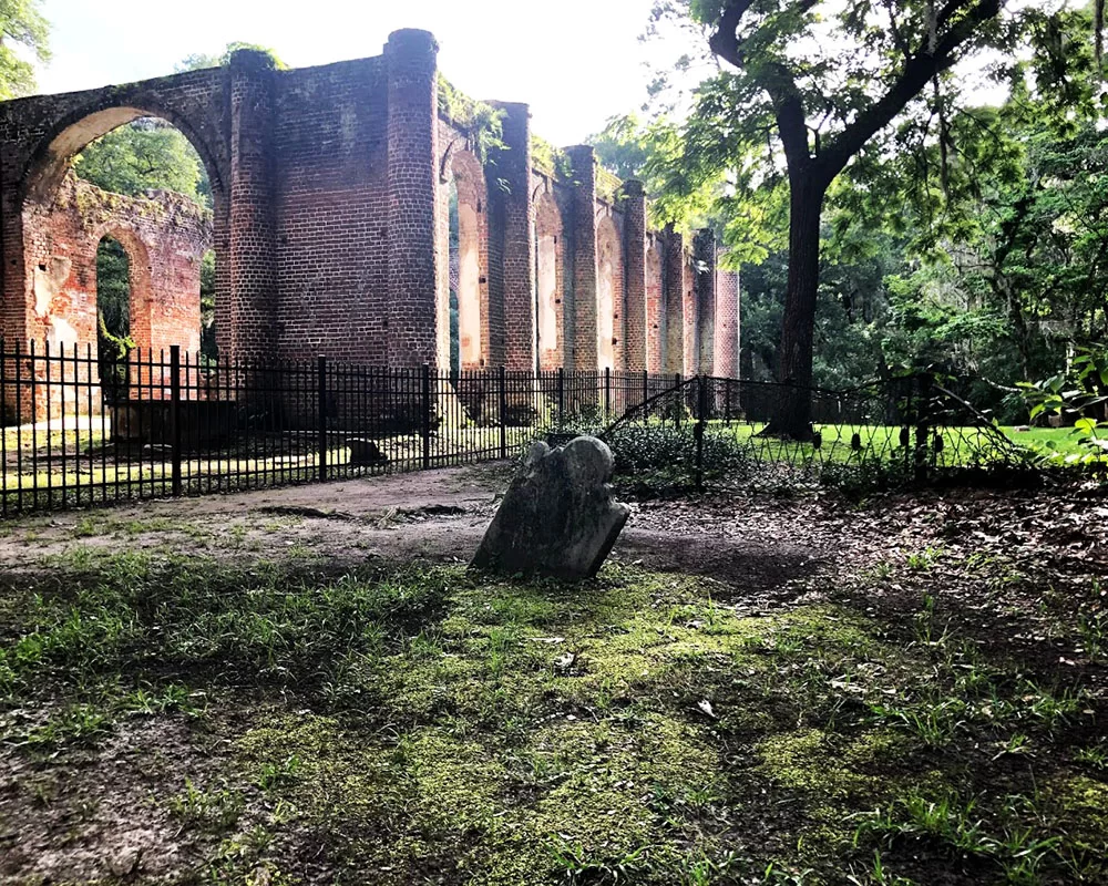
6. Old Sheldon Church Ruins
Old Sheldon Church Ruins image by Carmen Pinckney.
A simple turn off Hwy 17 onto Old Sheldon Church Road is like stepping back in time. Travel up the road for about two miles and see the church ruins on the right. Parking is located across the street. This church was burned during the Revolutionary War, rebuilt, and then destroyed again during the Civil War.
Old Sheldon Church Ruins includes a historic graveyard. Photo by Carmen Pinckney.
Located just past the turn to Beaufort off Hwy 17, Sheldon Church has laid in ruin for more than 140 years. Its gable roof, pediment, windows & interior have disappeared, but the classic simplicity of its design still remains. Burned by British troops in 1779 and destroyed again during the Civil War it still serves as a religious center for special observances. For more information visit https://southcarolinalowcountry.com/experience-a-driving-detour-through-yemassee/.
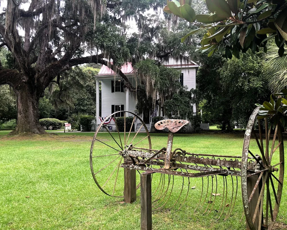
7. Frampton Plantation House & Visitors Center
Frampton House sits conveniently at the intersection of I-95 and Highway 17. Photo by Carmen Pinckney.
Historically speaking, the Frampton House property was part of an original King’s Grant to the Frampton family in the 1700s. The family oversaw the production of 4,000 acres of cotton, rice, and other crops. During the 1865 Campaign of the Carolinas, General Sherman’s troops burned the plantation house and all the farm buildings that stood on this site.
Go back in time at Frampton House. Photo by Carmen Pinckney.
The house was rebuilt in 1868 and the property was probably used for share cropping and tenant farming. Once slated for demolition, the house has been restored and the ground floor is open to the public. The second story holds the offices of the Lowcountry Tourism Commission. Frampton House is open to the public seven days a week, from 8:30 a.m. – 5:00 p.m. Come see us for all your SC Lowcountry travel questions and insider secrets. For more information visit https://southcarolinalowcountry.com/history-is-preserved-at-frampton-plantation-house/.
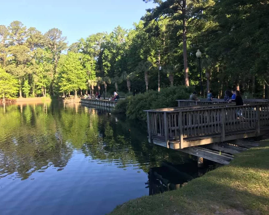
8. Blue Heron Nature Trail
Blue Heron Nature Trail travels along a pond and Lowcountry wetland. Photo by Lynn Boyles.
Blue Heron Nature Center & Trail offers relief for the road-weary, and it’s as easy to get to as any rest area.
This 10-acre green space meanders around a three-acre pond and through forested wetlands. The property also includes a butterfly garden, picnic area, outdoor classroom, observation decks, and a 4,200-square-foot Learning Center. Permanent trail side displays help visitors learn more about the native flora and fauna of Jasper County and the Lowcountry.
Look for turtles and fish from the docks at Blue Heron Nature Trail. Photo by Lynn Boyles.
The nature trail leads you around the pond with several scenic overlooks along the way. Along the trail you will find benches, swings, and an attractive butterfly garden. In addition to the herons, you may see ducks, turtles, fish, alligators, and other wildlife. Also, several boardwalks take you through the surrounding forested wetlands. Get out of the traffic and spend some time relaxing while you wander around this natural gem. For more information visit https://southcarolinalowcountry.com/lowcountry-activities-ridgeland-i-95-exit-21/.
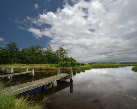
9. Sgt. Jasper Park
The boardwalks at Sgt. Jasper Park are wheelchair friendly. Photo by Carmen Pinckney.
Hardeeville’s Sgt. Jasper Park is conveniently located off I-95, at Exit 8. After exiting the interstate, point toward Hilton Head and turn left at the first traffic light. Follow the road around until you bump into the park entrance. Trails are located on both sides of the road. Some trails are wheelchair accessible. This is a great place to get off the interstate and stretch your legs. Dogs are welcome here, on a leash. A trail map is available in the park office.
Lowcountry nature trails are great places to walk the family dog while travelling. This trail is at Sgt. Jasper Park. Photo by Carmen Pinckney.
The trails alternate between gravel, boardwalk and natural footing. The views around the lake are pretty, and the trails are relaxing. There are other opportunities at the part as well. There are canoes, kayaks, and a disk golf course. Information can be found in the park office. There’s a playground for the kids and plenty of picnic spots. There is also a covered picnic shelter. Grills can be found at the park as well. The disk golf course is located on the left side of the road. The park also has fishing opportunities. For more information visit https://southcarolinalowcountry.com/spending-time-at-sgt-jasper-park/.
10. Savannah National Wildlife Refuge
The Savannah National Wildlife Refuge still operates a historic trunk system that controls water flow into the former rice fields. Photo by Allyson Jones.
The Savannah National Wildlife Refuge offers a variety of opportunities to explore and enjoy the great outdoors from sunrise to sunset every day. You can observe and photograph wildlife. Make the Savannah National Wildlife Refuge Visitor Center your first stop when visiting the refuge. The refuge is located on Hwy 17 between Hardeeville and Savannah.
Drive through or hike the trails of the Savannah National Wildlife Refuge. Photo by Allyson Jones.
The Savannah National Wildlife Refuge protects old rice fields & numerous species of wildlife including ducks, birds, deer, & alligators. The 4-mile driving tour is free and open sunrise to sunset. Wildlife viewing is excellent for photography, especially during fall, winter, and spring, along the 4-mile Laurel Hill Wildlife Drive and adjacent hiking/bicycling trails. Many species of wading and marsh birds can also be spotted here throughout the year.
The unspoiled natural habitat of the SC Lowcountry is pristine breeding grounds for many birds. This bald eagle was spotted at Bear Island by Rhonda Epper.
Visitors could easily spend several days in the area exploring all the natural wonders located between Charleston and Savannah on Highway 17. Pick a few favorites or see them all. The choice is yours. Bring along the camera, a picnic and don’t forget the bug spray!
Pack a picnic and stop for lunch at Frampton House. Enjoy free wifi, picnic tables, clean restrooms and a friendly staff ready to help you on your journeys.
Visitors could easily spend several days in the area exploring all the natural wonders located between Charleston and Savannah on Highway 17. Pick a few favorites or see them all. The choice is yours. Bring along the camera, a picnic and don’t forget the bug spray!
If you’re looking for a more civilized picnic spot under the oaks, plan to have lunch at Frampton Plantation House. Our ground floor contains a visitors center, complete with restrooms, museum displays and a gift shop. The backyard has picnic tables and plenty of room to stretch your legs. As always, pets are welcome both inside and out! Our friendly staff can answer any questions or give suggestions for their favorite attractions in the area. For more information visit https://southcarolinalowcountry.com/ or call 843-717-3090.
To download a PDF version of the map, complete with addresses and phone numbers click HERE.
Artwork near Yemassee’s Amtrack Station Honors Marine Recruit Depot History
The Folded Flag, by Sophie Docalavich, 2020.
A second installation of artwork has popped up near the Yemassee Amtrack Station. The mural, entitled “The Folded Flag” was positioned along the fence line that formerly bordered the Marine Recruit Depot barracks.
Where heroes Stood, by Sophie Dacalavich was installed in 2019.
The artwork compliments work that was installed in 2019. Artist Sophie Docalavich of Estill, SC was commissioned to paint both murals to honor the many marine recruits that made a brief stop in Yemassee before heading to Parris Island for basic training.
Photo by Peter McCusket., 1959.1918 image from Parris Island website.
More than 500,000 marine recruits rode the Atlantic Coast Line Railroad to Yemassee’s Marine Recruit Depot between 1915 and 1965. These recruits began their military career in the Yemassee barracks before heading to Parris Island for basic training. During this time, Yemassee had a bank, general store, and hotel complete with ballroom.
Photo by Peter McCusket, 1959.Yemassee train station in the 1950s and today.
Depending on the time of day, new marine recruits would either be processed and sent directly to Parris Island or spend their first night in the Yemassee barracks. When ready, recruits boarded the Charleston & Western Railroad and made the next leg of their journey to Port Royal. Prior to 1928, recruits would be loaded onto ferry boats, barges, long boats, or small motorboats to cross the river onto Parris Island.
The former marine barracks was moved across the street and repurposed as a store.
With all the activity in Yemassee, the town saw the construction of a soda fountain and several brick buildings in 1926. The town continued to grow and by 1932, Yemassee had over 30 buildings including a Greyhound Bus Station.
Life Magazine’s 1942 article on Yemassee, SC.
During World War II Yemassee continued to grow with the addition of barracks to house incoming recruits. 250,000 recruits (including women) began WWII marine training in Yemassee. The town became so popular that Life Magazine visited in 1942. Photographer Alfred Eisenstaedt created a photographic essay of the town entitled, “Life Spends a Day at Yemassee Junction”. Seven pages of photographs were published. He described Yemassee as “a railroad junction not too big to be confusing, not too small to be trivial.” The marine depot was still active during the Korean War, when as many as 350 new recruits would arrive daily.
Photo from Town of Yemassee.
In 1965 the Marine Corps terminated their lease with the Atlantic Coast Railroad Company. The receiving facility and barracks were returned to the railroad company as well. Recruits were then flown into Charleston and bused to Parris Island. This change ended the 50-year association with the railroad and the town of Yemassee.
Yemassee Marine Recruit Depot as it looked in its early days. Photo from Town of Yemassee.
A later renovation changed the roofline. 2011 photo by Big Daddy Dave.
Recent renovations transformed the station to its former glory.
After falling into disrepair, the historic Yemassee train station has been beautifully restored by the Yemassee Revitalization Corporation. The town purchased the train station in 2010 from CSX for $1 and launched a restoration campaign. While restoring the building, the team also raised funds to expand a brick memorial and garden on the site of the former marine barracks. Flags fly high over the site paying homage to the marine corps and the country.
Follow the Revolutionary War path of Dr. Uzal Johnson as he traveled the Lowcountry.
The Lowcountry Revolutionary Trail winds through Beaufort, Colleton, Hampton and Jasper Counties. It follows the path of Dr. Uzal Johnson of the New Jersey Volunteers during the Revolutionary War.
Dr. Johnson, a loyal American volunteer spent time in the Lowcountry during the spring of 1780. He witnessed skirmishes at Ft. Balfour, Saltketcher’s Bridge, McPherson’s Plantation, and the Battle of Coosawhatchie. You can retrace his footsteps and see what remains of the sites.
Start your Lowcountry Revolutionary War journey at Frampton Plantation House gazebo. Located behind the house, the gazebo contains a map of the sites and information about the trail. Come inside the visitors center if you have any questions, or need directions. We will be happy to help you with this journey. Frampton Plantation House is located behind the Marathon Gas Station in Point South 698 Kings Highway (Hwy. 17), 843-717-3090.
The first stop is the location of the Battle of Coosawhatchie (Hwy 17 at the Coosawhatchie River bridge). On May 3, 1774 Lt. Col. John Laurens and 250 men were in position on a slight rise near the bridge at Coosawhatchie. They were guarding the road against the expected assault by about 2,400 British soldiers from Savannah. Against orders, Laurens and his men crossed the river and formed a line for battle. With many of the soldiers and Laurens himself wounded, they fell back to the Tullifinny River, about two miles east.
2. Look for the Lowcountry Revolutionary War Trail marker on the eastern side of Highway 17 near the Coosawhatchie River bridge, and in front of the Second African Baptist Church, 6904 W. Frontage Rd.(Hwy 17). The sign bears an excerpt from Dr. Johnson’s journal stating, “Despite the defeat at Port Royal Island, General Prevost was determined to make a second attempt to capture Charleston. Instead of a small detachment of 150 men, this time he crossed the Savannah River with 2,400 British regulars, and once again, William Moultrie stood in his way. This time, however, Moultrie was outnumbered 2 to 1. He determined to make a stand on a slight ridge at the Tullifiny River, about 2 miles east of the Coosawhatchie River, where he left about 200 men to guard the crossing and warn him of the Redcoats arrival. As the enemy drew near, Moultrie was about to send as aide to pull these troops back to the main force when Col. John Laurens offered to lead them back. Moultrie had so much confidence in the officer that he sent along 250 men to help cover the flanks. In direct disobedience of orders Laurens crossed the river and formed the men in line for battle. He failed to take the high ground and his men suffered greatly from well placed enemy fire. Laurens himself was wounded, and his second in command fell back to the main force at the Tullifinny, where Moultrie was compelled to retreat towards Charleston.” Excerpt from South Carolina’s Revolutionary War Battlefields A Tour Guide.
3. From here, Dr. Johnson headed to the home of Isaac McPherson, who was described by the doctor as “a great (Revolutionary) Rebel, a man of property. British soldiers occupied the McPherson Plantation March 14-17 while trying to track down 50 Americans on horseback. During the occupation, the British engaged in what they thought was a skirmish with the Americans. They were mistaken and attacked their own troops instead.
The historical marker is located beside the Sheldon Chapel, 25481 Pocotaligo Rd. in McPhersonville. It reads, “Tuesday 14th March 1780 – At four o’clock in the afternoon, Col. Ferguson and part of the American Volunteers and twenty men in the British Legion proceeded nine miles to McPherson’s Plantation. We got to Isaac McPherson’s at nine o’clock. Fifty Rebels on horseback had just left this and gone to John McPherson’s. A party of ours pursued them but could not overtake them.
Wednesday 15th March 1780 – Still at McPherson’s Plantation foraging parties get everything that is needed for the Army.
Thursday 16th March 1780 – Lay at McPherson’s living off the fat of the land, the soldiers every side of us roasting turkeys, geese, fowl, ducks, pigs, and everything in great plenty. This McPherson is a great Rebel, a man of property and at present is in Charles Town.” Excerpt from the Diary of Dr. Uzal Johnson, Surgeon.
4. The British left McPherson’s Plantation on March 18, 1780 and marched to the crossing of the Saltketcher (now the Salkehatchie) River, where a bridge had stood before the beginning of the war. They were met by 80 American militiamen who tried to prevent their crossing. The British Light Infantry crossed the river below this spot and came up behind the Americans. A captain and 16 privates were bayoneted to death by the British, who then spent the night at nearby Ogilvy’s Plantation.
The historic sign is located at the boat ramp on Hwy 17-A on the Salkehatchie River, just outside Yemassee. It states, “Saturday 18th March 1780 – Got in motion eight o’clock in the morning and marched ten miles to the Saltketcher. Major Lordson with eighty militiamen placed themselves on the north side of the river to oppose our crossing. They were opposed by the British Legion returning their fire at a place where the bridge formerly stood, while the light Infantry and remainder of the Legion crossed the river below and came in their rear before they knew of it. Here the bayonet was introduced. A Capt. Mills and sixteen privates of the (Revolutionary) Rebels were killed, four badly wounded and one made prisoner that luckily escaped the bayonet.
Sunday 19th March 1780 – Passed Saltketcher River that place where the bridge stood.” Excerpt from the Diary of Uzal Johnson, Surgeon.
5. In the fall of 1780, the British built an earth and palisade fort to maintain control of Beaufort and protect the King’s Highway (Hwy 17) between Savannah and Charleston. Ft. Balfour was built at the key crossroad at Pocotaligo and named for the British commander of occupied Charleston. In April of 1781 Col. William Harden was detached from Gen. Francis Marion’s Brigade with 100 men. On April 14 Harden convinced old friends from Beaufort who were in command of Ft. Balfour that he had more troops than he did and that they should surrender. They believed him and did. Learning that British soldiers were on the way from Charleston, Harden and his men burned the garrison.
No one is quite sure of the fort’s exact location today, but the marker is places alongside the marsh of the Pocotaligo River at 2 Trask Parkway (Hwy. 17), beside the Family Worship Center Church. It reads, “In order to maintain control of the Beaufort District and protect communications on the King’s Highway, an earth and palisade fort was built on the high ground between Coosawhatchie and Pocotaligo bridges: the strategic crossroads of the Southern Parishes. This fort was named for the commander of the British garrison at Charleston during the fall of 1780, Lt. Col. Nisbet Balfour, one of the most disliked officers in South Carolina.” Excerpt from the Diary of Uzal Johnson, Surgeon.
Locating these historic spots and reading the journal entries of Dr. Johnson gives visitors the chance to reflect on how intensely our forefathers fought for the freedoms that we enjoy today. Let your gaze wander the landscape where these brave men engaged in battle and fought valiantly to protect us.
See what our visitors love about the
SOUTH CAROLINA LOWCOUNTRY
Use the #hashtag #sclowcountry to get your image featured!
The Lowcountry & Resort Islands Region of South Carolina includes the four, southern-most counties in the state, Beaufort, Jasper, Hampton, and Colleton, which are bordered on the east by the Atlantic Ocean and on the west by the Savannah River and the state of Georgia.
So happy that “Clouds Gather” has found its forever home. 💖 I hope this painting brings joy and memories of happy times to the new owners. #partagergallerygiftsandhome #acrylicpainting #SCLowcountry #southcarolina
This painting conveys a moment I captured of our son during one of our family beach walks, as we looked for nature’s treasures at low tide. He had broken his arm at the beginning of summer and wasn’t able to participate in his favorite summer activities such as sports and jumping waves in the ocean. As a parent, it was difficult watching him miss out, but I was constantly amazed at his positivity and resilience. Watching him in this moment made me think about how we are always searching and the many places our life’s journey takes us.
Discover at your own leisure at the coastaldiscoverymuseum 🌳 From century-old buildings with storied pasts, to wooden boardwalks that stretch into the Jarvis Creek salt marsh, there`s always something to explore!
Details ✨ • I love the perspective of this first shot. I know the angle isn’t a normal view, if you had this hung in your house, but I just think it’s so badass and cool and it’s my account so I can post it and y’all will just have to deal 😆😜. But really, thanks for all the love you’ve shown me on this piece so far. I’m really proud of it and can’t wait to make more versions of this design. 💙🌾 • Fiber sources tagged 🌊
Spanish moss drapes the live oak trees that are ubiquitous to the Edisto Island area. Did you know that Edisto gets its name from the native Edistow people? The Edistow Native Americans were a sub tribe of the Cusabo indians, a group of Native Americans who lived along the Atlantic coast in South Carolina.
⏰ Best time of the day to visit: Stop by mid-morning. That way you can explore the island, grab lunch, and stay for the amazing sunset if you choose.
🏖️ Things to do while there: Edisto Environmental Learning Center, Boneyard Beach, Scott Creek Inlet, Big Bay Creek, SeaCow Eatery.
☀️ Things to visit in the area: Jungle Road Park, Bay Creek Park, Otter Islands, Spanish Mount Point.
📆 Best time of the year to visit: For warmer weather come anywhere from March-August.
🏨 Where to stay: Fripp Island Golf & Beach Resort (frippislandrsrt), Seabrook Island Club (seabrook_sc), The Sanctuary at Kiawah Island Golf Resort (kiawahresort), Charleston Kiawah Island/Andell Inn (andellinn).
A visitor takes a leisurely stroke under a canopy of live oaks draped with Spanish moss in the Palmetto Bluff (palmettobluff) neighborhood of Bluffton, South Carolina. Palmetto Bluff is a picturesque community that sits in the heart of Lowcountry. Nestled along the May River, it’s abundant with beautiful walking trails, historic sites, and stunning views.
⏰ Best time of the day to visit: There is no wrong time to visit Palmetto Bluff. However, we highly recommend sticking around for one of their spectacular sunsets.
🛶 Things to do while there: Stop by Cole’s for some regionally inspired Southern fare, paddle board, kayak, or canoe along the May River, go saltwater fishing, take a tour at Bluffton Jack`s Old Town Tours.
🌊 Things to visit in the area: Palmetto Bluff Conservancy, Old Town Bluffton, Bluffton Oyster Factory Park, May River Sandbar, Heyward House Museum and Welcome Center (heywardhouse).
📆 Best time of the year to visit: For the best weather, we recommend visiting between March and May or from September to November.
🏨 Where to stay: The Montage Palmetto Bluff Resort (montagepalmettobluff) is the only resort in Palmetto Bluff. However, there are plenty of places to stay in the surrounding areas including: Old Town Bluffton Inn (oldtownblufftoninn), The Inn & Club at Harbour Town (theinnandclubatharbourtown), Sonesta Resort Hilton Head Island (sonestahhi).
Isn`t this live oak tree tunnel beautiful? Live oak, draped in Spanish moss, is emblematic of South Carolina and many of the Southern states. We love these iconic trees, not only for their beauty, but their history as well. The average lifespan of a live oak is 300 years!
The shore gently recedes beneath the stunning Pawleys Island Pier. The unique island town, located about 25 miles south of Myrtle Beach and 70 miles north of Charleston, exudes laid-back, beachy vibes. Locals have definitely adopted an island state of mind and encourage visitors to as well. When you go, make sure to relax on the beach, explore the famous sand dunes, or fish in one of the many adjacent creeks.
⏰ Best time of the day to visit: We guarantee that you’re going to want to spend a whole day here. We recommend getting to the beach at around 10am.
🗓️ Best time of the year: Pawleys Island has the best weather during the spring and early summer months.
🏖️ Things to do while there: Pawleys Island Nature Park, Pawleys Island Chapel, Hopsewee Plantation.
🐠 Things to visit in the area: Brookgreen Gardens (brookgreen_gardens), take a walking ghost tour, Myrtle Beach (mymyrtlebeach), Harborwalk Marina, South Carolina Maritime Museum (southcarolinamaritimemuseum).
🏨 Where to stay: The Oceanfront Litchfield Inn (oceanfrontlitchfieldinn), Litchfield Beach and Golf Resort (litchfieldbeachandgolf), Sea View Inn (seaviewinn), 620 Prince (620prince).
Pregnancy sleep = 😫. Silver lining, a sunrise walk with Sullie and Zoey. _ Anyone else deal with terrible sleep in the third trimester? It`s been brutal. Combo of overall anxiety/mind racing, digestion discomfort and having to pee all the time! 😐 _ #sunrise #follybeach #sclowcountry #scbeaches #goldenretrievers #goldensofinstagram #charleston #29weekspregnant #thirdtrimester #pregnancylife #pregnancyproblems #beach #beachsunrise
Angel Oak, Johns Island, South Carolina. ⠀ ⠀ The Angel Oak Tree is a Southern live oak (Quercus virginiana) located in Angel Oak Park on Johns Island near Charleston, South Carolina. The Angel Oak Tree is estimated to be at least 400 and possibly up to 1400 years old It stands 66.5 ft (20 m) tall, measures 28 ft (8.5 m) in circumference, and produces shade that covers 17,200 square feet (1,600 m2). Its longest branch distance is 187 ft. in length. ⠀ ⠀ #angeloak #angeloaktree #southcarolina #johnsisland #charleston #DiscoverSC #lowcountry #SCLowcountry #lowcountrylife #igerssouthcarolina #blackandwhite #b&w #oaktree #legacyoak #blackandwhite #blackandwhitephotography #totravelistolive #travel_captures #travellove #travelpics #travelpic #travelbug #travelandlife #lifeisajourney #adventuroussoul
The South Carolina Lowcountry Guidebook is filled with many things to see and do in the beautiful Lowcountry of South Carolina. Please fill out the information and we will send you a FREE GUIDE BOOK.


