Photo by Colleton County Historical & Preservation Society.
Historic Walterboro’s Bedon-Lucas House was built for Richard Bedon in 1820 by New York architect NY Perry. Mr. Bedon was able to spend the next 20 years using this beautiful downtown home as a summer residence. During Mr. Bedon’s time, he donated the land directly in front of the house for a public park. The Library Society moved their “Little Library” there.
Photo by walterborosc.org.
The Bedon-Lucas House is a key property in Walterboro. It is one of five remaining “high houses” in the historic district. “High” refers to its elevation off the ground. Houses in the Lowcountry were typically built on higher elevations and built up to avoid the damp ground and illnesses that accompanied the summers. The higher elevation of this Federal raised cottage also catches the best chance for summer breezes. The house also has a separate kitchen to avoid fire spreading to the entire structure.
The home was sold to Clarence Lucas in the 1840s. At this time renovations were made to reflect the Victorian period. The house remained in his family for several decades. Hurricane Gracie rolled through Walterboro in 1959. The house suffered extensive damage. The roof was replaced but the house remained vacant and neglected for the next 40 years.
Photo found at SC Dept. of Archives and History.
The effects of time took its toll on the property. Wisteria and smilax vines covered the house and yard. Shutters, porcelain doorknobs and light fixtures were looted. Although interest was shown in buying and restoring the house, it was difficult to reach a deal with the Lucas heirs.
Photo found on Visit Walterboro website.
The Colleton County Historical and Preservation Society stepped in to help in the 1990s. The house was nominated for the Palmetto Trust for Historic Preservation’s Endangered Places Program. In 1995 it was listed as one of the “Eleven Most Endangered Structures in South Carolina”. One year later the society secured ownership of the house. They worked to rehabilitate the property and moved their offices into the house. The original heart pine floors have been beautifully restored.
Photo found on Locations Hub.
Repairs were made again in 2014. The porch floors were replaced where necessary. Trees that caused damage with limbs and roots were removed. Rotting wood on the exterior of the house was replaced. The foundation was waterproofed, and the exterior was repainted. The interior is furnished to represent the mid-1800s through the early 1900’s.
Photo from Colleton County Historical & Preservation Society website.
The Bedon-Lucas House offers visitors a glimpse into history and culture of Walterboro. It was listed in the National Register along with the rest of the Walterboro Historic District. It is open Monday, Wednesday and Friday 9 a.m.-12 p.m.
Savannah National Wildlife Refuge is a great place to observe nature along the Spanish moss covered wildlife drive.
The South Carolina Lowcountry is draped in Spanish moss, just like the rest of the coastal old south. Sights of Spanish moss evoke childhood memories of spooky nights telling ghost stories with the cousins. My grandfather’s watermelon farm was located just outside Charleston. We would congregate there every summer and spend our days running along fire breaks, playing in the barn and sleeping on the porch. Spanish moss was a big part of these memories. It surrounded us and enveloped our very beings. It became a part of us as we played under the branches of live oaks that were lavishly decorated in the grey bearded plant.
Jasper County’s Frampton Plantation house is surrounded by 300 year old live oaks covered in Spanish moss.
Spanish moss is a flowering plant that is neither Spanish, nor a moss. It is a bromeliad that grows hanging from tree branches in a chain-like manner. The plant is particularly fond of live oak and bald cypress trees that grow in the lowlands, swamps and savannas of the south. Here the climate is warm enough and has a relatively high humidity. Native Americans called it “Itla-okla”, which means “tree hair.” The French renamed it “Spanish Beard” because it was reminiscent of the conquistadors. After time the name evolved into Spanish moss.
Yes, I did say Spanish moss is a flowering plant. It’s also related to the pineapple. Sounds strange, right? The flowers are tiny and inconspicuous. They are brown, green, yellow or grey. The plant propagates by seed or finds new locations when fragments break off and blow in the wind. Birds also help the process by carrying it from tree to tree.
The Spanish moss on Frampton Plantation’s front live oak flourishes.
Don’t worry, Spanish moss will not harm the trees. It has no roots and takes all its nutrients from the air. Even though Spanish moss grows on trees, it is not a parasite. The plant thrives on moisture in the air, sunlight, and particles found in the air. The plant is covered in tiny scales that trap and store water and nutrients. When full of water Spanish moss appears almost green. As it dries out it becomes a deeper grey.
This Spanish moss draped drive is in Colleton County’s Donnelley Wildlife Management Area.
There are two different legends about where this plant got its name. They are both told in many versions and change with each telling. The first one is the story of a beloved Indian princess who died. She was buried at the base of a live oak. Her husband cut off her braids and draped them in the tree. As time passed, the braids became grey and the wind carried the strands from tree to tree. They turned into Spanish moss to remind us of the love between the couple.
The Grove Plantation House sits in the middle of Colleton County’s Ace Basin National Wildlife Refuge. The live oak trees come to life with the sway of the Spanish moss.
Another story involves the favorite daughter of an Indian chief and a Spanish conquistador. They were forbidden to see each other. As any good love story goes, they couldn’t stay apart, so the chief tied him high in the top of an ancient oak tree. The Spaniard told the chief that his love for the daughter would continue to grow even after death. His beard grew and became tangled in the branches. Until this very day, his beard still hangs in the trees.
The live oaks at St. Helena’s Penn Center are covered in Spanish moss.
Spanish moss reminds us of the deep south because it grows in subtropical humid southern locations. It also grows as far down as South America, but we like to take all the credit for this beautiful plant. Is anything more magical than an evening drive through the South Carolina Lowcountry where Spanish moss sways and fireflies intermingle in a choreographed dance that speaks to the soul?
Hampton County’s Webb Wildlife Center is inland, but the Spanish moss grows beautifully.
The much-anticipated Walterboro Wildlife Center opened recently to much excitement. The center is in the heart of downtown Walterboro.
The Walterboro Wildlife Center is an interpretive exhibit hall showcasing the plant and animal life that is present in the Walterboro Wildlife Sanctuary and throughout the Lowcountry.
The historic building was beautifully re-purposed into a 7,000 square foot discovery center. The floor is painted to resemble the braided system of the creeks that intertwine in the Walterboro Wildlife Sanctuary.
Specimens of native Colleton County wildlife are on display in aquariums throughout the center. The Wildlife Center will feature snakes, turtles, frogs, fish and alligators! A large meeting space is available in the back of the center for special events.
On opening day, the center featured birds of prey from Lowcountry Raptors and reptiles from Edisto Serpentarium. Similar programs and demonstrations will be scheduled throughout the year.
The Walterboro Wildlife Center also offers information on
other nature-based attractions within a 100-mile radius.
The center is located at 100 S Jefferies Blvd, in downtown Walterboro. Hours are 10 a.m. – 5 p.m. For more information call 843-782-1002.
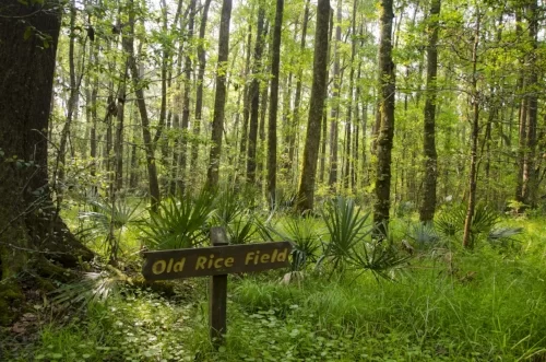
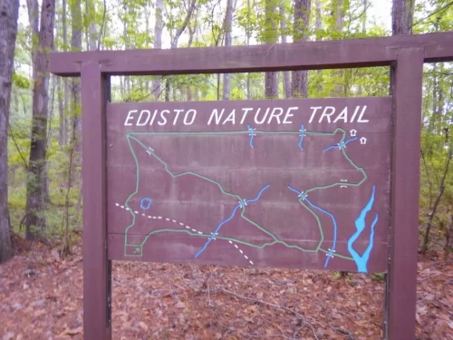
The Lowcountry town of Jacksonboro (between Point South and Charleston) is the perfect spot to get out and stretch your legs on the Edisto Nature Trail. The trail is located on Highway 17, adjacent to the Edisto River. Jacksonboro is in the area known as the ACE Basin. This low-lying part of the state is full of former rice plantations with beautiful marsh and river views, and teeming with wildlife.
The boardwalk trail meanders through the woods that change from pineland and maritime forests to cypress and tupelo swamp. The trail follows the old Westvaco timber road.
Before and after the Revolutionary War, this area was rich in rice production. After the Civil War, phosphate was mined here. A wooden sign can be spotted near the parking lot that points out an overgrown section of the old “Kings Highway” roadbed that eventually was replaced by Highway 17.
Evidence of phosphate mining can still be seen at the Edisto Nature Trail. Phosphate mining became commonplace in the area after the Civil War. This rich limestone deposit contained substances that were particularly good for fertilizer production. The long, shallow pits that were dug to remove the phosphate are still visible.
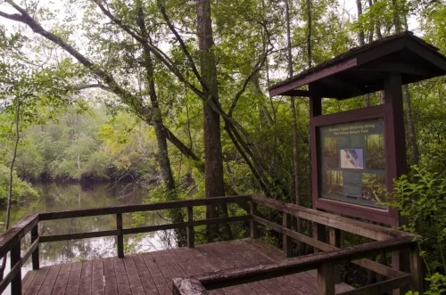
A 15-minute walk along the boardwalk will take you to a dock overlooking the Edisto River. You can also press on and take the 1.5-mile loop trail that can be completed in about an hour. It will transport you from the wetlands to higher upland forest area. Make sure to wear appropriate shoes. The trail may be muddy, and the roots can make the trek challenging. Also, the boardwalk narrows when traveling through the old phosphate pits. Be sure to bring bug spray if you come in the spring or summer.
Bring a picnic and blanket if you want to enjoy lunch on the dock overlooking the Edisto River. Bring along the camera so you can capture the beauty of the area’s flora and fauna. Relax and watch the river flowing gracefully. Look carefully and you just might see an alligator or two.
Anyone who drives Highway 17 from Point South toward Charleston will cross the Combahee River and the Harriet Tubman Bridge.
Tubman, also know as “Moses”, was a former slave from Maryland who fled to freedom in 1849. After settling in Philadelphia, she spent the next decade returning to Maryland multiple times to bring over 300 enslaved people north to freedom through the Underground Railroad. She even rescued her parents, sister and her sister’s children. She came back for her husband, but he had already remarried. She was quoted as saying, “I was the conductor of the Underground Railroad for eight years, and I can say what most conductors can’t say; I never ran my train off the track and I never lost a passenger.”
Harriet was born in 1820 along the Maryland coast. She was named Araminta by her enslaved parents Ben and Rit Ross. At the age of 13 she was nearly killed by a blow to the head. She recovered but was always troubled by the damage.
Image of Harriet and John Tubman from NY Daily News.
She changed her name to Harriet when she married freeman John Tubman in 1844. Five years later Harriet learned she was to be sold. She escaped then vowed to bring others to freedom. She used the stars to find her way north, along with other skills learned in the fields.
In 1862 she left her home in Philadelphia to work in Union-occupied Hilton Head as a nurse and Union spy. The following year, Colonel James Montgomery asked if she would lead a covert military mission against the Confederates in South Carolina. She and 150 black members of the US Second South Carolina Volunteers travelled into Confederate territory and freed slaves. They also worked to destroy rice plantations and recruit ex-slaves into joining the Union Army.
In 1863 Tubman gained vital information about the placement of torpedoes along the Combahee River. Three Union gunboats were able to navigate the river because of the information gained by her covert interactions with slaves along the river.
Combahee River Raid Marker
She led the gunboats to specific spots along the river where fugitive slaves were awaiting rescue. The gunboats carried Union soldiers that were unloaded and succeeded in destroying several estates owned by prominent secessionists. As the soldiers were offloaded, slaves boarded the boats. That night, more than 700 slaves were rescued.
Harriet Tubman is the only woman to have led a military operation during the Civil War. This was known as the Combahee River Raid. 100 of the escaped male slaves joined the Union Army after the raid. This very successful raid dealt a mighty blow to the Confederate Army.
Harriet Tubman is on the far left. Gertie stands beside her and her husband Nelson Davis sits to her left.
Harriet became a lifelong humanitarian and civil rights activist. She became friends with very influential people. She knew Frederick Douglas and John Brown. She was close with suffragists Lucretia Coffin Mott, Martha Coffin Wright and Susan B Anthony. She also spent time with Ralph Waldo Emerson and Harriet Beecher Stowe.
The Harriet Tubman Home for the Aged stood less than 100 yards from her home.
She also set up the Harriet Tubman Home for the Aged. She was admitted to the facility which stood less than 100 yards from her house in 1911. She lived there until her death in 1913, at the age of 90. She was buried with military honors at Fort Hill Cemetery.
Take a trip across the Lowcountry to visit these historically significant spots.
Today’s Green Book of South Carolina pays homage to the original Green Book by highlighting African American heritage sites across the state. The original Green Book was published in 1936. It played a critical role in protecting African American travelers by providing information on safe travel and welcoming establishments across the United States. This guide was instrumental in helping black motorists navigate the dangers of racial segregation. It included gas stations, restaurants and lodging that were safe for African American travelers.
Calvin Ramsey has revived the Green Book as a guide to historically significant sites. The South Carolina Lowcountry counties of Beaufort, Colleton, Hampton and Jasper are very fortunate to have 36 sites memorialized in the Green Book of South Carolina. The following sites were shared from https://greenbookofsc.com/.
BEAUFORT “Freedom Along the Combahee”: Combahee Ferry Raid Hwy 17 at Combahee River, Beaufort County A Union force consisting of nearly 300 members of the 3rd Rhode Island Artillery and the 2nd S.C. Volunteer Infantry, an African American unit, raided several plantations along the Confederate-held Combahee River on June 1-2, 1863. Col. James Montgomery led the expedition. The famed Underground Railroad conductor Harriet Tubman also participated. More than 700 enslaved men, women, and children were freed. Some of the freedmen enlisted in the U.S. Army.
Photo by Terry Kearns
Berean Presbyterian Church / J.I. Washington Branch Library 602 Carteret St. Beaufort Samuel J. Bampfield, an influential African American political figure during Reconstruction, was the founder of Berean Presbyterian Church. He served as postmaster, clerk of the Beaufort County court, and a member of the South Carolina House of Representatives. The congregation purchased this lot in 1892 and built a Gothic Revival style church. Solomon P. Hood, a future U.S. Minister to Liberia, was appointed as its first pastor. The Beaufort Township Library purchased the building in 1931 and used it as a segregated library for African Americans. After the desegregation of the Township Library, the segregated branch closed. Later, the Neighborhood Youth Corps used the building as its headquarters. USC-Beaufort purchased the site in 1993 for use as an art studio.
Camp Saxton Ribaut Rd. on the US Naval Hospital Grounds, Port Royal The Camp Saxton Site is nationally significant as an intact portion of the camp occupied from early November 1862 to late January 1863 by the 1st South Carolina Volunteers, the first black regiment mustered into regular service in the United States Army during the Civil War, and as the site of the elaborate ceremonies held here on New Year’s Day 1863 which formally announced and celebrated the enactment of the Emancipation Proclamation freeing all slaves in areas then “in rebellion” against the United States. This area is preserved as part of Reconstruction Era National Historical Park. However, it is located on the campus of the Beaufort Naval Hospital, an active duty military installation. As a result, this area is not currently open to public access.
Detreville House 701 Green St. Beaufort Rev. James Graham built this house c. 1785. It became known as “the Mission” during Reconstruction, when Mrs. Rachel C. Mather of Boston occupied the house. She and other Baptist missionaries built Mather School in Beaufort to educate African Americans. The house is included in the Beaufort Historic District.
First African Baptist Church, Beaufort 601 New St. Beaufort This church, founded in 1865, grew out of an antebellum praise house for black members of the Baptist Church of Beaufort. During the Civil War, after the Federal occupation of the town, it hosted a school for Freedmen. Rev. Arthur Waddell (1821-1895), organized the church with two fellow black ministers in 1867. Robert Smalls (1839-1915), Civil War hero, state legislator, and U.S. Congressman, was its most prominent member.
Image found on the Green Book of SC website.
Grand Army of the Republic Hall 706 Newcastle St. Beaufort Although Beaufort’s black military companies remained active after the Civil War, statewide the “Negro militia” rapidly declined during the 19th century. By 1903, the only units left were two companies in Beaufort. Many black Union veterans lived in the community, and after the war they formed the David Hunter Post #9 of the Grand Army of the Republic, an organization for veterans of the Union Army. Built in 1896, this meeting hall for the post is believed to be the only surviving building in South Carolina associated with the Grand Army of the Republic. It is included in the Beaufort Historic District.
Mather Museum and Interpretive Center 921 Ribaut Road, building #1, Beaufort This interpretive center chronicles the history of Mather School in Beaufort, a boarding school for freed African American females. The institution was founded in 1868 by Boston schoolteacher Rachel Crane Mather, and is one of many post-Civil War developments that sought to educate recently emancipated African Americans. It first served elementary school-age girls. In 1910, high school grades were added, and in the 1950s, it became a junior college. Today, the museum is housed in the historic school’s former library, and the campus is the site of the Technical College of the Lowcountry. Moor Hall (pictured below,) one of the campus’ original historic buildings, housed classrooms, served as an administration building, a science laboratory, a library and a bookstore. The school of cosmetology training was housed in the basement.
Tabernacle Baptist Church 907 Craven St. Beaufort The Tabernacle, a meeting house and lecture room, was built by Beaufort Baptist Church in the 1840s. In 1863, Tabernacle Baptist Church was organized by Solomon Peck of Boston with most of the 500 African American members of the congregation coming from Beaufort Baptist Church. The new congregation acquired this building for their worship services. The church was rebuilt after it was damaged by the hurricane of 1893. A bust of Civil War Hero Robert Smalls is on the church grounds. Tabernacle Baptist Church is included in the Beaufort Historic District.
Wesley Methodist Church, Beaufort 701 West St. Beaufort This church, established in 1833, was the first Methodist church in Beaufort and was founded as a mission to slaves and free blacks here and on the neighboring sea islands. The congregation had both black and white members but many more black members in the antebellum era. This church, first built in the “meeting house” form common to the Methodist church, was dedicated in 1849. In 1861, after the Federal occupation of Beaufort and the sea islands, this church hosted a school for Freedmen. Its first black minister was appointed in 1873 during Reconstruction.
Image from SC Historic Properties Record.
BEAUFORT SEA ISLANDS Coffin Point Plantation Seaside Rd. St. Helena Island Coffin Point Plantation, a prosperous sea island cotton plantation, became a hub of activity when St. Helena Island was captured by Union troops in 1861. With the Union occupation of the island, the Coffin family fled, and 260 slaves were left behind. The United States government developed a plan to train and educate the newly released slaves to prove their effectiveness as free laborers. This effort became known as the Port Royal Experiment.
Dr. York Bailey House US Hwy. 21 St. Helena Island This house was built c. 1915 for Dr. York Bailey, St. Helena Island’s first African American doctor and its only physician for more than 50 years. Bailey ordered the parts for the house from a mail-order catalog and they were shipped to Beaufort, then brought across to the island by boat. The house is a good example of the vernacular American Foursquare house form. Bailey, born on St. Helena in 1881, graduated from Penn School and Hampton Institute and studied medicine at Howard University. He returned to the island in 1906 to practice medicine.
Image found on Green Book of SC website.
Eddings Point Praise House On Eddings Point Drive, .1 miles north of junction with Secondary Road 74 St. Helena Island The small wood frame building, c. 1900, is a rare example of a praise house. Praise houses were first established on plantations as places to meet and worship. Since there were few formal church buildings on St. Helena Island, most islanders could only walk or ride to the main church on Sunday mornings. For other meetings or services, they used praise houses, holding services on Sunday night and some weeknights. There were as many as 25 praise houses on St. Helena Island as recently as 1932, but only four remain today.
Emanuel Alston House Sec. Rd. 161, .25 mi. N of jct. with US 21 Frogmore/St Helena Island This house is an intact and significant example of a one-story hipped roof house, an early 20th century vernacular architectural form common to St. Helena Island. It was built c. 1915 by Tecumseh Alston, a carpenter, for his brother Emanuel. Emanuel “Mannie” Alston, born 1900, lived here until his death in 1985. He served for many years as an elder at Ebenezer Baptist Church and took a prominent part in the services there.
Knights of Wise Men Lodge Hall 14 Dr. Martin Luther King Jr. Dr. St. Helena Island The Knights of Wise Men was organized in 1870 to provide financial and farming assistance to the families of its members. The Knights purchased this property at the rear of “The Green” in 1889 for $8.00 and built a two-story wood frame building, which burned in 1940. The current concrete building was constructed shortly thereafter by local masons. It is similar in fashion to the earlier building. At its height in the 1920s, the Knights of Wise Men had some 350 members. The lodge is still used during times of celebration.
Mary Jenkins Community Praise House 355 Eddings Point Rd. St. Helena Island Mary Jenkins Community Praise House is one of only four praise houses remaining on St. Helena Island. The small wood frame building, which was built c. 1900, represents a vernacular architectural form that has survived since the plantation era. Paris Capers, born in 1863, was one of the early elders. As a place of religious worship as well as community meetings, this praise house is an important reminder of St. Helena Island’s African American heritage.
Penn Center Historic District / Reconstruction Era National Monument 16 Penn Center Cir. E. St. Helena Island Penn School was founded in 1862 by northern missionaries and abolitionists who came to South Carolina after the capture of the Sea Islands by Union troops. The site and its collection of historic buildings were venues for education, the preservation and interpretation of sea island culture, and a strategy meeting for Dr. Martin Luther King Jr. before his March on Washington in 1963. In January 2017, Penn Center and other historic sites in Beaufort County were declared the nation’s first Reconstruction Era National Monument by President Barack Obama. In 2019, the monument was officially recognized as a National Park.
Image found on the Green Book of SC website.
Robert Simmons House On unpaved road .5 mile south of US HWY. 21 St. Helena Island This house was built c. 1910 by Robert Simmons, an African American farmer. The house is a rare surviving example of a double pen house, a vernacular architectural form once common on St. Helena Island. Double pen houses had two rooms side-by-side, each usually measuring approximately 16×16 feet. The house has been enlarged, but the original core is still distinguishable.
BLUFFTON Campbell AME Church 23 Boundary Street Bluffton White Methodists built Campbell Chapel AME Church in 1853. Nine African American freedmen, who were likely once enslaved by members of the white congregation, purchased the 19th-century Greek Revival structure in 1874. Members of the new African Methodist Episcopal (AME) Church congregation immediately altered the building and expanded the site as the church thrived. They likely installed the cast-iron bell that is currently visible in the cupola. The church retains historic fabric that is both original and reflective of the change in ownership. Campbell Chapel AME continues to provide a space where congregants can educate youth, worship freely, and participate in outreach ministries. This historic church was listed in the National Register of Historic Places on April 26, 2019.
Image by Lloyd Wainscott.
HILTON HEAD Cherry Hill School 210 Dillon Rd. Hilton Head Island This one-room frame school, built ca. 1937, was the first separate school building constructed for African American students on Hilton Head Island. It replaced an earlier Cherry Hill School, which had held its classes in the parsonage of St. James Baptist Church. After the black community on the island raised funds to buy this tract, Beaufort County agreed to build this school. This was an elementary school with one teacher, with an average of about 30 students. It served grades 1-5 when it opened in 1937, adding grade 6 the next school year.
First African Baptist Church, Hilton Head Island 70 Beach City Rd. Hilton Head Island This church, founded in 1862, was originally the church in the town of Mitchelville, a Freedmen’s village established on Hilton Head by the United States Army. Rev. Abraham Murchinson, its first minister, was a former slave and the church had about 120 members when it was organized in August 1862. The church moved to the Chaplin community after the Civil War and was renamed Goodwill Baptist Church. It moved to this site by 1898 and was renamed Cross Roads Baptist Church before retaking its original name. The present church was built in 1966.
Former Home of William Simmons: Gullah Museum of Hilton Head 187 Gumtree Rd. Hilton Head Island This house, built in 1930, is typical in materials and methods of construction of those built on the sea islands from the end of the Civil War to the mid-20th century. It was built on land bought by William Simmons (c. 1835-1922), who was born a slave and served in the 21st U.S. Colored Infantry during the Civil War. His granddaughter Georgianna Jones Bryan built this house in 1930 for her brother. It illustrates everyday life and the persistence of Gullah culture in an African American farm community. It was renovated in 2010-11 as the Gullah Museum of Hilton Head Island.
Fort Howell 160 Beach City Rd. Hilton Head Island This Civil War fort, named for Gen. Joshua Blackwood Howell (1806-1864,) was built by the U.S. Army’s 32nd Colored Infantry and the 144th N.Y. Infantry to defend Hilton Head and the nearby freedmen’s village of Mitchelville from potential Confederate raids or expeditions. That village, just east of the fort, had been established by Gen. Ormsby M. Mitchel in the fall of 1862 and was named for him after his death. The fort was an enclosed pentagonal earthwork with a 23-foot high parapet and emplacements for up to 27 guns. Though Fort Howell never saw action, it is significant for its design and its structural integrity.
The Mitchelville site is preserved as the Mitchelville Freedom Park, complete with a walking trail.
Mitchelville Site Beach City Rd. Hilton Head Island After Hilton Head’s fall to Union forces in 1861, this town was planned for the area’s former slaves and named for General Ormsby M. Mitchel. It was developed into neatly arranged streets and Ľ-acre lots. The town had elected officials, a church, laws, taxes and a school for children, and was home to about 1,500 residents in 1865. The village continued relatively intact until the 1870s and was abandoned by 1890.
Queen Chapel AME Church 114 Beach City Rd. Hilton Head The AME denomination experienced rapid growth after the Civil War and Queen Chapel was among the early churches founded. In 1865, Charleston born AME Bishop D.A. Payne returned to S.C. and brought a group of missionaries to Hilton Head Island. They met with Rev. James Lynch, who had come to S.C. in 1863 to perform missionary work among the freedmen of Mitchelville.
St. James Baptist Church 209 Dillon Rd. Hilton Head Island This church, founded in 1886 by former members of First African Baptist Church, is one of the oldest surviving institutions remaining from the town of Mitchelville, a Freedmen’s village established here by the United States Army in 1862. The present brick sanctuary, covered in stucco, is the third to serve this congregation. It was built in 1972 and renovated in 2005.
Daufuskie Island Historic District 18 Simmons Rd. Daufuskie Island – Accessible only by ferry. The cotton trade spurred the growth of the slave population on Daufuskie Island from 1805-1842, and ruins of slave houses and archaeological sites remain from this period. The island was largely abandoned during the Civil War, but many former slaves returned during Reconstruction, reoccupying slave houses and building churches, schools, and meeting places. In the early 20th century, the population swelled to almost 1000, with oysters, logging, and trucking providing jobs. By the 1940s and 1950s, outside competition had caused many to leave the island and search for jobs elsewhere, leaving the population in 1980 at fewer than 75 people.
EDISTO ISLAND Edisto Island Baptist Church 1813 SC Highway 174 Edisto Island The original core of Edisto Island Baptist Church was built in 1818 to serve the island’s white planters. Enslaved African Americans attended the church with their owners, and the original slave gallery still lines both sides of the sanctuary. After Edisto Island was occupied by Union troops during the Civil War, most of the white plantation families left the island. In 1865 the trustees of the church turned it over to the black members. Edisto Island Baptist Church has operated as an African American church since that time.
The Henry Hutchinson House is in the process of a major restoration. It is being transformed into its former glory.
Hutchinson House 7666 Point of Pines Rd. Edisto Island Built by Henry Hutchinson around the time of his marriage to Rosa Swinton in 1885, the Hutchinson House is the oldest intact house identified with the African American community on Edisto Island after the Civil War. Hutchinson was born enslaved in 1860, and according to local tradition, he built and operated the first cotton gin owned by an African American on the island from about 1900-1920. Hutchinson lived here until his death in 1940.
Image found on the Green Book of SC website.
29 Seaside School 1097 SC Hwy. 174 Edisto Island This Seaside School, which was built c. 1931 as its second building, is reported to be the oldest African American school remaining on Edisto Island. From 1931 until the construction of a consolidated school in 1954, black residents of Edisto Island received their primary education in this building, a one-story, two-room rectangular frame. In 1930, the Edisto Island school district had planned to merge Seaside with Central African American school, but the community, affected by the Great Depression, could not raise enough money for the lot and school supplies. This smaller structure was built instead.
WALTERBORO Episcopal Church of the Atonement 207 Chaplin St. Walterboro This African American congregation was formed in 1892 as a mission of St. Jude’s Episcopal Church, a white congregation. The rector of St. Jude’s supplied services for the Church of the Atonement. This distinctive Gothic Revival church was built in 1896. The wood frame building features a steep gable roof. A tower on the front, which contains the Gothic-arched entrance, is decorated with fish-scale shingles and topped with an open belfry. The Church of the Atonement is included in the Walterboro Historic District.
St. James the Greater Catholic Mission 3087 Ritter Rd. Walterboro vicinity St. James the Greater Catholic Mission is an extremely rare example of a rural, southern, black Roman Catholic parish in continuous existence from its antebellum origins to today. The site includes a sanctuary, a school, and a cemetery. The sanctuary, built around 1935 in the late Gothic Revival style and entirely clad in wooden shingles, is on the same site as two previous churches built in 1833 and 1894. The schoolhouse, constructed in 1901, is rare example of a turn-of-the-twentieth-century I-house built specifically as a school for African Americans. It provided private education for local students, regardless of religious affiliation, until 1960.
St. Peter’s AME Church 302 Fishburne St. Walterboro St. Peter’s African Methodist Episcopal Church was formed in 1867 under the leadership of Rev. James Nesbitt. This building, a Gothic Revival wood frame structure, was constructed around 1870. It features Gothic windows and a tower with an open belfry. It is part of the Walterboro Historic District.
Training the Tuskegee Airmen Tuskegee Airmen Dr. Walterboro Airport During World War II, the first African Americans in the U.S. Army Air Corps graduated from the Tuskegee Army Flying School in Alabama. From May 1944 to October 1945, some of them took further combat training here, at Walterboro Army Airfield. Several of the earliest “Tuskegee Airmen,” who had already won fame in missions in Europe and North Africa, were assigned as combat flight instructors. Trainees here flew the P-39, P-47, and P-40 fighter planes and the B-25 bomber. Officers’ quarters and enlisted men’s barracks stood just east and just west of this spot, respectively.
HAMPTON Hampton Colored School Holly St., between Lightsey St. & Hoover St. Hampton This two-room school was built under the leadership of Ervin Johnson, a local African American carpenter in 1929. It served students in grades one through eight. At first funds were so scarce it was only open from October to March. Eventually however, donations from the black community allowed it to operate for a full school year. Later, high school courses were offered. This remained the only black school in town until the Hampton Colored High School was built in 1947. Then it was converted into the lunchroom for the high school. Marker erected by Hampton County Historical Society, 1989.
Image found on the Green Book of SC website.
Huspah Baptist Church and School 729 Magnolia St. W. Hampton Organized c. 1873, the congregation first met in the homes of church members before erecting a permanent sanctuary. It also began operating a school for African American students around 1890. The first school burned in 1895 (arson was suspected, but never proven). It re-opened the following year. Elizabeth Evelyn Wright and Jessie Dorsey were the first teachers at the new school. Wright would go on to found Voorhees College in 1897. The school at Huspah remained in service until the County built a new school for African American students in 1927. Marker sponsored by Huspah Baptist Church, 2015.
TILLMAN St. Matthew Baptist Church 1454 Tillman Rd. Tillman This church was founded in 1870 with Rev. Plenty Pinckney as its first minister and worshipped in a “bush tent” nearby until a log church was built a few years later. A new frame church was built on this site in the 1890s during the pastorate of Rev. C.L. Lawton. The present sanctuary was built in 1960 during the tenure of Rev. R.M. Youmans, who served here for more than 35 years. Marker erected by the Congregation, 2002.
The Colleton State Park is a paddlers paradise. The 35-acre park is conveniently located off I-95 at Exit 68. The park provides easy access to the Edisto River, one of the longest free-flowing, blackwater rivers in the country, and serves as the headquarters for the Edisto River Canoe and Kayak Trail. Although it is the smallest of South Carolina’s state parks, it connects to Givhans Ferry State Park 23 miles away via the Edisto River.
Photo from Colleton State Park website.
If you are interested in camping, fishing, picnicking, boating, canoeing, kayaking, swimming, bird-watching, geocaching or biking, this park is perfect for you.
Photo by Jason P.
Other amenities at Colleton include an easy nature trail, a campground, picnic shelters and ballfields. There is also an air-conditioned cabin that is available that overlooks the Edisto River. This rustic cabin sleeps six and includes two sets of bunk beds, heating and air conditioning, a fireplace, indoor lights, electrical outlets small refrigerator and microwave. The 25 campsites come complete with water and electricity.
Photo by Maryann F.
The Cypress Swamp Nature Trail runs along the bank of the Edisto River. This easy trail has a self-guided nature brochure and the trail has numbered signs to help identify a variety of trees and plants including cypress, poplar, hickory, sweetgum, maple, dogwood, birch, and magnolia. You can follow the canoe dock boardwalk spur trail to the dark water of Edisto River. Watch for a variety of birds, deer, turtles, snakes and other wildlife.
Photo by Jessica S.
Pets are allowed in most outdoor areas provided they are kept under physical restraint or on a leash not longer than six feet. Owners will be asked to remove noisy or dangerous pets or pets that threaten or harass wildlife. Pets are not allowed in or around lodging facilities.
Photo by Maryann F.
Whether it’s boating, fresh-water fishing or just sharing stories around the campfire, you’ll find everything you need to at Colleton State Park.
Photo from Colleton State Park website.
For reservations call (866)345-7275. Colleton State Park is located at 147 Wayside Lane, Walterboro, Sc 29488. Admission is free.
Driving Directions: From I-95: Take exit 68. go east. toward Charleston/Canadys on Hwy 61. Go 3 miles to Hwy 15. Take Hwy 15 North (left) for .5 miles. The park is on the left.
The entrance to Edisto Island’s Botany Bay is just a sneak peek of the natural beauty found inside this wildlife management area.
Edisto Island is widely known for its unspoiled beaches and yesteryear way of life. Did you know it’s also a great place to hike? The flat ground and moderate winters make it a great location for a short stroll or a day-long hike.
The ancient live oaks along the Botany Bay tour route are breathtaking. Photo credit:Brooke Sheree
Botany Bay Plantation Heritage Preserve/Wildlife Management Area is managed by the South Carolina Department of Natural Resources. Botany Bay has over 4,600 acres of maritime forest, beach, freshwater ponds, and historical buildings to explore. This land was once two cotton plantations: Sea Cloud and Bleak Hall plantations. Once combined they formed one of the largest long staple cotton plantations on the east coast.
Bring your horses for a day of fun trail riding.
Now you can drive, hike, bike, kayak or ride horses on this property. Be sure to pick up a day pass and MAP at the kiosk. The staff is very helpful and knowledgeable. They will point you in the right direction for your chosen excursion. The map is useful for the driving tour. All historical locations are pointed out and explained in detail. The trails are also marked for exploration. There are many places to park while you explore each site.
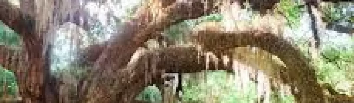
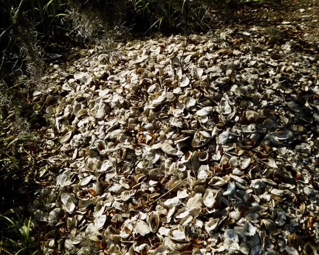
Boneyard Beach trees are spectacular.
The Boneyard Beach walk is particularly interesting because the shore is loaded with weather-worn trees and seashells. While you can pick them up to examine them, be sure to leave anything you find behind. Seashell and shark tooth removal is strictly forbidden.
Using the map as a guide, locate any of the secondary lanes and fire breaks. Park well off the road and start exploring. The trails behind the icehouse are exceptionally nice, as well as the Westcoat Road trails. Botany Bay is open from one half hour before sunrise to one half hour after sunset. It is closed Tuesdays and for scheduled hunts. For closing dates check their WEBSITE.
The plantation is located off Highway 174 on Botany Bay Road. Follow signage along Botany Bay Road to the park.
Edisto Beach State Park trails are shorter but just as beautiful.
Just down the road on Highway 174 you’ll find Edisto Beach State Park. This beach-front park has several trails for hiking and biking. While the trails are shorter in distance, they can be combined for a longer 4.2-mile hike. These trails are well maintained and easy to follow. Use this MAP to plan your route. Benches are placed along the trails for rest and relaxation. They are also bike friendly.
Shell mound photo by Michael B.
The trails are marked with information along the paths. Explore historic monuments and a Native American shell mound while you travel through the maritime forest and beach areas of the park. Bring the camera to capture shore birds and the beautiful scenery.
The Edisto Beach State Park trail. Image by Michael B.
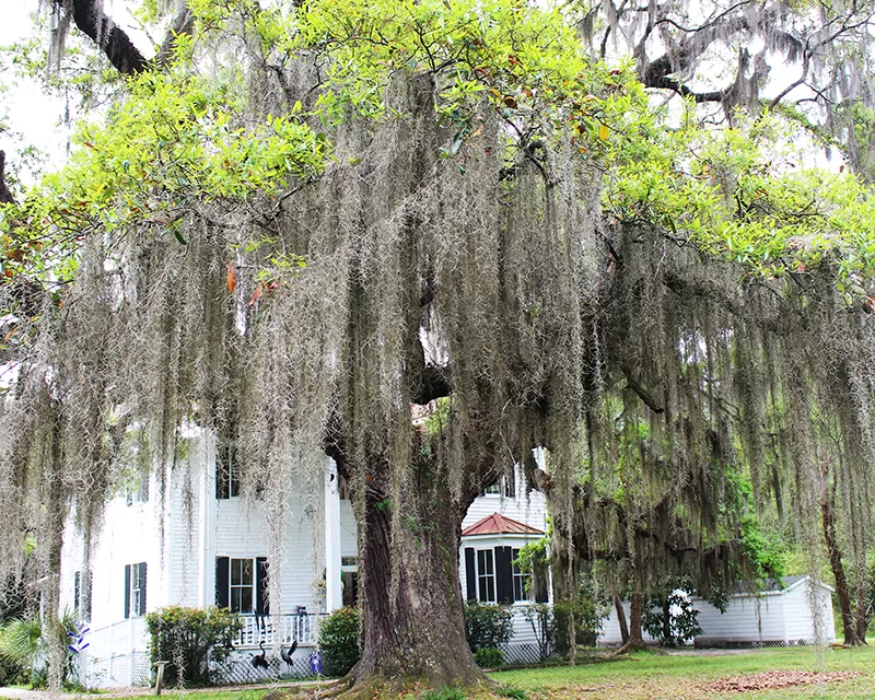
The Bedon Lucas House porch is a great place to visit. Photo credit: Christan Spires
The beautiful historic city of Walterboro sits right on I-95 at exits 53 and 57. If you’re traveling, this is the perfect spot to get out and stretch your legs. There are many interesting attractions for you to chose from. You just might decide to make this historic city a part of your itinerary.
The C. G. Padgett House. Photo Credit: City of Walterboro Facebook Page
Walterboro was founded in 1783 as a summer retreat for local planters. Plantations were sources of malaria during the summer months so towns like Walterboro were started on higher elevations away from bodies of water. The original settlement was started on a hilly area covered with pine and hickory trees. It was named Hickory Valley.
Nature comes indoors at the Walterboro Wildlife Center.
The Walterboro Wildlife Center is in the heart of downtown Walterboro. It is an interpretive exhibit hall showcasing the plant and animal life that is present in the Walterboro Wildlife Sanctuary and throughout the Lowcountry.
Specimens of native Colleton County wildlife are on display in aquariums throughout the center. The Wildlife Center features snakes, turtles, frogs, fish and alligators!
Boardwalks cross through the lowlands of the Walterboro Wildlife Sanctuary.
Just three minutes from I-95, the Walterboro Wildlife Sanctuary combines history, culture, recreation, and education into a southern lowland setting. The 600 plus acre sanctuary features what may be the only “braided creek” swamp accessible to the public.
A completed network of boardwalks, hiking, biking and canoe trails provide a perfect vantage point to observe the diversity of wildlife inhabiting the black water bottomland. Native populations of wild turkey, deer, raccoons, beaver, otter, mink, opossum, squirrels, fox and wildcats have been spotted along the trail. The sanctuary’s Washington Street entrance is located only steps from Walterboro’s main historic district.
The Colleton County Museum and Farmers Market are conveniently located together. Photo Credit: City of Walterboro Facebook Page.
TheColleton County Museum & Farmers Market is located just down the road at the end of historic Washington Street. This museum features exhibits represent the county’s history, culture, natural resources, plantations, as well as Revolutionary and Civil War. There’s also a children’s play area.
Baked goods are popular at the Marketplace Cafe. Photo credit: Barry McRoy.
The farmers market offers local produce on Tuesdays and Saturdays. The site also has a Marketplace Café and a gift shop that sells local produce, crafts and home goods.
Bedon Lucas House. Photo credit: Christan Spires.
Located in Walterboro’s first settlement of Hickory Valley, the Bedon Lucas House is the location of the Colleton County Historic & Preservation Society. The house was constructed in 1820. For tours please visit the Colleton County Historical & Preservation Society website.
Fripp Fishbourne House.
The streets of the Hickory Valley District are laden with beautiful homes. A walk is the best way to appreciate these lovely homes. Take a nice, leisure stroll to photograph your favorites. Hampton Street is a favorite walking destination. Start here and let your feet guide you through the neighborhood.
The SC Artisans Center is loaded with locally made works of art. Photo Credit: Borys Kusyk.
The South Carolina Artisans Centeris another must-see destination in Walterboro. The center is housed in a restored eight-room Victorian cottage downtown, which showcases over 300 local artists. Artwork ranges from traditional and indigenous folk art to contemporary. There are educational exhibits, craft demonstrations and live performances as well. Each piece is truly unique. Pieces range from glass work, jewelry, paintings and sweet grass baskets.
The Lowcountry Regional Airport is the home of the Tuskegee Airmen Monument. Photo credit: Mike O.
A visit to the Tuskegee Airmen Memorial is a great way to honor these brave men who fought for our country. Located on the grounds of the Lowcountry Regional Airport, the monument commemorates the heroism of the valiant young men who enlisted during WWII to become America’s first African American military airmen. These men spent the final three months of combat training at this airport, which was then called the Walterboro Army Airfield. Here airmen learned to fly the Air Cobra, Thunderbolt and Kitty Hawk airplanes.
Washington Street is the destination for antique shopping.
The city of Walterboro is known for its antique shopping. Washington Street has a vast assortment of antiques stores loaded with interesting finds.
Hiott’s Pharmacy has been serving sodas and shakes since 1969. Photo Credit: City of Walterboro Facebook Page.
While antiquing, head to the end of Washington Street and right into a Walterboro landmark. Hiott’s Pharmacy Soda Fountain. This icon is a great spot to wet your whistle and step back in time. The pharmacy fountain has been operational since 1969.
Slow down and catch your breath in Walterboro, the front porch of the Lowcountry!
If you are in search of a great oceanfront campground, look no further than Edisto Beach State Park. The park is rich in Native American history, wildlife, hiking and biking opportunities, as well as two campgrounds, cabins and 1.5 miles of pristine shell-covered beachfront.
Marsh view at Edisto Beach State Park. Image by Ecogardengroup.
The park is made up of 1,255 acres of maritime forest along the beautiful SC coastline. There you will find the environmental learning center, ranger station, and welcome station.
Shell hunting is a favorite pastime on Edisto Beach. Photo by Danie Becknell.
Edisto Beach, along with its neighboring Botany Bay, is famous for its seashells. While Botany Bay does not allow the collection of shells, Edisto Beach State Park does.
There are many trails for hiking and biking. Photo by R2ontheroad.
The Edisto Beach State Park also has 4 miles of ADA accessible trails for hiking and biking. These trails take you through maritime forest, historic monuments, and a Native American shell mound. These trails are also great for bird watching. Many shore and wading birds can be seen here.
A baby Sea Turtle heads for the ocean. Photo by Walterborolive.
The park is a nesting area for loggerhead sea turtles. You can also spot white-tailed deer, raccoons, alligators, bobcats, and opossums.
Stay in one of the seven furnished cabins. Photo by Elizabeth Faulkner
Furnished cabins sit nestled in the woods, and campsites can be found along the Edisto Island oceanfront or in the shaded maritime forest. There are 120 campsites that accommodate RVs or tents. There are seven cabins located on the salt marsh.
Photo of the environmental learning center by Elizabeth Faulkner.
While visiting the environmental learning center you can learn about the ACE Basin and more, featuring interactive displays including a touch tank. The ACE Basin is an estuary that is made from the Ashepoo, Combahee and Edisto Rivers. This is the largest undeveloped estuary along the Atlantic Coast.
These two sets of tracks show a turtle coming and going. Photo by Cole Rise.
Mornings at Edisto State Park can be spent hunting for turtle tracks. You can also cast a line and enjoy some of the island’s best fishing in Scott Creek Inlet. If you’re a boater, launch into Big Bay Creek and enjoy a day of fishing or exploring the waters of the ACE Basin.
Picnic tables can be found scattered in the shade of oaks near the beach. Photo by Crystal Golden.
The park also includes picnic shelters and a park store.
There are many fishing spots at Edisto Island State Park. Photo by Jeff Wayne.
The park offers a mile and a half of beach where surf fishing is allowed. Other locations include Steamboat Landing, Old bridge replaced by the McKinley Washington Bridge, and along the banks of Scott’s Creek along the Spanish Mount trail. There is also a small dock in the cabin area for cabin guests only.
The sun rises and sets beautifully over Edisto Island State Park. Photo by Joshua Mattingly.
See what our visitors love about the
SOUTH CAROLINA LOWCOUNTRY
Use the #hashtag #sclowcountry to get your image featured!
The Lowcountry & Resort Islands Region of South Carolina includes the four, southern-most counties in the state, Beaufort, Jasper, Hampton, and Colleton, which are bordered on the east by the Atlantic Ocean and on the west by the Savannah River and the state of Georgia.
So happy that “Clouds Gather” has found its forever home. 💖 I hope this painting brings joy and memories of happy times to the new owners. #partagergallerygiftsandhome #acrylicpainting #SCLowcountry #southcarolina
This painting conveys a moment I captured of our son during one of our family beach walks, as we looked for nature’s treasures at low tide. He had broken his arm at the beginning of summer and wasn’t able to participate in his favorite summer activities such as sports and jumping waves in the ocean. As a parent, it was difficult watching him miss out, but I was constantly amazed at his positivity and resilience. Watching him in this moment made me think about how we are always searching and the many places our life’s journey takes us.
Discover at your own leisure at the coastaldiscoverymuseum 🌳 From century-old buildings with storied pasts, to wooden boardwalks that stretch into the Jarvis Creek salt marsh, there`s always something to explore!
Details ✨ • I love the perspective of this first shot. I know the angle isn’t a normal view, if you had this hung in your house, but I just think it’s so badass and cool and it’s my account so I can post it and y’all will just have to deal 😆😜. But really, thanks for all the love you’ve shown me on this piece so far. I’m really proud of it and can’t wait to make more versions of this design. 💙🌾 • Fiber sources tagged 🌊
Spanish moss drapes the live oak trees that are ubiquitous to the Edisto Island area. Did you know that Edisto gets its name from the native Edistow people? The Edistow Native Americans were a sub tribe of the Cusabo indians, a group of Native Americans who lived along the Atlantic coast in South Carolina.
⏰ Best time of the day to visit: Stop by mid-morning. That way you can explore the island, grab lunch, and stay for the amazing sunset if you choose.
🏖️ Things to do while there: Edisto Environmental Learning Center, Boneyard Beach, Scott Creek Inlet, Big Bay Creek, SeaCow Eatery.
☀️ Things to visit in the area: Jungle Road Park, Bay Creek Park, Otter Islands, Spanish Mount Point.
📆 Best time of the year to visit: For warmer weather come anywhere from March-August.
🏨 Where to stay: Fripp Island Golf & Beach Resort (frippislandrsrt), Seabrook Island Club (seabrook_sc), The Sanctuary at Kiawah Island Golf Resort (kiawahresort), Charleston Kiawah Island/Andell Inn (andellinn).
A visitor takes a leisurely stroke under a canopy of live oaks draped with Spanish moss in the Palmetto Bluff (palmettobluff) neighborhood of Bluffton, South Carolina. Palmetto Bluff is a picturesque community that sits in the heart of Lowcountry. Nestled along the May River, it’s abundant with beautiful walking trails, historic sites, and stunning views.
⏰ Best time of the day to visit: There is no wrong time to visit Palmetto Bluff. However, we highly recommend sticking around for one of their spectacular sunsets.
🛶 Things to do while there: Stop by Cole’s for some regionally inspired Southern fare, paddle board, kayak, or canoe along the May River, go saltwater fishing, take a tour at Bluffton Jack`s Old Town Tours.
🌊 Things to visit in the area: Palmetto Bluff Conservancy, Old Town Bluffton, Bluffton Oyster Factory Park, May River Sandbar, Heyward House Museum and Welcome Center (heywardhouse).
📆 Best time of the year to visit: For the best weather, we recommend visiting between March and May or from September to November.
🏨 Where to stay: The Montage Palmetto Bluff Resort (montagepalmettobluff) is the only resort in Palmetto Bluff. However, there are plenty of places to stay in the surrounding areas including: Old Town Bluffton Inn (oldtownblufftoninn), The Inn & Club at Harbour Town (theinnandclubatharbourtown), Sonesta Resort Hilton Head Island (sonestahhi).
Isn`t this live oak tree tunnel beautiful? Live oak, draped in Spanish moss, is emblematic of South Carolina and many of the Southern states. We love these iconic trees, not only for their beauty, but their history as well. The average lifespan of a live oak is 300 years!
The shore gently recedes beneath the stunning Pawleys Island Pier. The unique island town, located about 25 miles south of Myrtle Beach and 70 miles north of Charleston, exudes laid-back, beachy vibes. Locals have definitely adopted an island state of mind and encourage visitors to as well. When you go, make sure to relax on the beach, explore the famous sand dunes, or fish in one of the many adjacent creeks.
⏰ Best time of the day to visit: We guarantee that you’re going to want to spend a whole day here. We recommend getting to the beach at around 10am.
🗓️ Best time of the year: Pawleys Island has the best weather during the spring and early summer months.
🏖️ Things to do while there: Pawleys Island Nature Park, Pawleys Island Chapel, Hopsewee Plantation.
🐠 Things to visit in the area: Brookgreen Gardens (brookgreen_gardens), take a walking ghost tour, Myrtle Beach (mymyrtlebeach), Harborwalk Marina, South Carolina Maritime Museum (southcarolinamaritimemuseum).
🏨 Where to stay: The Oceanfront Litchfield Inn (oceanfrontlitchfieldinn), Litchfield Beach and Golf Resort (litchfieldbeachandgolf), Sea View Inn (seaviewinn), 620 Prince (620prince).
Pregnancy sleep = 😫. Silver lining, a sunrise walk with Sullie and Zoey. _ Anyone else deal with terrible sleep in the third trimester? It`s been brutal. Combo of overall anxiety/mind racing, digestion discomfort and having to pee all the time! 😐 _ #sunrise #follybeach #sclowcountry #scbeaches #goldenretrievers #goldensofinstagram #charleston #29weekspregnant #thirdtrimester #pregnancylife #pregnancyproblems #beach #beachsunrise
Angel Oak, Johns Island, South Carolina. ⠀ ⠀ The Angel Oak Tree is a Southern live oak (Quercus virginiana) located in Angel Oak Park on Johns Island near Charleston, South Carolina. The Angel Oak Tree is estimated to be at least 400 and possibly up to 1400 years old It stands 66.5 ft (20 m) tall, measures 28 ft (8.5 m) in circumference, and produces shade that covers 17,200 square feet (1,600 m2). Its longest branch distance is 187 ft. in length. ⠀ ⠀ #angeloak #angeloaktree #southcarolina #johnsisland #charleston #DiscoverSC #lowcountry #SCLowcountry #lowcountrylife #igerssouthcarolina #blackandwhite #b&w #oaktree #legacyoak #blackandwhite #blackandwhitephotography #totravelistolive #travel_captures #travellove #travelpics #travelpic #travelbug #travelandlife #lifeisajourney #adventuroussoul
The South Carolina Lowcountry Guidebook is filled with many things to see and do in the beautiful Lowcountry of South Carolina. Please fill out the information and we will send you a FREE GUIDE BOOK.


