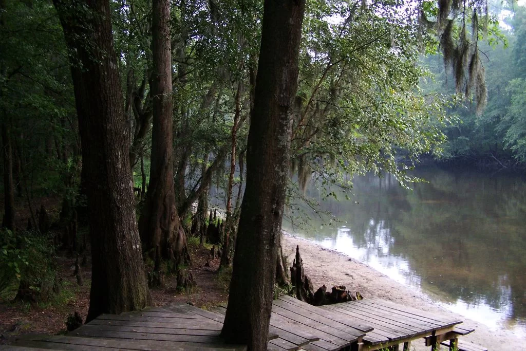
An anhinga suns itself along the bank of Crystal Lake. Photo by Jim Ferrell.
Crystal Lake Park can be found just across the bridge from Beaufort, on Lady’s Island. This 25-acre park winds through forested habitats, salt marsh and around Crystal Lake. Boardwalk leads over saltwater wetlands, to the beautiful 7-acre Crystal Lake.
Photo by Friends of Crystal Lake Park
The pine trees around Crystal Lake make excellent perches for herons and egrets. Photo by Friends of Crystal lake Park.
Crystal Lake is an extraordinary habitat for bird species. Many species have been documented here. Songbirds, wading birds, birds of prey, migratory waterfowl, and endangered species such as wood storks. Egrets and herons can also be spotted here. Turtles, snakes, and alligators also call the park home.
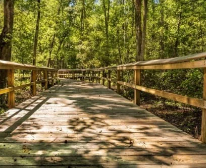
A beautiful boardwalk surrounds the lake. Image by Beaufort County Parks.
The park has many opportunities for visitors to learn about the Lowcountry’s natural resources. Walk the trail or visit the interpretative center. Be on the look-out for birds and other wildlife that live in this Lowcountry habitat.
Docks can be used for catch and release fishing. Image by Dawn Ramsey.
Catch and release fishing can also be done from the docks. The lake has a population primarily of redfish and mullet.
The Crystal Lake Conservation Center can be found out front. Photo by Moreece Maddox.
Beaufort County has renovated the former Butler Marine building into the Crystal Lake Conservation Center. Offices for the Beaufort Open Land Trust and the Beaufort County Conservation District can be found inside. A pollinator garden created and maintained by volunteers is adjacent to the park office building. The park is located at 124 Lady’s Island Drive.
Alligators can be found in Crystal Lake. Photo by Dawn Ramsey.
Wildlife biologist Charles Pinckney enjoys birding in the SC Lowcountry. Photo by Carmen Pinckney.
Exploring SC Lowcountry Parks is a great way to get outdoors! During these stressful times, it is important for us to maintain our connection with nature. While we’re all social distancing and staying home, it’s a good idea to get outdoors and soak up sunshine and fresh air. If we take precautions and listen to the guidelines put in place by our leaders, exploring a park is just what the doctor ordered! Colleton, Beaufort, Hampton and Jasper Counties have a multitude of outdoor possibilities to connect with nature. For additional information and maps of these properties visit https://southcarolinalowcountry.com/wildlife-preserves-and-nature-trails/.
Colleton County and Walterboro have some wonderful parks and wildlife management areas. Whether you want to stretch your legs or take a scenic car ride, these natural wonders have something for everyone.
ACE Trail image found on Friends of the Ace Trail website.
The ACE Trail is located two miles north of the intersection of Hwy 17 and SC HWY 303 in Green Pond. This trail runs along the abandoned Atlantic Coast Railroad Line that parallels SC Hwy 303. This trail is currently 2.8 miles, but another extension is planned soon. The trail is ideal for walking, biking and bird watching. The trail head has picnic tables and plenty of space for parking.
Colleton State Park borders the Edisto River. Image found on southcarolinastateparks.com.
Colleton State Park borders the Edisto River. Here, you’ll find a short, easy walking loop trail that travels along the river. Signs are placed along the trail to help you identify a variety of trees and plants, including Cypress trees. While here, look for birds, deer, turtles and other wildlife. The park can be found at 147 Wayside Lane, Walterboro – just a few miles off I-95.(843)538-8206
The ACE Basin National Wildlife Refuge is home to a large variety of wildlife. Image by Hometown Hiker.
Ernest F. Hollings ACE Basin National Wildlife Refuge has trails that weave through the forest and across dikes of a historic rice plantation. The refuge also has one of the few remaining antebellum houses in the area. This refuge protects the largest undeveloped estuary along the Atlantic Coast. The area is home to a wide variety of wildlife. The refuge is located at 8675 Willtown Road, Hollywood, SC, on the way to Edisto Beach. (843)889-3084
Bear Island Wildlife Management Area is a great place to look for bald eagles. Photo by Rhonda McFadden Epper.
Bear Island Wildlife Management Area is located off Hwy 17 in the Green Pond area. This wma is managed to provide quality habitat for wintering waterfowl. It’s a great spot to view bald eagles, wood storks and roseate spoonbills. Drive through this area for many opportunities to spot wildlife. The forest, marsh and river views are beautiful. Bear Island is located between the Asheepoo and S Edisto Rivers. From Hwy 17, turn onto Bennett’s Point Road and follow for 13 miles. The entrance is on TiTi Road. (843)844-8957
Former rice fields at Donnelley Wildlife Management Area are breeding grounds for American alligators. Photo by William Purcell.
Donnelley Wildlife Management Area has more than 8,000 acres of diverse wildlife habitats. This property features a historic rice field system that is now managed to attract waterfowl and migratory birds. The former rice plantation is nestled between the Combahee and Asheepoo Rivers. All types of wildlife can be found here. There are 11 miles of roads that can be driven through the property. There are also walking trails that lead to dikes that cross old rice fields. Herons, egrets, ibises and many more varieties of birds can be found on this freshwater wetland. Located at 585 Donnelley Drive in Green Pond. The entrance is at the intersection of US Hwy 17 and SC Hwy 303. (843)844-8957
The Walterboro Wildlife Sanctuary is in the heart of historic Walterboro. Photo by walterborosc.org.
Just three minutes of I-95, the Walterboro Wildlife Sanctuary is a great place to get back to nature. There are trails for hiking, biking and even canoeing. This wildlife sanctuary is in the heart of downtown Walterboro. Parking can be accessed on DeTreville Street. Boardwalks lead through a braided creek with a diversity of wildlife that inhabit the black water bottomland. (843)538-4353
The drive into Botany Bay is one of the most photographed live oak avenues in the Lowcountry. Photo by Carmen Pinckney.
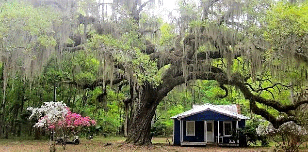
Botany Bay Plantation Wildlife Management Area can be found on the way to Edisto Beach. This wildlife management area borders the Atlantic Ocean and the North Edisto River. Beach access is closed until further notice, but the remainder of the property is open. Drive through this undeveloped wetland ecosystem, then park to walk trails located throughout the property. The remains of two plantations can be explored here. You can even trailer in horses and go for a ride along the many roads of Botany Bay. The entrance to the property is one of the most photographed live oak canopies in the lowcountry. Many varieties of birds and wildlife call this coastal property home. (843)844-8957
These baby raccoons make a home in a hollow tree. Photo found on southcarolinaparks.com.
Edisto Beach State Park is located on the beach and its adjacent maritime forest. The park has seven trails that are available for hiking, biking and birding. The trails wind through the forest and past the earliest Native American shell mound site in the state. A series of short, mostly level hikes travel through Edisto Island’s maritime forest of live oak, hanging Spanish moss, and palmetto trees. During your walk you may see white-tailed deer, osprey, raccoons, or alligators, and may even catch a glimpse of the wary bobcats.
There are many spots along the Spanish Moss Trail to relax and soak up the views. Image by Carmen Pinckney.
Beaufort’s Spanish Moss Trail is the product of the Lowcountry’s Rails to Trail program. The ten- mile trail follows the path that the railroad took from Yemassee to Parris Island, carrying recruits to the training facility. The rail lines were removed, and the trail was paved for walking, running, biking, fishing, skating, scooting and strolling. The Spanish Moss Trail offers spectacular river and marsh views, and a great opportunity to view wildlife. Historic points are noted along the trail.
Hunting Island State Park’s trails stretch across boardwalks and maritime forest. Photo by Scott Densmore.
Hunting Island State Park is located on the beach and its maritime forest. The park has wonderful hiking and biking trails. The park’s walking nature trails provide an opportunity to experience the island’s natural environment. The biking and hiking trail is 8 miles long. The trails lead through the maritime forest, providing scenic views of the lagoon and various wildlife habitats. The trails have dense vegetation that provides protected habitat for many animals including deer, raccoon, owls, hawks and squirrels. Walk the beach to search for shells and shore birds. Bring a picnic and pick from one of the many spots to enjoy lunch.
Strolling Crystal Lake is quite an experience. Photo by Jim Ferrell.
Crystal Lake Park can be found just across the bridge on Lady’s Island. This 25 acre park winds through forested habitats, salt marsh and around Crystal Lake. The park has many opportunities for visitors to learn about the Lowcountry’s natural resources. Walk the trail or visit the interpretative center. Be on the look-out for birds and other wildlife that makes the park home. Catch and release fishing can also be done from the docks. 124 Lady’s Island Drive, (843) 255-2152
Visiting Cypress Wetlands walking trails gives you the opportunity to see rookery wildlife. Photo by Trover.
Port Royal has two natural habitats to explore that are located relatively close to each other. You can visit both in one day. Cypress Wetlands Walking Trail is located on Paris Ave right off Ribaut Road, with parking on Paris Avenue. There are several species of birds that call this place home including herons, hawks, eagles, owls, falcons, geese, ducks, and other migratory waterfowl. It is absolutely a birdwatcher’s paradise. In addition to birds, regular visitors among the cypress trees are alligators, turtles, and snakes.
The best views at the Henry Robinson Boardwalk can be found at sun-up and sun-down. Photo by Miles Sanders.
The Henry Robinson Boardwalk is a great place for a stroll. Enjoy the wildlife while walking along the vast waterway. Located on the southern tip of Port Royal, Battery Creek flows into the Beaufort River. Search for shark’s teeth on the sandy beach. Boats and kayaks can be launched from a ramp into the river. The boardwalk is a popular place for strolling, crabbing and fishing. An observation tower is located near the end of the boardwalk. (843)986-2200
Victoria Bluff Heritage Preserve is a hidden gem in Bluffton. Photo by Justin P.
Bluffton’s Victoria Bluff Heritage Preserve is located in Bluffton off Hwy 278 on Sawmill Creek Road. Spend a day hiking, bird watching and picnicking. Avoid the preserve during hunting season. The area is used for bow hunting. Birders will want to bring binoculars and keep a sharp eye out, particularly in the spring. The understory thickets are dominated by saw palmetto and a range of evergreens. This habitat is ideal for migratory species such as tanagers, white-eyed vireos and a host of different warblers. Overhead, massive live oaks, and longleaf and slash pines cast deep shadows on the trail. In no time at all during a midday walk, things get cool and quiet.
Audubon Newhall Preserve is in top condition for spring. Photo by Ed Funk.
Hilton Head Island is commonly known for its beaches and golf community, but did you know there are many places to enjoy nature? Audubon Newhall Preserve is located at 55 Palmetto Bay Road. The birds are singing, and the plants and nature trails are in top condition for spring. This woodland ecosystem is known as pine/saw palmetto flatwoods. The preserve has a series of short, easy walking trails through the fifty-acre property. Pick up a trail guide at the entrance which will guide you through a wide variety of trees and plants, from Florida Scrub to native hardwoods. (843)785-5775
Coastal Discovery trails offer marsh views and birding opportunities. Photo from museum website.
The Coastal Discovery Museumhttps://www.coastaldiscovery.org/nature trails are open for walking and picnicking. Tale a leisurely stroll around the 68-acre property. The seashell nature trail leads to Jarvis Creek, and the camellia garden boasts 120 different varieties of bloom and color. (843-689-6767)
Jarvis Creek Park walking paths circle the lake and through the woods. Photo by Hendrik Beenker.
Jarvis Creek Park is located at 50 Jarvis Creek Road. The park was closed April 1st but will reopen on May 7th. The park is great freshwater pond fishing. There’s a floating dock and grass meadow. There’s a paved pathway that surrounds the lake and a fitness trail. Call the park for opening date. (843) 341-4600
Egrets love the unspoiled natural habitat of Pinckney Island. Photo by Betsy Arrington.
Pinckney Island National Wildlife Refuge is located between Hilton Head Island and Bluffton. 4,052 acres that preserve the salt marsh and maritime habitat. The refuge offers a variety of opportunities to explore and enjoy the great outdoors from sunrise to sunset every day. You can observe and photograph wildlife, go fishing, hike or bike the 14-miles of roads that wind across the island. (843) 784-2468
Follow the trail for a glimpse of a historic shell ring. Photo from Google Maps.
Sea Pines Forest Preserve is a protected area for wildlife habitat and outdoor exploration. The preserve includes bridle paths, wetland boardwalks, bridges and fishing docks. Explorers can pick up a map and stroll the trails independently. View marshes and wildlife from a boardwalk at Old Lawton Rice Field. Explore a secluded forest on the boardwalk through the Vanishing Swamp. Discover the 4,000-year-old Sea Pines Shell Ring, which is listed on the National Register of Historic Places. See acres of native flora in bloom. Enjoy a picnic along the banks of Fish Island. (843) 785-3333
Turtles, alligators ducks and fish call Blue Heron Nature Trail home. Photo by Lyn Boyles.
Ridgeland’s Blue Heron Nature Trail is a 10-acre green space that has a half-mile trail around a three-acre pond, and forested wetlands. The property also includes a butterfly garden, picnic area, and observation decks. Trail side displays help visitors learn more about the native flora and fauna of Jasper County and the Lowcountry. Exit 21, Ridgeland, (843)726-7611
Savannah national Wildlife Refuge has 40 miles of trails to explore. Photo by Nolen Yehlik.
Savannah National Wildlife Refuge is located off US Hwy 17, between Hardeeville and Savannah. Many visitors take the car tour through the former rice plantation, but did you know there are 40 miles of hiking trails through the 7,000-acre refuge? Jasper County’s Savannah National Wildlife Refuge consists of 31,551 acres of freshwater marshes, tidal rivers and creeks, and bottomland hardwoods. Well-maintained hiking trails wind throughout the refuge, giving hikers and bikers access to these former rice fields. Explore the nearly 40 miles of trails that are built on dikes that contained rice fields dating back to the early 1700’s. (843) 784-2468
Come to Webb Wildlife Management Area to get a glimpse at red-cockaded woodpeckers. Photo by Karen Marts.
Hampton has two great places to get some exercise in the great outdoors. Webb Wildlife Management Area is located off Hwy. 321, bordering the historical Savannah River. The 5,866 acres encompass upland pine stands that host endangered species such as red-cockaded woodpeckers, as well as wildlife openings, bottomland hardwood forests and cypress-tupelo swamps. The property provides excellent viewing of deer, wild turkeys, bobwhite quail, gray squirrel and many types of birds. Several nature trails can be found on the property. Ponds are available for fishing. 1282 Webb Ave, Garnett. (803)625-3569
Birds of prey search for dinner at Lake Warren State Park. Photo by southcarolinaparks.com
Lake Warren State Park is located in Hampton. The park has three trails for outdoor enthusiasts. The nature trail winds through the woods and around the fishing pond. The fitness trail has 10 exercise stations. The Yemassee Trail follows a path along Lake Warren. Interpretive signs are placed throughout. There are also fishing opportunities at the park. (803)943-5051
Many Beaufort, SC homes located in the historic district pre-date the Civil War, thanks in part to the fact that its citizens fled the city before Union troops made their way into town. Beaufort became the headquarters of the US Army, Department of the South. Most homes were converted into hospitals, offices and officer’s quarters. One home was even repurposed as a bakery.
Most historic homes in Beaufort are framed in live oaks, palms and Spanish moss. Photo by Carmen Pinckney.
The Beaufort historic district is a mix of Federal, Neoclassical, Greek Revival and Victorian styles. The city is also known for its widespread use of tabby construction, using oyster shells, sand, lime and ash to make an early form of concrete.
The oyster shell can be seen in this tabby wall, located in the historic district. Photo by Carmen Pinckney.
212 New Street. Photo by Carmen Pinckney.
The house at 212 New Street was built by William Waterhouse for his wife. The piazzas of this late Victorian span across the eastern and southern sides of the house. The style of this house combines Queen Anne and Classical Revival elements of design.
214 New Street. Photo by Carmen Pinckney.
The Thomas Hepworth House, located at 214 New Street, is long been referred to as Beaufort’s oldest house. Thomas Hepworth was Chief Justice of the colony. He acquired an original land grant in 1717, with a stipulation that a house be built within 5 years. The Dutch-influenced home has served as a residence, Republican Headquarters, a boy’s school and a meeting place for Masons. It was converted into apartments during World War II, then restored to a single-family dwelling in the 1950s. The Colonial two-story cottage is located in the heart of the Old Point. Rumor has it that the ventilation piercings of the tabby foundation (at the back of the house) were used as rifle slots to defend against Indian attacks.
500 Port Republic Street. Photo by Carmen Pinckney.
The George Mosse Stoney house is located at 500 Port Republic Street. Dr. Stoney built the house for his wife Sarah Barnwell around 1823. Visible Greek Revival details were added around 1840. The street view has a small porch, but the side and back open with large porches to catch the river breeze. When first built, this house was only one room deep.
915 Port Republic Street. Photo by Carmen Pinckney.
The Cuthbert Scheper Simmer House was built in 1820. It sits on a beautiful corner lot at 915 Port Republic Street. The house was built on a high brick foundation and originally one room deep. The house was expanded in 1875. During Civil War occupation, the Cuthbert family moved to Aiken and never returned to Beaufort. The Federal Army used the home as a bakery. Harriet Tubman baked bread here when she was stationed in Beaufort with the Federal Army. The house was changed in the 1870s with the addition of the second story veranda, a cupola, a storm entrance and a beautiful iron fence. The yard has a Victorian garden that still retains its original footprint. The house also contains a basement cistern that supplies water from 120 feet underground.
1113 Craven Street. Photo by Carmen Pinckney.
The Milton Maxcy Secession House, at 1113 Craven Street, is the spot where southerners first hatched plans for secession. The house was built in 1810 as a school for boys. Edmund Rhett bought the house in the 1850s and renovated it in the Greek Revival style. Edmund and his brother Congressman Robert Barnwell Rhett hosted gatherings of like-minded southerners in the house. During the Civil War the house was used as a hospital, officer’s quarters and paymaster’s office. Civil War scribblings have been discovered on the basement walls. Governor Carroll Campbell and US Senator Strom Thurmond added their signatures to the wall. Vice President George HW Bush added his signature to the wall in 1988.
1109 Craven Street. Photo by Carmen Pinckney.
The William Fickling House sits at 1109 Craven Street. It is believed to have been built in the 1790s when Mr. Fickling came to Beaufort to teach at a boy’s school. Another theory suggests it was built in the 1820s with renovations and additions being completed before and after the Civil War. The house is now the rectory for St. Helena Episcopal Church.
901 Craven Street. Photo by Carmen Pinckney.
The W.J. Jenkins house sits two blocks away at 901 Craven Street. Built in 1845, this house is a good example of a finely proportioned Beaufort house. Union troops occupied the house during the Civil War.
713 Craven Street. Photo by Carmen Pinckney.
The Beaufort Arsenal is down the street at 713 Craven Street. Construction began in 1795. It was designed to house a magazine capable of containing a hundred thousand weight of gun powder and a thousand stand of arms. The Beaufort Volunteer Artillery rebuilt the complex in 1852. This army was organized in 1775 and fought in every war fought by this nation including the Revolutionary War. The Beaufort Museum is in the building today. Two brass trophy guns captured from the British in 1779 are in the yard. The guns were seized by Union troops during the Civil War at the Fall of Fort Walker in 1861. They were returned to Beaufort around 1880.
Photo by Carmen Pinckney.
The 500 Block of Craven Street contains charming examples of Victorian architecture. These homes were built in the 1880s and 1890s. The houses are nearly identical in design and ornamentation. Newly invented woodworking machinery was invented in the late 19th century and was implemented in the decorations of these homes.
411 Craven Street. Photo by Carmen Pinckney.
The Castle is located across the street at 411 Craven Street. This house was built for Dr. Joseph Johnson in 1861. Some elements of the house were waylaid during the Union naval blockade. Bricks for the house were made on Dr. Johnson’s plantation on Lady’s Island. During the Civil War the house was used as a hospital. After the war Dr. Johnson reacquired his house for the sum of $2,000 in back taxes. The house remained in the Johnson family until 1981. The Italian Renaissance house is made of bricks covered in plaster. The house towers over an entire city block. The gardens contain hundreds of azaleas and camelias. Live oaks cover the yard as well. The garden also contains two ancient olive trees brought from the Mount Olives in the Holy Land.
310 Federal Street. Photo by Carmen Pinckney.
The current house at 310 Federal Street was built sometime after the Civil War. It is known as Moorelands. It was built on the original tabby foundation of the home that burned in the 1890s. That home was used as a hospital during the war. The house sits beautifully against the backdrop of the Beaufort River.
302 Federal Street. Photo by Carmen Pinckney.
The William Fripp House, or Tidewater is located at 302 Federal Street. It was built in 1830 by one of Beaufort’s wealthiest planters. He also owned more than 3,000 acres of land on St Helena Island with nine plantations. The home’s two-story portico faces the river to take advantage of the breeze.
315 Federal Street. Photo by Carmen Pinckney.
Cassena sits at 315 Federal Street. Built in the early 1800s, the house was owned by sisters Ann B. Oswald and Mary Bell. After the Civil War the house was bought by a former slave of Mary Bell. The house remained in her family until it was severely damaged in the storm of 1893. It stood abandoned until 1898. The home was restored to its former glory.
501 King Street. Photo by Carmen Pinckney.
The William Wigg Barnwell House sits two blocks away at 501 King Street. It formerly sat at the corner of Prince and Scott Streets until 1973. It was slated for demolition when the Historic Beaufort Foundation stepped in and saved the historic home. During the Civil War the house served as Union Hospital #4. The house stayed in the Barnwell family until 1895. The house next served as a school and apartment house. The house was purchased and restored by Savannah’s famous antiques dealer Jim Williams
411 King Street. Photo by Carmen Pinckney.
411 King Street’s F.W. Sanders House was built in 1910 after the original structure burned in the Fire of 1907. Like so many of its neighbors, the house is built of heart-pine, but it contains mahogany woodwork.
401 King Street. Photo by Carmen Pinckney.
Built in 1856, Little Taj stands proudly at 401 King Street. It looks out over a tidal basin The name refers to a modern reference due to the fact that a reflection of the house can be seen in the tidal pool across the road. The Beaufort style house was built to take full advantage of the breezes. A recent renovation revealed the corner supports of the house are made from limbs of trees that are six inches in diameter and were not sawed.
604 Pinckney Street. Photo by Carmen Pinckney.
Located at 604 Pinckney Street, the Edward Means House was built between 1855-57. The brick mansion was used as Union Hospital #2 during the Civil War. The interior boasts marble mantles and a floating spiral staircase. The porches face south to capture the prevailing breezes.
100 Laurens Street. Photo by Carmen Pinckney.
The Paul Hamilton House, or the Oaks is located at 100 Laurens Street. Magnificent oaks shade the Italianate house that was built in 1855. Expansive porches wrap around two stories and three sides of this beautiful house. The house was abandoned in 1861 and used as Union Hospital #1. After the war Mr. Hamilton bid on his house and was given three days to secure the funds. He traveled to Charleston to do just that when his young son ran home to inform the family the home was going to be sold at sunset. Local citizens saved the day when they rallied to raise the funds to purchase the home in the name of Mr. Hamilton.
1 Laurens Street. Photo by Carmen Pinckney.
The Edgar Fripp House is commonly known as “Tidalholm” because the Beaufort River practically surrounds it. Located at 1 Laurens Street, this Italianate house was built in 1853 as a summer home. During the Civil War the home served as Union Hospital #7. According to family legend, when Mr. Fripp returned to Beaufort after the war, the house was being sold for taxes. He was regrettably unable to bid on the home. A Frenchman who was sympathetic to the South won the bid on the home. He then presented the deed to the former owner, then returned to France before the debt could be repaid.
201 Laurens Street. Photo by Carmen Pinckney.
The Berners Barnwell Sams House can be found at 201 Laurens Street. This home was built in 1852 with massive Doric columns and plantation-made brick. The flat roof is topped by a lovely balustrade. The Classic Revival home was used as a hospital during the Civil War. The dependency outback used to contain a cookhouse, blacksmith shop, laundry room, storeroom and servant’s quarters.
207 Hancock Street. Photo by Carmen Pinckney.
Elizabeth Hext House is located at 207 Hancock Street. Built in 1720, the house is considered to be one of the oldest homes in Beaufort. This early example of Beaufort architecture is set high on a tabby foundation. The house remained in her family until 1864, when it was sold by the US Tax Commission for $640.
804 Pinckney Street. Photo by Carmen Pinckney.
The John Archibald Johnson House can be found at 804 Pinckney Street. This three-story house was built by Dr. Johnson in the 1850s. It was used as a hospital during the Civil War. The house sustained damage in the 1970s and slated for demolition when the Historic Beaufort Foundation purchased the property. It was resold to new owners who wanted to restore the historic property. The home reflects the prosperity of the time it was built. The wrap around piazzas can be accessed from multiple rooms, allowing breezes to enter the house in the summer.
313 Hancock Street. Photo by Carmen Pinckney.
The Talbird-Sams House sits at 313 Hancock Street. This simple example of Beaufort architecture was built around 1786. The house served as part of Union Hospital #3 during the Civil War.
511 Prince Street. Photo by Carmen Pinckney.
The Robert Smalls House proudly stands tall at 511 Prince Street. Robert Smalls was born into slavery at this home in 1839, to the household of John McKee. At 12, Smalls was sent to Charleston, and remained there until the outbreak of the Civil War. He worked for the Confederacy on the CSS Planter. During a daring act of heroism, Smalls sailed the ship through the Charleston harbor to freedom. After presenting the ship to the Union Army he became a Union soldier. After the war he returned to Beaufort and bought the home where he was formerly a slave. After his return to Beaufort he was elected as the first African American Congressman.
711 Prince Street. Image from Beaufort Online.
The Daniel Hingston Bythewood House can be seen at 711 Prince Street. This house is another fine example of early Beaufort style. Mr. Bythewood was a British merchant and sea captain. He built this house in 1792 for his wife Elizabeth Taylor. She convinced him to give up life on the sea to become a Baptist missionary. The home is built on a tabby foundation and flanked with chimneys.
901 Prince Street. Image from Beaufort Online.
901 Prince Street is the site of the Frederick Fraser House. The 1803 home is built on a raised foundation and is fronted by double verandas. The exterior is made of brick covered in stucco and scored to resemble masonry blocks. The first-floor veranda is accessed by way of double stairs. A Palladian doorway accesses the second.
Beaufort’s lovely homes fan out in every direction from here. Take a walk and get lost on the beautiful streets framed in Spanish moss draped live oaks. Stroll through the church yards while you’re here. Bring the camera and capture the images for future viewing. Beaufort is sure to amaze you.
The Cypress Wetlands Rookery is located off Paris Avenue in Port Royal. This beautiful section of coastal wetlands is surrounded by a 0.6-mile paved trail loop that is wheelchair accessible. Birds that call the wetlands home include snowy egrets, great blue herons, hawks, eagles, owls, falcons, geese, ducks and other migratory shorebirds.
Cypress Wetlands Rookers boardwalk image by Lewis Martin.
If you like to bird-watch, this is the place for you. Visitors can also spot alligators, turtles, snakes and other woodland creatures. The best time to see bird activity is between April and October. Dogs are welcome on the trail, but for their safety, they must always remain on a leash.
This egret family was photographed by Trover.
If you’re looking for a spot to enjoy birdwatching, this is the place for you. The rookery is a birdwatcher’s paradise. You should easily spot snowy egrets, especially if they have breeding plumage. The trail is full of cypress trees covered in Spanish moss.
This alligator was photographed from the rookery boardwalk by Jean Dupre.
The Cypress Wetlands Rookery is open during daylight hours. Public restrooms are located next-door in the Port Royal Police Station.
1700 Paris Ave, Port Royal, SC 29935
Sunrises are spectacular from the boardwalk.
Sands Beach and Henry Robinson Boardwalk is just down the street. Located at the end of Sands Beach Road, this is the spot where Battery Creek flows into the Beaufort River. The boardwalk stretches for a ½ mile along Battery Creek. The panoramic views offered here are outstanding. Fishermen, photographers and wildlife enthusiasts enjoy this attraction.
A four-story observation tower can be found at one end of the boardwalk. Climb to the top to see amazing 360-degree views. Sunrise and sunset vistas are spectacular. Fishing and crabbing are excellent from the boardwalk. Bring your gear and catch dinner!
The Sands Beach image found on Trip Advisor.
Sit in the sun and enjoy the views from the beach. This is also a great spot to search for shark’s teeth and shells. This is one of the few beaches where you can drive straight onto the beach and park your car. Pack a picnic, enjoy the water and hunt for treasures in the surf. If you enjoy kayaking, this is a great spot for you also.
Image by Miles Sanders.
Sit in the sun and enjoy the views from the beach. This is also a great spot to search for shark’s teeth and shells. This is one of the few beaches where you can drive straight onto the beach and park your car. Pack a picnic, enjoy the water and hunt for treasures in the surf. If you enjoy kayaking, this is a great spot for you also.
This older photo by Charles N Bayless shows repairs being made to the Cuthbert House.
The Beaufort Historic District has been listed on the National Register of Historic Places since 1969. It was declared a National Historic Landmark in 1973. A city with this much architectural history is one you surely want to visit.
Beaufort, SC is a city rich in history and culture. Most of the homes located in the historic district pre-date the Civil War, thanks in part to the fact that its citizens fled the city before Union troops made their way into town. The city fell early during the war, surrendering on November 7, 1861. Beaufort became the headquarters of the US Army, Department of the South. Most homes were converted into hospitals, offices and officer’s quarters. One home was even re-purposed as a bakery.
This image on the Verdier House is from the Library of Congress.
The district is a mix of Federal, Neoclassical, Greek Revival and Victorian architectural wonders. The city is also known for its widespread use of tabby construction, using oyster shells, sand, lime and ash to make an early form of concrete. The raised basements of many Beaufort homes are made from tabby.
This Tabby Manse image was captured by Charles Bayless.
Some of the most iconic homes in Beaufort can be found along the waterfront of Bay Street. These homes, found in the areas known as the Bluff and the Point, sit just across the street from the scenic Beaufort River.
1411 Bay Street. Photo by Carmen Pinckney.
1411 Bay Street is home to the E. A. Scheper House. This house is believed to have been built in 1896. Originally it had intricate gingerbread trim, which was popular in the Victorian period. The house was bought in 1938 and almost completely rebuilt. The exterior was transformed into a more neo-Colonial style that we see today.
1405 Bay Street. Photo by Carmen Pinckney.
The Edward Barnwell-Geddes Dowling House is located next door at 1405 Bay Street. This house has had a very interesting past. The house has been dated at no older than 1815. Union soldiers used the roof as a signal station to communicate with soldiers through the passageway of Port Royal Sound to the Atlantic Ocean. Edward Barnwell was the grandson of Colonel John Barnwell, also known as Tuscarora Jack. He was an Indian fighter and founder of Beaufort. Two brothers once lived in the house. Because of their hatred for each other, they divided the house right down the middle. The nail holes can still be seen today along the floor. The house was owned by Broadway actress Maude Odell Doremus in the 1920s. The house was next purchased by the McTeer family in 1937. James McTeer was known as the high sheriff of the lowcountry. He was a big fan of Gullah culture and was called the white witch doctor.
400 Wilmington Street. Photo by Carmen Pinckney.
Continuing down Bay Street, the John Joyner Smith House sits next. The actual address is 400 Wilmington Street, but the house faces Bay Street. This Federal-style home was built in 1813. A Greek Revival remodel was subsequently done to the house. During the Civil War a Federal military commander occupied the house along with his staff.
1307 Bay Street. Photo by Carmen Pinckney.
This 1883 Victorian sits proudly among its statelier neighbors at 1307 Bay Street. The William Ritchie House was built by a foot soldier from Connecticut who came to Beaufort during the Civil War. While stationed in Beaufort, Ritchie fell in love with the town and decided to make it his home.
1305 Bay Street. Photo by Carmen Pinckney.
The General Stephen Bull House is located next, at 1305 Bay Street. This 1910 house sits high on the bluff overlooking the Beaufort River. The cast iron fence that surrounds the house is said to have been cast from Swedish ore.
1301 Bay Street. Photo by Carmen Pinckney.
The Charles Edward Leverette House sits next door at 1301 Bay Street. This home was built in the early 1800s. The home is named after Reverend Leverette, who was the last rector of Old Sheldon Church, which now lies in beautiful ruins between Beaufort and Yemassee. The home was confiscated during the Civil War, but Reverend Leverette was lucky enough to petition to have his property returned. He regained ownership and it remained in his family until 1920
1211 Bay Street. Photo by Carmen Pinckney.
The Thomas Fuller House is more commonly known as the Tabby Manse. It sits at 1211 Bay Street. This house is one of the finest early homes in Beaufort. Built in 1786, this home resembles the Miles Brewton House of Charleston. This home is a great example of tabby construction. This early building material composed of oyster shells and lime mortar was used to cover the home. Tabby Manse was built by Thomas Fuller as a wedding gift for his bride Elizabeth Middleton. The house was built on a raised basement to take advantage of river breezes. The house was converted to a guest house in the 1870s. Francis Griswold wrote A Sea Island Lady while staying in the house.
1207 Bay Street. Photo by Carmen Pinckney.
The Robert Means House can be found next, at 1207 Bay Street. The house was built around 1800 by a prominent Beaufort merchant and planter. The stately two-story veranda wasn’t added until the early 1900s.
1203 Bay Street. Photo by Carmen Pinckney.
The John A. Cuthbert House sits just down the street at 1203 Bay Street. Built around 1810, the house underwent significant remodeling in the late 1930s. The Federal-style house was given Victorian elements in the form of gingerbread trim and a south porch expansion. The house operates as the Cuthbert House Bed and Breakfast today.
1103 Bay Street. Photo by Carmen Pinckney.
The William Elliott House is commonly known as the Anchorage. This magnificent home at 1103 Bay Street was built around 1800. The double verandas are topped with a roof line balustrade. The house was used by Union troops as a hospital and was designated as the Mission House. The home was greatly altered in the early 1900s when stucco was added to the exterior. The Anchorage was threatened with demolition, but the Historic Beaufort Foundation stepped in to save it. Today this protected property serves as the Anchorage Bed and Breakfast.
1001 Bay Street. Photo by Carmen Pinckney.
The George Elliott House sits proudly on a corner lot at 1001 Bay Street. When originally built, the house had no upper veranda. The second story porch was added in the late nineteenth century. The three-story 7,980 square foot home is built on a raised basement. This stately home with massive columns was used as a hospital during the Civil War. Union soldiers were posted upstairs where they kept an eye on the harbor.
801 Bay Street. Photo by Carmen Pinckney.
Just two blocks away sits the Verdier House at 801 Bay Street. This c.1804 Federal-style mansion was built by and named after John Mark Verdier, a wealthy merchant and planter. Verdier acquired wealth trading indigo, lost his money then revived his wealth by planting sea island cotton. This home served as Union army headquarters and the adjutant general’s office from 1861-1865. Today the house is open as a museum Monday – Saturday, from 10:30 – 3:30.
611 Bay Street. Photo by Carmen Pinckney.
The Wallace House sits just steps away at 611 Bay Street. This 1908 home was built after the Great Fire of Beaufort in 1907. The fire was started by three boys, all under 10, who sneaked into a barn to smoke cigarettes. The wrought iron fence in front dates to the early 19th century. The brick home’s double verandas are accentuated with arched doors and window trim.
607 Bay Street. Photo by Carmen Pinckney.
The William Joseph Thomas House can be found at 607 Bay Street. Built in 1909, this Victorian structure was built of concrete stone blocks from materials brought from Charleston. The two-story porches and large windows are positioned to catch the breezes coming off the Beaufort River
601 Bay Street. Photo by Carmen Pinckney.
The Lewis Reeve Sams House sits on the Point at 601 Bay Street. This three-story 7,600 square foot Beaufort Style house was built in 1852. The double verandas are held up beautifully with Doric and Ionic columns. The beautiful house was used as a hospital and headquarters for General Rufus Saxon during the Civil War. According to local folklore, the house was spared from fire in 1907 by the efforts of the Waterhouse cotton gin workers. They extinguished the flames by forming a bucket brigade and using wet blankets. This house was also used in the movie Prince of Tides.
Sunrise at Hunting Island is second to none. Photo from SC State Parks website.
Hunting Island State Park is the most popular park in the state. Over one million visitors visit each year. The Lowcountry barrier island contains five miles of beautiful beaches, a saltwater lagoon along with 5,000 acres of maritime forest and marsh.
Image from marinas.com.
Hunting Island is also home to the state’s only publicly accessible lighthouse. Visitors are encouraged to climb the 167 steps to the top and observe the breath-taking views of the maritime forest and beach from 130 feet above.
Campsite 167 image from SC State Parks website.
Hunting Island State park also has a 100-site campground that sits directly on the beach. Amenities include water and electrical hookups, shower and restroom facilities, beach walkways and a playground. There is also one cabin near the lighthouse.
Image from HuntingIsland.com.
Visiting the park’s nature center should be on your list of things to do. There you can see interesting creatures and regularly scheduled programs for you to enjoy.
Photo from Trip Advisor.
Every time you visit Hunting Island, visitors notice change. This barrier island is a temporary stop for many migrating birds as well as those who stick around all year. The ocean forces have been known to wreak havoc on the coastline, which is ever-changing.
The saltwater lagoon was created by sand dredging in 1968. This beautiful waterway is a great area for kayaking, crabbing and fishing. Seahorses and barracuda have also been spotted in the lagoon. This area is also a great backdrop for a picnic on a sunny day.
Higher inland areas of the park contain some of the state’s best examples of semi-tropical maritime forest and ancient sand dunes. The dunes are now covered in slash pines, cabbage palmetto and live oaks. Nature trails are interwoven throughout this area for closer inspection. Look for deer and raccoons when traveling through the forest. Alligators can be spotted in the freshwater ponds.
Photo from Trip Advisor.
The island is also a great spot for bird watching. Painted buntings, tanagers and orioles can be spotted in the trees. Pelicans, oystercatchers, skimmers, terns, herons, egrets and wood storks can be seen along the shores and in the sky.
Hundreds of different species of birds can be found at Hunting Island throughout the year. Photo from SC Parks website.
The beaches on Hunting Island are important habitat for shorebirds and sea birds. They use the beach to feed, and nest. Migrating birds use the beach as well. Some areas of the beach designated for birds only. Guests are always encouraged to keep out of posted areas and keep dogs on a leash to protect these important birding grounds. The beaches of Hunting Island are also important nesting areas for loggerhead sea turtles during the summer months.
Lagoon Trail image from Trip Advisor.
The park has several hiking trails that make their way across the island. These trails are easy and can be combined to lengthen the experience. The trails wind along the lagoon and through the maritime forest through various wildlife habitats. They can also take you deep into the interior of the maritime forest where the habitat supports a population of deer, raccoon, owls, hawks and squirrels.
Marsh Boardwalk image by Will McConnell.
The Marsh Boardwalk Trail is a designated National Recreational Trail. It is a wooden boardwalk that leads to a dock that provides a great area for viewing life in the salt marsh. The dock is also the perfect spot for observing beautiful sunsets.
Lighthouse image from the Island Packet.
There is even a hiking trail from the campground to the lighthouse so campers can walk to the iconic landmark without getting into traffic or dealing with the effects of high tide. More experienced hikers will enjoy the Diamondback Rattlesnake Trail. This moderately strenuous trail is for experienced hikers and mountain bikers only.
Lighthouse images from Trip Advisor.
Climbing to the top of the historic Hunting Island Lighthouse should be on the bucket list of anyone visiting the island. Anyone over the height of 44” can climb the 167 steps to the top where the views are worth the trip. From the top you can see a panoramic view of the maritime forest and Atlantic Ocean. The lighthouse is open daily, except for Christmas day and in the event of inclement weather.
Images from US Coast Guard and USLHS Digital Archive.
The original lighthouse was built in 1859. It was destroyed during the Civil War, then rebuilt in 1875. It was built of interchangeable cast-iron sections so it could be dismantled if it ever needs to be moved. This proved beneficial because that is exactly what happened in 1889. The lighthouse was moved 1.3 miles inland due to beach erosion. In 2003 cracks were discovered in several of the cast iron steps leading up. A crew spent more than 18 months making repairs and installing steel braces beneath the stairs for reinforcement. The braces were left unpainted, which creates a contrast with the original structure which protects the lighthouse’s historic integrity.
Photos from Trip Advisor.
If you haven’t already, make plans to visit Hunting Island
State Park. Climb to the top of the lighthouse. Enjoy the sunrise as you walk
along the beach. Search for shells and shark’s teeth along the surf. Stop at
the nature center and view the alligators. Experience the sunset from the Marsh
Boardwalk and explore the eight miles of walking and biking trails. Come to the
place where time stands still, and memories last a lifetime.
The Penn School was founded in 1862 as a part of the Port Royal Experiment. It was one of the first schools in the south to educate former slaves. 80 students were enrolled in the first year, and classes were held in the brick church. Just two years later, the school started acquiring more land, and by 1865, a three-room schoolhouse was built. This school building made history as the first schoolhouse built for the instruction of former slaves.
Between 1865 and 1877 Penn School was supported
by a private charity started by Quaker abolitionists in Philadelphia. The
school started experiencing financial difficulties and the Hampton Institute of
Virginia provided sponsorship from 1901-1917.
The academic school reorganized in 1901 as the Penn Normal, Agricultural
and Industrial School. For eighty-six
years the school educated African Americans of St Helena Island.
The Great Depression sunk the school into further
financial hardship and by 1931 enrollment dropped from 600 to 262. By 1948 Penn
School closed when the school was removed to the Beaufort County School
District. The facility became Penn Community Services, focusing on social
justice and the Civil Rights Movement. The center trained midwives, opened the
first daycare for African Americans, started a Teen Canteen and developed a
community health care clinic.
Penn Center was a very important retreat during the Civil rights Movement. Dr. Martin Luther King, Jr and other human rights advocates spent valuable time here. The center was used for religious and organizational retreats, Peace Corps training and the study of black history and culture during the 1970s.
The Penn School for Preservation was started in the 1980s with the establishment of the Land Use and Environmental Education Program. This promoted sustainability and economic development. Sierra Leone’s President Joseph Momoh even made a trip to Penn Center in 1988. The following year a group of Gullah community members traveled to his country for a reunion with ancestral families.
The first classes were held in the Brick Baptist Church.
By 1990 the center was placed on the National Trust for
Historic Preservation “Most Endangered Historic Places” list. The mission of
this list was to focus on promoting and preserving Gullah cultural assets. Then
in 2006 Congress created The Gullah Geechee Cultural Heritage Corridor along
the coastal areas from Florida to North Carolina.
Many important buildings make up the Penn Center campus. Visit
the Courtney P. Siceloff Welcome Center and Gift Shop to purchase your
admission to the museum and self-guided walking tour map. The gift shop has
Penn Center memorabilia and books such as the Letters and Diary of Laura M.
Towne, Penn Center: A History Preserved by Orville Vernon
Burton and De Nyew Testament (Gullah Bible)
The York W. Bailey Museum began life
as the Cope Industrial Shop. Built in 1912, this facility was used to teach
harness-making, wheel-righting, blacksmith, basketry, carpentry and cobbling
classes. The building was named after Philadelphia Quaker Francis Cope, who
served as a trustee to the school for many years. African American Civil War
hero General Robert Smalls spoke at the 1912 dedication. The building was
rededicated in 1999 and repurposed as the York W. Bailey Museum. The museum was
named for a prominent Penn School graduate who attended Howard University
medical school, then returned to St. Helena to bring medical services to his
community.
View the Education for Freedom exhibition in the museum,
which interprets the 86-year history of Penn School beginning in 1862, Penn
School during the Reconstruction Era, Penn Normal Industrial and Agricultural
School, and the Civil Rights Movement at Penn Community Services. The museum
also showcases many other temporary and traveling exhibitions. The museum is
open Monday – Saturday 9 am – 4 pm.
Discover and learn how all 25 historic buildings and
structures were utilized during the history of Penn School and Penn Center.
Enjoy a self-guided walking tour of the 50-acre Penn School National Historic
Landmark District. Maps are available in the welcome center. Groups can also
enjoy a more engaging experience with a Penn School Guided Walking Tour.
Take a trip across the Lowcountry to visit these historically significant spots.
Today’s Green Book of South Carolina pays homage to the original Green Book by highlighting African American heritage sites across the state. The original Green Book was published in 1936. It played a critical role in protecting African American travelers by providing information on safe travel and welcoming establishments across the United States. This guide was instrumental in helping black motorists navigate the dangers of racial segregation. It included gas stations, restaurants and lodging that were safe for African American travelers.
Calvin Ramsey has revived the Green Book as a guide to historically significant sites. The South Carolina Lowcountry counties of Beaufort, Colleton, Hampton and Jasper are very fortunate to have 36 sites memorialized in the Green Book of South Carolina. The following sites were shared from https://greenbookofsc.com/.
BEAUFORT “Freedom Along the Combahee”: Combahee Ferry Raid Hwy 17 at Combahee River, Beaufort County A Union force consisting of nearly 300 members of the 3rd Rhode Island Artillery and the 2nd S.C. Volunteer Infantry, an African American unit, raided several plantations along the Confederate-held Combahee River on June 1-2, 1863. Col. James Montgomery led the expedition. The famed Underground Railroad conductor Harriet Tubman also participated. More than 700 enslaved men, women, and children were freed. Some of the freedmen enlisted in the U.S. Army.
Photo by Terry Kearns
Berean Presbyterian Church / J.I. Washington Branch Library 602 Carteret St. Beaufort Samuel J. Bampfield, an influential African American political figure during Reconstruction, was the founder of Berean Presbyterian Church. He served as postmaster, clerk of the Beaufort County court, and a member of the South Carolina House of Representatives. The congregation purchased this lot in 1892 and built a Gothic Revival style church. Solomon P. Hood, a future U.S. Minister to Liberia, was appointed as its first pastor. The Beaufort Township Library purchased the building in 1931 and used it as a segregated library for African Americans. After the desegregation of the Township Library, the segregated branch closed. Later, the Neighborhood Youth Corps used the building as its headquarters. USC-Beaufort purchased the site in 1993 for use as an art studio.
Camp Saxton Ribaut Rd. on the US Naval Hospital Grounds, Port Royal The Camp Saxton Site is nationally significant as an intact portion of the camp occupied from early November 1862 to late January 1863 by the 1st South Carolina Volunteers, the first black regiment mustered into regular service in the United States Army during the Civil War, and as the site of the elaborate ceremonies held here on New Year’s Day 1863 which formally announced and celebrated the enactment of the Emancipation Proclamation freeing all slaves in areas then “in rebellion” against the United States. This area is preserved as part of Reconstruction Era National Historical Park. However, it is located on the campus of the Beaufort Naval Hospital, an active duty military installation. As a result, this area is not currently open to public access.
Detreville House 701 Green St. Beaufort Rev. James Graham built this house c. 1785. It became known as “the Mission” during Reconstruction, when Mrs. Rachel C. Mather of Boston occupied the house. She and other Baptist missionaries built Mather School in Beaufort to educate African Americans. The house is included in the Beaufort Historic District.
First African Baptist Church, Beaufort 601 New St. Beaufort This church, founded in 1865, grew out of an antebellum praise house for black members of the Baptist Church of Beaufort. During the Civil War, after the Federal occupation of the town, it hosted a school for Freedmen. Rev. Arthur Waddell (1821-1895), organized the church with two fellow black ministers in 1867. Robert Smalls (1839-1915), Civil War hero, state legislator, and U.S. Congressman, was its most prominent member.
Image found on the Green Book of SC website.
Grand Army of the Republic Hall 706 Newcastle St. Beaufort Although Beaufort’s black military companies remained active after the Civil War, statewide the “Negro militia” rapidly declined during the 19th century. By 1903, the only units left were two companies in Beaufort. Many black Union veterans lived in the community, and after the war they formed the David Hunter Post #9 of the Grand Army of the Republic, an organization for veterans of the Union Army. Built in 1896, this meeting hall for the post is believed to be the only surviving building in South Carolina associated with the Grand Army of the Republic. It is included in the Beaufort Historic District.
Mather Museum and Interpretive Center 921 Ribaut Road, building #1, Beaufort This interpretive center chronicles the history of Mather School in Beaufort, a boarding school for freed African American females. The institution was founded in 1868 by Boston schoolteacher Rachel Crane Mather, and is one of many post-Civil War developments that sought to educate recently emancipated African Americans. It first served elementary school-age girls. In 1910, high school grades were added, and in the 1950s, it became a junior college. Today, the museum is housed in the historic school’s former library, and the campus is the site of the Technical College of the Lowcountry. Moor Hall (pictured below,) one of the campus’ original historic buildings, housed classrooms, served as an administration building, a science laboratory, a library and a bookstore. The school of cosmetology training was housed in the basement.
Tabernacle Baptist Church 907 Craven St. Beaufort The Tabernacle, a meeting house and lecture room, was built by Beaufort Baptist Church in the 1840s. In 1863, Tabernacle Baptist Church was organized by Solomon Peck of Boston with most of the 500 African American members of the congregation coming from Beaufort Baptist Church. The new congregation acquired this building for their worship services. The church was rebuilt after it was damaged by the hurricane of 1893. A bust of Civil War Hero Robert Smalls is on the church grounds. Tabernacle Baptist Church is included in the Beaufort Historic District.
Wesley Methodist Church, Beaufort 701 West St. Beaufort This church, established in 1833, was the first Methodist church in Beaufort and was founded as a mission to slaves and free blacks here and on the neighboring sea islands. The congregation had both black and white members but many more black members in the antebellum era. This church, first built in the “meeting house” form common to the Methodist church, was dedicated in 1849. In 1861, after the Federal occupation of Beaufort and the sea islands, this church hosted a school for Freedmen. Its first black minister was appointed in 1873 during Reconstruction.
Image from SC Historic Properties Record.
BEAUFORT SEA ISLANDS Coffin Point Plantation Seaside Rd. St. Helena Island Coffin Point Plantation, a prosperous sea island cotton plantation, became a hub of activity when St. Helena Island was captured by Union troops in 1861. With the Union occupation of the island, the Coffin family fled, and 260 slaves were left behind. The United States government developed a plan to train and educate the newly released slaves to prove their effectiveness as free laborers. This effort became known as the Port Royal Experiment.
Dr. York Bailey House US Hwy. 21 St. Helena Island This house was built c. 1915 for Dr. York Bailey, St. Helena Island’s first African American doctor and its only physician for more than 50 years. Bailey ordered the parts for the house from a mail-order catalog and they were shipped to Beaufort, then brought across to the island by boat. The house is a good example of the vernacular American Foursquare house form. Bailey, born on St. Helena in 1881, graduated from Penn School and Hampton Institute and studied medicine at Howard University. He returned to the island in 1906 to practice medicine.
Image found on Green Book of SC website.
Eddings Point Praise House On Eddings Point Drive, .1 miles north of junction with Secondary Road 74 St. Helena Island The small wood frame building, c. 1900, is a rare example of a praise house. Praise houses were first established on plantations as places to meet and worship. Since there were few formal church buildings on St. Helena Island, most islanders could only walk or ride to the main church on Sunday mornings. For other meetings or services, they used praise houses, holding services on Sunday night and some weeknights. There were as many as 25 praise houses on St. Helena Island as recently as 1932, but only four remain today.
Emanuel Alston House Sec. Rd. 161, .25 mi. N of jct. with US 21 Frogmore/St Helena Island This house is an intact and significant example of a one-story hipped roof house, an early 20th century vernacular architectural form common to St. Helena Island. It was built c. 1915 by Tecumseh Alston, a carpenter, for his brother Emanuel. Emanuel “Mannie” Alston, born 1900, lived here until his death in 1985. He served for many years as an elder at Ebenezer Baptist Church and took a prominent part in the services there.
Knights of Wise Men Lodge Hall 14 Dr. Martin Luther King Jr. Dr. St. Helena Island The Knights of Wise Men was organized in 1870 to provide financial and farming assistance to the families of its members. The Knights purchased this property at the rear of “The Green” in 1889 for $8.00 and built a two-story wood frame building, which burned in 1940. The current concrete building was constructed shortly thereafter by local masons. It is similar in fashion to the earlier building. At its height in the 1920s, the Knights of Wise Men had some 350 members. The lodge is still used during times of celebration.
Mary Jenkins Community Praise House 355 Eddings Point Rd. St. Helena Island Mary Jenkins Community Praise House is one of only four praise houses remaining on St. Helena Island. The small wood frame building, which was built c. 1900, represents a vernacular architectural form that has survived since the plantation era. Paris Capers, born in 1863, was one of the early elders. As a place of religious worship as well as community meetings, this praise house is an important reminder of St. Helena Island’s African American heritage.
Penn Center Historic District / Reconstruction Era National Monument 16 Penn Center Cir. E. St. Helena Island Penn School was founded in 1862 by northern missionaries and abolitionists who came to South Carolina after the capture of the Sea Islands by Union troops. The site and its collection of historic buildings were venues for education, the preservation and interpretation of sea island culture, and a strategy meeting for Dr. Martin Luther King Jr. before his March on Washington in 1963. In January 2017, Penn Center and other historic sites in Beaufort County were declared the nation’s first Reconstruction Era National Monument by President Barack Obama. In 2019, the monument was officially recognized as a National Park.
Image found on the Green Book of SC website.
Robert Simmons House On unpaved road .5 mile south of US HWY. 21 St. Helena Island This house was built c. 1910 by Robert Simmons, an African American farmer. The house is a rare surviving example of a double pen house, a vernacular architectural form once common on St. Helena Island. Double pen houses had two rooms side-by-side, each usually measuring approximately 16×16 feet. The house has been enlarged, but the original core is still distinguishable.
BLUFFTON Campbell AME Church 23 Boundary Street Bluffton White Methodists built Campbell Chapel AME Church in 1853. Nine African American freedmen, who were likely once enslaved by members of the white congregation, purchased the 19th-century Greek Revival structure in 1874. Members of the new African Methodist Episcopal (AME) Church congregation immediately altered the building and expanded the site as the church thrived. They likely installed the cast-iron bell that is currently visible in the cupola. The church retains historic fabric that is both original and reflective of the change in ownership. Campbell Chapel AME continues to provide a space where congregants can educate youth, worship freely, and participate in outreach ministries. This historic church was listed in the National Register of Historic Places on April 26, 2019.
Image by Lloyd Wainscott.
HILTON HEAD Cherry Hill School 210 Dillon Rd. Hilton Head Island This one-room frame school, built ca. 1937, was the first separate school building constructed for African American students on Hilton Head Island. It replaced an earlier Cherry Hill School, which had held its classes in the parsonage of St. James Baptist Church. After the black community on the island raised funds to buy this tract, Beaufort County agreed to build this school. This was an elementary school with one teacher, with an average of about 30 students. It served grades 1-5 when it opened in 1937, adding grade 6 the next school year.
First African Baptist Church, Hilton Head Island 70 Beach City Rd. Hilton Head Island This church, founded in 1862, was originally the church in the town of Mitchelville, a Freedmen’s village established on Hilton Head by the United States Army. Rev. Abraham Murchinson, its first minister, was a former slave and the church had about 120 members when it was organized in August 1862. The church moved to the Chaplin community after the Civil War and was renamed Goodwill Baptist Church. It moved to this site by 1898 and was renamed Cross Roads Baptist Church before retaking its original name. The present church was built in 1966.
Former Home of William Simmons: Gullah Museum of Hilton Head 187 Gumtree Rd. Hilton Head Island This house, built in 1930, is typical in materials and methods of construction of those built on the sea islands from the end of the Civil War to the mid-20th century. It was built on land bought by William Simmons (c. 1835-1922), who was born a slave and served in the 21st U.S. Colored Infantry during the Civil War. His granddaughter Georgianna Jones Bryan built this house in 1930 for her brother. It illustrates everyday life and the persistence of Gullah culture in an African American farm community. It was renovated in 2010-11 as the Gullah Museum of Hilton Head Island.
Fort Howell 160 Beach City Rd. Hilton Head Island This Civil War fort, named for Gen. Joshua Blackwood Howell (1806-1864,) was built by the U.S. Army’s 32nd Colored Infantry and the 144th N.Y. Infantry to defend Hilton Head and the nearby freedmen’s village of Mitchelville from potential Confederate raids or expeditions. That village, just east of the fort, had been established by Gen. Ormsby M. Mitchel in the fall of 1862 and was named for him after his death. The fort was an enclosed pentagonal earthwork with a 23-foot high parapet and emplacements for up to 27 guns. Though Fort Howell never saw action, it is significant for its design and its structural integrity.
The Mitchelville site is preserved as the Mitchelville Freedom Park, complete with a walking trail.
Mitchelville Site Beach City Rd. Hilton Head Island After Hilton Head’s fall to Union forces in 1861, this town was planned for the area’s former slaves and named for General Ormsby M. Mitchel. It was developed into neatly arranged streets and Ľ-acre lots. The town had elected officials, a church, laws, taxes and a school for children, and was home to about 1,500 residents in 1865. The village continued relatively intact until the 1870s and was abandoned by 1890.
Queen Chapel AME Church 114 Beach City Rd. Hilton Head The AME denomination experienced rapid growth after the Civil War and Queen Chapel was among the early churches founded. In 1865, Charleston born AME Bishop D.A. Payne returned to S.C. and brought a group of missionaries to Hilton Head Island. They met with Rev. James Lynch, who had come to S.C. in 1863 to perform missionary work among the freedmen of Mitchelville.
St. James Baptist Church 209 Dillon Rd. Hilton Head Island This church, founded in 1886 by former members of First African Baptist Church, is one of the oldest surviving institutions remaining from the town of Mitchelville, a Freedmen’s village established here by the United States Army in 1862. The present brick sanctuary, covered in stucco, is the third to serve this congregation. It was built in 1972 and renovated in 2005.
Daufuskie Island Historic District 18 Simmons Rd. Daufuskie Island – Accessible only by ferry. The cotton trade spurred the growth of the slave population on Daufuskie Island from 1805-1842, and ruins of slave houses and archaeological sites remain from this period. The island was largely abandoned during the Civil War, but many former slaves returned during Reconstruction, reoccupying slave houses and building churches, schools, and meeting places. In the early 20th century, the population swelled to almost 1000, with oysters, logging, and trucking providing jobs. By the 1940s and 1950s, outside competition had caused many to leave the island and search for jobs elsewhere, leaving the population in 1980 at fewer than 75 people.
EDISTO ISLAND Edisto Island Baptist Church 1813 SC Highway 174 Edisto Island The original core of Edisto Island Baptist Church was built in 1818 to serve the island’s white planters. Enslaved African Americans attended the church with their owners, and the original slave gallery still lines both sides of the sanctuary. After Edisto Island was occupied by Union troops during the Civil War, most of the white plantation families left the island. In 1865 the trustees of the church turned it over to the black members. Edisto Island Baptist Church has operated as an African American church since that time.
The Henry Hutchinson House is in the process of a major restoration. It is being transformed into its former glory.
Hutchinson House 7666 Point of Pines Rd. Edisto Island Built by Henry Hutchinson around the time of his marriage to Rosa Swinton in 1885, the Hutchinson House is the oldest intact house identified with the African American community on Edisto Island after the Civil War. Hutchinson was born enslaved in 1860, and according to local tradition, he built and operated the first cotton gin owned by an African American on the island from about 1900-1920. Hutchinson lived here until his death in 1940.
Image found on the Green Book of SC website.
29 Seaside School 1097 SC Hwy. 174 Edisto Island This Seaside School, which was built c. 1931 as its second building, is reported to be the oldest African American school remaining on Edisto Island. From 1931 until the construction of a consolidated school in 1954, black residents of Edisto Island received their primary education in this building, a one-story, two-room rectangular frame. In 1930, the Edisto Island school district had planned to merge Seaside with Central African American school, but the community, affected by the Great Depression, could not raise enough money for the lot and school supplies. This smaller structure was built instead.
WALTERBORO Episcopal Church of the Atonement 207 Chaplin St. Walterboro This African American congregation was formed in 1892 as a mission of St. Jude’s Episcopal Church, a white congregation. The rector of St. Jude’s supplied services for the Church of the Atonement. This distinctive Gothic Revival church was built in 1896. The wood frame building features a steep gable roof. A tower on the front, which contains the Gothic-arched entrance, is decorated with fish-scale shingles and topped with an open belfry. The Church of the Atonement is included in the Walterboro Historic District.
St. James the Greater Catholic Mission 3087 Ritter Rd. Walterboro vicinity St. James the Greater Catholic Mission is an extremely rare example of a rural, southern, black Roman Catholic parish in continuous existence from its antebellum origins to today. The site includes a sanctuary, a school, and a cemetery. The sanctuary, built around 1935 in the late Gothic Revival style and entirely clad in wooden shingles, is on the same site as two previous churches built in 1833 and 1894. The schoolhouse, constructed in 1901, is rare example of a turn-of-the-twentieth-century I-house built specifically as a school for African Americans. It provided private education for local students, regardless of religious affiliation, until 1960.
St. Peter’s AME Church 302 Fishburne St. Walterboro St. Peter’s African Methodist Episcopal Church was formed in 1867 under the leadership of Rev. James Nesbitt. This building, a Gothic Revival wood frame structure, was constructed around 1870. It features Gothic windows and a tower with an open belfry. It is part of the Walterboro Historic District.
Training the Tuskegee Airmen Tuskegee Airmen Dr. Walterboro Airport During World War II, the first African Americans in the U.S. Army Air Corps graduated from the Tuskegee Army Flying School in Alabama. From May 1944 to October 1945, some of them took further combat training here, at Walterboro Army Airfield. Several of the earliest “Tuskegee Airmen,” who had already won fame in missions in Europe and North Africa, were assigned as combat flight instructors. Trainees here flew the P-39, P-47, and P-40 fighter planes and the B-25 bomber. Officers’ quarters and enlisted men’s barracks stood just east and just west of this spot, respectively.
HAMPTON Hampton Colored School Holly St., between Lightsey St. & Hoover St. Hampton This two-room school was built under the leadership of Ervin Johnson, a local African American carpenter in 1929. It served students in grades one through eight. At first funds were so scarce it was only open from October to March. Eventually however, donations from the black community allowed it to operate for a full school year. Later, high school courses were offered. This remained the only black school in town until the Hampton Colored High School was built in 1947. Then it was converted into the lunchroom for the high school. Marker erected by Hampton County Historical Society, 1989.
Image found on the Green Book of SC website.
Huspah Baptist Church and School 729 Magnolia St. W. Hampton Organized c. 1873, the congregation first met in the homes of church members before erecting a permanent sanctuary. It also began operating a school for African American students around 1890. The first school burned in 1895 (arson was suspected, but never proven). It re-opened the following year. Elizabeth Evelyn Wright and Jessie Dorsey were the first teachers at the new school. Wright would go on to found Voorhees College in 1897. The school at Huspah remained in service until the County built a new school for African American students in 1927. Marker sponsored by Huspah Baptist Church, 2015.
TILLMAN St. Matthew Baptist Church 1454 Tillman Rd. Tillman This church was founded in 1870 with Rev. Plenty Pinckney as its first minister and worshipped in a “bush tent” nearby until a log church was built a few years later. A new frame church was built on this site in the 1890s during the pastorate of Rev. C.L. Lawton. The present sanctuary was built in 1960 during the tenure of Rev. R.M. Youmans, who served here for more than 35 years. Marker erected by the Congregation, 2002.
The Beaufort Arsenal stands sentinel in downtown Beaufort. This
massive brick and tabby structure was constructed over four years, from 1795-1799.
Stationed in the facility, the Beaufort Volunteer Artillery was organized in April
1775 and is the fifth oldest military unit in the United States.
Image found at beauforthistorymuseum.wildapricot.org.
The Beaufort Arsenal was the home of the Beaufort Volunteer
Artillery, which traced its formation to an earlier company organized in 1776
and served in the Revolutionary War. The BVA was stationed at Fort Beauregard
during the Battle of Port Royal on November 7, 1861. They were instrumental in
driving the British away from Port Royal.
Image from beaufortonline.com.
The building had deteriorated substantially by 1852, when
the Beaufort Volunteer Artillery Company rebuilt the complex, “on the
foundation of the old Arsenal a building capable of accommodating a garrison of
250 men and a battery of six guns.”
Photo by Frank Hodges.
The 225-year-old Beaufort Arsenal has been involved in every
war fought by this nation, from the Revolutionary War to the Civil War. It then
became the home of the National Guard.
Photo found on Beaufort History Museum website.
The Beaufort History Museum now calls the arsenal home. A Visitors
Center also shares the space. It is also used for parties, events and living
history. The museum showcases over 450 years of Lowcountry history and culture.
Exhibits of Native Americans, European settlers, Antebellum era and Civil War
can be seen.
Photo by Kendokken 3.
Make a visit to the Beaufort Arsenal your first stop in Beaufort. Pop into the Visitors Center and pick up information on local attractions. Visit with the friendly staff and experience the local charm. You will be glad you did.
The St Helena steeple towers over Beaufort. Photo Credit: Robert Gecy
With a steeple that towers over the town of Beaufort, SC, the Parish Church of St. Helena is one of the oldest churches in North America. Established in 1712 as a colonial parish of the Church of England, this church still serves the community it surrounds. The original church was almost completely demolished in 1824 to allow for an expansive rebuild.
Photo Credit: Denise Berry
The church and grounds were used by the Union Army as a hospital during their occupation of Beaufort during the Civil War. It is rumored that they even used slabs from the graveyard as operating tables.
The cemetery and back view of the church. Photo Credit Luciano Periera do Souza
Luckily the church was spared from ruin, and after the war services resumed. The church was preserved, and its steeple tower was extended in 1942. The historic church boasts white pillared columns on its stately exterior
Cemetery image by Matt Zeigler.
The neighboring churchyard is just as historically significant as the church itself. Many founding fathers of Beaufort are buried here. One of the first church members laid to rest here was Colonel John Barnwell, also known as Tuscarora Jack. He was an important officer during the Tuscarora (1712) and Yemassee Wars (1715). Two British officers killed during the Battle of Port Royal are buried here as well. It is also the resting place of two Confederate officers. Lt General Richard H Anderson and Brigadier General Stephen Elliott.
Grave stone image by Becca Brashear.
While visiting Beaufort stroll over and explore the church and its graveyard. Be sure to bring a camera to capture the beautiful church exterior and gravestones dating back to the 1700s. Your visit will give you a look back in time to the beginnings of this great and historic city.
See what our visitors love about the
SOUTH CAROLINA LOWCOUNTRY
Use the #hashtag #sclowcountry to get your image featured!
The Lowcountry & Resort Islands Region of South Carolina includes the four, southern-most counties in the state, Beaufort, Jasper, Hampton, and Colleton, which are bordered on the east by the Atlantic Ocean and on the west by the Savannah River and the state of Georgia.
So happy that “Clouds Gather” has found its forever home. 💖 I hope this painting brings joy and memories of happy times to the new owners. #partagergallerygiftsandhome #acrylicpainting #SCLowcountry #southcarolina
This painting conveys a moment I captured of our son during one of our family beach walks, as we looked for nature’s treasures at low tide. He had broken his arm at the beginning of summer and wasn’t able to participate in his favorite summer activities such as sports and jumping waves in the ocean. As a parent, it was difficult watching him miss out, but I was constantly amazed at his positivity and resilience. Watching him in this moment made me think about how we are always searching and the many places our life’s journey takes us.
Discover at your own leisure at the coastaldiscoverymuseum 🌳 From century-old buildings with storied pasts, to wooden boardwalks that stretch into the Jarvis Creek salt marsh, there`s always something to explore!
Details ✨ • I love the perspective of this first shot. I know the angle isn’t a normal view, if you had this hung in your house, but I just think it’s so badass and cool and it’s my account so I can post it and y’all will just have to deal 😆😜. But really, thanks for all the love you’ve shown me on this piece so far. I’m really proud of it and can’t wait to make more versions of this design. 💙🌾 • Fiber sources tagged 🌊
Spanish moss drapes the live oak trees that are ubiquitous to the Edisto Island area. Did you know that Edisto gets its name from the native Edistow people? The Edistow Native Americans were a sub tribe of the Cusabo indians, a group of Native Americans who lived along the Atlantic coast in South Carolina.
⏰ Best time of the day to visit: Stop by mid-morning. That way you can explore the island, grab lunch, and stay for the amazing sunset if you choose.
🏖️ Things to do while there: Edisto Environmental Learning Center, Boneyard Beach, Scott Creek Inlet, Big Bay Creek, SeaCow Eatery.
☀️ Things to visit in the area: Jungle Road Park, Bay Creek Park, Otter Islands, Spanish Mount Point.
📆 Best time of the year to visit: For warmer weather come anywhere from March-August.
🏨 Where to stay: Fripp Island Golf & Beach Resort (frippislandrsrt), Seabrook Island Club (seabrook_sc), The Sanctuary at Kiawah Island Golf Resort (kiawahresort), Charleston Kiawah Island/Andell Inn (andellinn).
A visitor takes a leisurely stroke under a canopy of live oaks draped with Spanish moss in the Palmetto Bluff (palmettobluff) neighborhood of Bluffton, South Carolina. Palmetto Bluff is a picturesque community that sits in the heart of Lowcountry. Nestled along the May River, it’s abundant with beautiful walking trails, historic sites, and stunning views.
⏰ Best time of the day to visit: There is no wrong time to visit Palmetto Bluff. However, we highly recommend sticking around for one of their spectacular sunsets.
🛶 Things to do while there: Stop by Cole’s for some regionally inspired Southern fare, paddle board, kayak, or canoe along the May River, go saltwater fishing, take a tour at Bluffton Jack`s Old Town Tours.
🌊 Things to visit in the area: Palmetto Bluff Conservancy, Old Town Bluffton, Bluffton Oyster Factory Park, May River Sandbar, Heyward House Museum and Welcome Center (heywardhouse).
📆 Best time of the year to visit: For the best weather, we recommend visiting between March and May or from September to November.
🏨 Where to stay: The Montage Palmetto Bluff Resort (montagepalmettobluff) is the only resort in Palmetto Bluff. However, there are plenty of places to stay in the surrounding areas including: Old Town Bluffton Inn (oldtownblufftoninn), The Inn & Club at Harbour Town (theinnandclubatharbourtown), Sonesta Resort Hilton Head Island (sonestahhi).
Isn`t this live oak tree tunnel beautiful? Live oak, draped in Spanish moss, is emblematic of South Carolina and many of the Southern states. We love these iconic trees, not only for their beauty, but their history as well. The average lifespan of a live oak is 300 years!
The shore gently recedes beneath the stunning Pawleys Island Pier. The unique island town, located about 25 miles south of Myrtle Beach and 70 miles north of Charleston, exudes laid-back, beachy vibes. Locals have definitely adopted an island state of mind and encourage visitors to as well. When you go, make sure to relax on the beach, explore the famous sand dunes, or fish in one of the many adjacent creeks.
⏰ Best time of the day to visit: We guarantee that you’re going to want to spend a whole day here. We recommend getting to the beach at around 10am.
🗓️ Best time of the year: Pawleys Island has the best weather during the spring and early summer months.
🏖️ Things to do while there: Pawleys Island Nature Park, Pawleys Island Chapel, Hopsewee Plantation.
🐠 Things to visit in the area: Brookgreen Gardens (brookgreen_gardens), take a walking ghost tour, Myrtle Beach (mymyrtlebeach), Harborwalk Marina, South Carolina Maritime Museum (southcarolinamaritimemuseum).
🏨 Where to stay: The Oceanfront Litchfield Inn (oceanfrontlitchfieldinn), Litchfield Beach and Golf Resort (litchfieldbeachandgolf), Sea View Inn (seaviewinn), 620 Prince (620prince).
Pregnancy sleep = 😫. Silver lining, a sunrise walk with Sullie and Zoey. _ Anyone else deal with terrible sleep in the third trimester? It`s been brutal. Combo of overall anxiety/mind racing, digestion discomfort and having to pee all the time! 😐 _ #sunrise #follybeach #sclowcountry #scbeaches #goldenretrievers #goldensofinstagram #charleston #29weekspregnant #thirdtrimester #pregnancylife #pregnancyproblems #beach #beachsunrise
Angel Oak, Johns Island, South Carolina. ⠀ ⠀ The Angel Oak Tree is a Southern live oak (Quercus virginiana) located in Angel Oak Park on Johns Island near Charleston, South Carolina. The Angel Oak Tree is estimated to be at least 400 and possibly up to 1400 years old It stands 66.5 ft (20 m) tall, measures 28 ft (8.5 m) in circumference, and produces shade that covers 17,200 square feet (1,600 m2). Its longest branch distance is 187 ft. in length. ⠀ ⠀ #angeloak #angeloaktree #southcarolina #johnsisland #charleston #DiscoverSC #lowcountry #SCLowcountry #lowcountrylife #igerssouthcarolina #blackandwhite #b&w #oaktree #legacyoak #blackandwhite #blackandwhitephotography #totravelistolive #travel_captures #travellove #travelpics #travelpic #travelbug #travelandlife #lifeisajourney #adventuroussoul
The South Carolina Lowcountry Guidebook is filled with many things to see and do in the beautiful Lowcountry of South Carolina. Please fill out the information and we will send you a FREE GUIDE BOOK.