
Ridgeland and its surrounding villages are home to many beautiful and historic churches. They are close enough in proximity to make a day trip to visit these special houses of worship.
Located in the Grahamville area you will find both Church of the Holy Trinity Episcopal and its neighbor Euhaw Baptist Church.
Holy Trinity Church & Euhaw Baptist Church
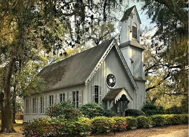
The current Holy Trinity Church was built in 1858. Two earlier versions dating as far back as 1824 were built as chapels of ease for planters using the Grahamville area as a summer retreat village. The live oaks that surround the building were planted by the women of the congregation in the 1800s.

Most of the buildings of Ridgeland were burned during the Civil War, but this church was spared, having served as Union headquarters during Sherman’s famous March to the Sea. Rumor also has it that horses were stabled in the church. The antebellum church was ransacked of its possessions during its occupation. Years later, in 1928 a bible belonging to the church was discovered in the attic of a New York music publisher. He returned it to the church with a note stating, “How it came into possession of my family I do not know.” The bible’s endsheet bears the scribbled name of a Union officer. The church now protects the bible as a treasured keepsake.

Photo by Richard Horry
The church is a notable example of Carpenter Gothic style architecture. The asymmetrical composition, wheel windows and buttressed tower are great examples of this style. The bell tower serves as a stairway that leads to the old slave gallery. A pipe organ now sits in this gallery. The interior boasts an original hammer-beam timber ceiling. If you would like to read more about this church, visit the Church of the Holy Trinity’s website.

Photo by Carie Robertson
Euhaw Baptist Church was first built on this site in 1860. This church is the second oldest Baptist organization in the South. Originally located on Edisto Island, the first structure was built in 1686. This church split, and relocated to the Grahamville village, which is now a part of Ridgeland. Euhaw means “Indian Lands.” The church was named in their honor. The original church at this location was burned during the Civil War. Luckily the congregation was able to restore it. Unfortunately, a forest fire destroyed the building in 1904, and the current structure was built in 1906.

Photo by Carie Robertson
This beautiful village church has gentle whispers of a late Victorian style. The asymmetrical arched and hooded windows, central round windows, towers and gingerbread draw homage to the period of architecture that was popular at the turn of the century. The 1906 Euhaw Baptist Church stands proudly as it was built, and no longer used for services. The congregation built a new more modern building next door in 1985. This structure is used only for special occasions. If you would like to read more, visit the SC Picture Project‘s page about the Euhaw Baptist Church or the EBC Faith Web.

Photo by Carie Robertson
Robertville Baptist Church
Robertville Baptist Church sits in the village of Robertville, just a few miles outside Ridgeland. The original 1824 church was burned during the Civil War. This beautiful structure was built in the 1840s and moved from Gillisonville to its current location in 1871. It was transported and moved piece-by-piece to the current site. Church members included Confederate Brigadier General Alexander Robert Lawton, who founded the American Bar Association, and his nephew, General Henry Martyn Robert, who wrote Robert’s Rules of Order.

Photo by Carmen Pinckney
The unaltered church is a lovely blend of Greek and Gothic Revival styles. The interior pews date to 1867. According to the National Register, the church “Remains unaltered and designed with graceful simplicity, the little church gains its charm from an unusual but successful blending of styles: the Greek Revival with Gothic Revival details. The portico is supported by only two Doric columns (without capitals) on pedestals. The double front paneled door is crowned by a lancet arch. The Gothic detail is repeated in the gable ornament above and in the windows. All interior wood is said to be original.”

Photo by Carmen Pinckney
If you would like to read more about this historic church, visit the South Carolina Picture Project’s page on the Robertville Baptist Church.

Photo by Carmen Pinckney
Gillisonville Baptist Church
Gillisonville Baptist Church stands proudly in what was once the courthouse village of old Beaufort District. The courthouse, square and adjacent buildings of Gillisonville were burned by Sherman’s army in 1865.

Photo by Carie Robertson
Built in 1838, the antebellum church was spared during the Civil War because it was used as headquarters for a contingent of Union troops when they passed through the area. A Union soldier carved into the original antique silver communion set “War of 1861-2-3-4. Feb. 1865″. As Union troops approached the Gillisonville village in 1865, a cannonball damaged the building’s steeple and bell tower. The tower has remained “steeple-free” as a reminder of its occupation. After the war the sanctuary served as a temporary courtroom until 1868, then the seat of government moved back to Beaufort.

Photo by Carie Robertson
The Greek Revival structure is covered in white clapboard and sits on a brick foundation. Constructed by local craftsmen, the church still possesses many of the original features. Boxed pews, random width flooring, and a former slave balcony can still be seen inside the sanctuary. The pulpit was repurposed and moved from the neighboring Coosawhatchie courthouse. It was formerly a judge’s seat. It is still in use today.

Photo by Carie Robertson
Holy Trinity Episcopal – 2718 Bees Creek Road, Grahamville
Euhaw Baptist Church – 2576 Bees Creek Road, Grahamville
Robertville Baptist Church – 26 Robertville Drive, Robertville
Gillisonville Baptist Church – 10158 Grays Highway, Gillisonville

For more interesting day trip ideas in the Ridgeland area visit https://southcarolinalowcountry.com/ridgeland-day-trips/ .
Information for this article can be found on the following websites:
South Carolina Picture Project
https://www.scpictureproject.org/
The National Register of Historic Places
https://www.nps.gov/subjects/nationalregister/index.htm
Moving Finger of Jasper Churches of the County, by Grace Fox Perry
http://genealogytrails.com/scar/jasper/churches.html


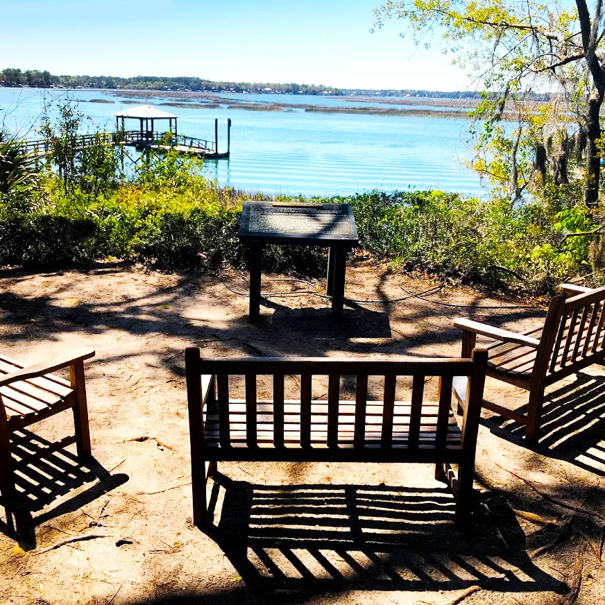


 The trails alternate between gravel, boardwalk and natural footing. The views around the lake are pretty, and the trails are relaxing.


