We’re Accessible

Limited mobility is not a problem in the SC Lowcountry.

mobility impaired destination
Sgt. Jasper Park photo by SC Lowcountry Tourism Commission.

The South Carolina Lowcountry is the perfect destination for people with limited mobility. The consistency of our flat ground makes reaching many attractions easily attainable. Come tour the natural beauty of our unspoiled landscape. Bask in the sunshine at one of our beaches, view the carefully preserved architecture and experience a fishing expedition. There’s something here for everyone!

Photo by Carmen Pinckney.

Beaufort

The sidewalks and streets of downtown Beaufort make touring the city quite easy. Take a walking tour of Beaufort’s Historic Churches, or tour along Bay Street’s Waterfront Homes. Venture across Boundary Street to view the Homes of the Point . The Historic Churches of Beaufort  can be viewed, either driving or walking.

Penn Center
Penn Center image by Carmen Pinckney.

Looking for an indoor adventure? Visit the Beaufort Arsenal Museum , or the Penn Center.

Sands Boardwalk image by Miles Sanders.

For beautiful sunsets that are unmatched in beauty, head over to Port Royal’s Sands Boardwalk. Make sure to stop by the Cypress Wetlands Rookery on the way. Roll through the paved trail loop and look for egrets, herons, eagles and migratory birds.

Image by Friends of Crystal Lake.

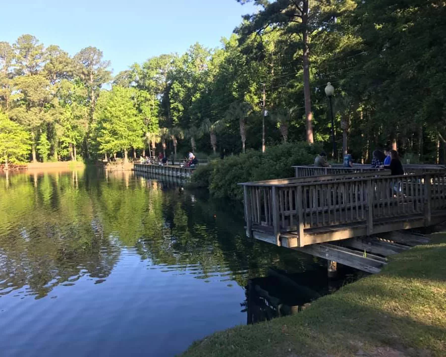
Interested in fishing while in Beaufort? Head over to the Crystal Lake Park. The 25-acre park has a boardwalk that surrounds the lake and has docks that are perfect for catch and release fishing.

Hwy 21 Drive-in image by Dan Reger.

Looking for nighttime fun? Beaufort is one of the few cities where you can step back in time and go to a drive-in movie. The Highway 21 Drive-in has been updated with a digital format and concession stand snacks can be ordered online. They have two screens which show double features Thursday – Sunday nights. Grab your blankets and pillows and have fun the old-fashioned way!

This image, taken from the top of the lighthouse, shows wheelchair friendly sidewalks that can be used to tour the lighthouse grounds. Photo by Bobby Weiner.

Like to go camping on the beach? The Hunting Island State Park Campground has an all-terrain wheelchair and Handicapped-equipped restrooms and mobi-mats that allow for smooth access to the beach. There’s also another wheelchair located near the lighthouse. Call 843-838-2011 for more information. Visit the nature center and the marsh boardwalk. Both are accessible by wheelchair. Tour the grounds of the lighthouse and see the footprint of the former facilities.

Spanish Moss Trail image by Carmen Pinckney.

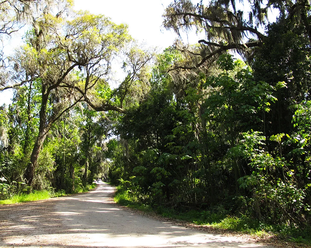
Beaufort’s Spanish Moss Trail is a 12-ft wide trail that follows the path to Parris Island that was used by the railroad to bring recruits to the marine training facility. No longer in use, the rails were removed, and a trail was constructed to lead visitors and locals along a path that winds through wooded areas and across the waterways of Beaufort County. Fishing can be done from several bridges along the way.

Bluffton

The Garvin-Garvey House and adjacent Oyster Factory Park have sidewalks for easy wheelchair access. Photo by Carmen Pinckney.

Old Town Bluffton is located along the shores of the May River. Stroll along the paths of the Oyster Factory Park or Wright Family Park. Oyster shell-paved sidewalks lead right to the door of the Garvin-Garvey House for a tour of Bluffton’s restored freedmen cottage. If Spending a Day in Old Town Bluffton be sure to visit the Church of the Cross, and stroll through the grounds of the Heyward House Museum.

The Bluffton Shell Art Trail leads throughout Old Town Bluffton. Image by Carmen Pinckney.

The Bluffton Shell Art Trail is another fun outdoor activity that is accessible. Download the map and set out to discover all 21 shells that are placed throughout the historic district.

Hilton Head

Image from Coastal Discovery Museum website.

Hilton Head is home to the Coastal Discovery Museum. This facility also has nature trails and a butterfly pavilion. The museum also conducts tours on site and around the island.

If getting out on the water is on the agenda, spend an afternoon Sailing the Coastal Waters. Tours range from dolphin searching to dinner cruises.

Hilton Head Beaches are handicapped accessible. Image from HiltonHead.com.

The town of Hilton Head offers matting for regular wheelchairs near beach accesses at Alder Lane, Coligny Beach Park, Driessen Beach Park, Fish Haul Beach Park, Folly Field Beach Park, and Islanders Beach Park. The town does not offer modified wheelchairs. Call 843-341-4600 for more information. 

Daufuskie Island is best seen by golf cart. Image from SC Living Magazine.

Daufuskie Island is an adventure that is not to be missed. The island is situated between Savannah and Hilton Head. It is only accessible by boat. Ferry services are available. Rent a golf cart and explore the Robert Kennedy Trail   and learn the History of this Gullah Paradise where Pat Conroy used to teach in a two-room schoolhouse. Explore the island to your heart’s content with so much to see. Experience the secluded beaches, Daufuskie Island Rum Company, Bloody Point Lighthouse, Historic Gullah Homes, Mary Field School, The Iron Fish Studio, historic churches, Silver Dew Winery, and so much more.

Hampton

Lake Warren fishing pier is the perfect place to park a wheelchair and throw out a fishing line. Image by SC Lowcountry Tourism Commission.

Hampton County is home to the Lake Warren State Park. Enjoy fishing in the lake for largemouth bass, brim, redbreast, and other freshwater fish. There are docks to fish from shore or you can rent a boat and troll the 200-acre lake.

Hardeeville

Look for alligators while driving through the Savannah National Wildlife Refuge.
Image by David Moran.

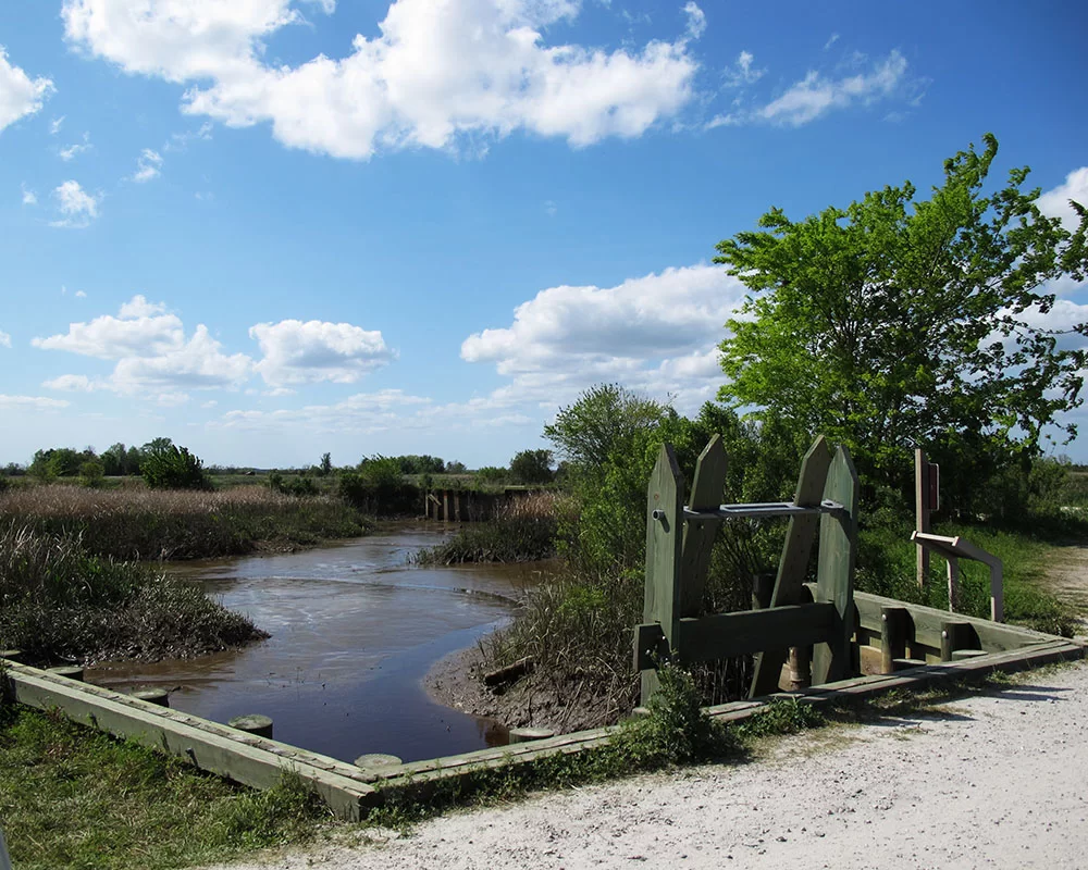
Hardeeville is home to the Savannah National Wildlife Refuge. This vast natural wonder has a driving tour through former rice fields that are teaming with an abundance of waterfowl. Look for alligators and migratory birds as you make the slow drive through the refuge.

Sgt. Jasper Park image by Carmen Pinckney.

Sgt. Jasper Park is another great place to view nature in Hardeeville. Several of the trails are designed for people with mobility impairment.  You can also fish at the park.

Ridgeland

Blue Heron Park image from Facebook.

Ridgeland’s Blue Heron Nature Trail winds around a pond and its surrounding wetlands. It’s conveniently located just off the interstate. It’s a great place to get out of the car and take in fresh air and relaxation.

Just up the street you’ll find the Morris Center for Lowcountry Heritage.   This museum has fun travelling exhibits and permanent displays.

Frampton Plantation House, c. 1868 – Lowcountry & Resort Islands Visitors Center and Museum has a ramp for easy access into the house. Photo by SC Lowcountry Tourism Commission.

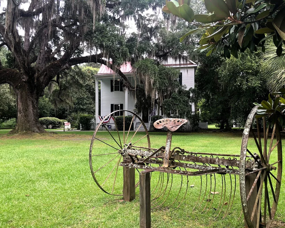
Another Jasper County gem that’s located on I-95 is the Frampton Plantation House Visitors Center and Museum. It has sidewalks, a picnic area and ramp for guests with disabilities. Come inside and see the 153 year-old house that was saved from demolition by the Lowcountry Tourism Commission.

Walterboro

Photo from Walterboro Wildlife Center Facebook.

The newly opened Walterboro Wildlife Center features native wildlife of the state’s largest city park, the Walterboro Wildlife Sanctuary. Come to the center to view the interpretive exhibit hall showcasing plant and animal life. Click HERE to see the newest addition to the collection. After a visit to the center, drive over to tour the sanctuary and experience nature firsthand.

Donnelley Wildlife Management Area photo by Carmen Pinckney.

Bear Island Wildlife Management Area and Donnelley Wildlife Management Area are other great places for bird watching. Both are easily driven, and nature can be seen up close and personal from the seats of your car. Look for Wood Storks, Roseate Spoonbills, and other native species.

Edisto Island

A drive down this avenue of oaks takes you to Botany Bay. Image by Carmen Pinckney.

Edisto Island is steeped in history and natural beauty. Botany Bay Wildlife Management Area is a beautiful spot to tour from your car. The entrance to the former plantation property is lined with an iconic alley of live oaks dripping in Spanish moss. Upon check-in, guests receive a driving tour map that includes information on the history of the property.   

Henry Hutchinson House image by Grayce Gonzalez.

The Henry Hutchinson House is another Edisto Island treasure. The house was built by a freedman during Reconstruction. It is the oldest house of its kind on the island. It has recently been restored and the exterior is on display to celebrate this important time in American history.

Photo from the Town of Edisto Beach Facebook.

Edisto Beach has rolled out the carpet for beach goers with disabilities – literally! New mats have been installed for visitors with mobility impairment. Beach wheelchairs are also available at the fire station. Simply call 843-869-2505, ext. 217 to make a reservation.

Read More

Ridgeland’s Blue Heron Nature Trail

Interstate weary? This conveniently located nature trail is just what the doctor ordered!

The 10-acre Blue Heron Nature Trail and Learning Center offers relief for the road-weary, and it’s as easy to get to as any rest area. The nature trail is conveniently located at Ridgeland’s I-95, Exit 21.

This in-town green space boasts a nature trail that travels around a three-acre pond and through forested wetlands filled with ferns and native plants. The property also includes a butterfly garden, picnic area, outdoor classroom, observation decks, and a Nature Center. Permanent trailside displays help visitors learn more about the native flora and fauna of Jasper County and the Lowcountry.

Along the trail you will find benches, swings, and an attractive butterfly garden. Be on the look-out for wildlife that frequently stop along the shores of the pond.

In addition to the herons, you may see egrets, ducks, turtles, fish, alligators, and other wildlife. The forest boardwalks take visitors in two different directions so make sure you travel both ways.

The nature trail is open daily dawn to dusk. The Nature Center is open Monday thru Friday 9 a.m. – 1 p.m.  Here you’ll find many displays of animals and other interesting facts about the South Carolina Lowcountry.

There is a parking lot that has plenty of room for a camper. The nature trail is also dog-friendly but be sure to pick up what your furry friend puts down.

Get out of the traffic and spend some quality time wandering around this natural gem located at 321 Bailey Lane in Ridgeland.

All images found on Blue Heron Nature Center Facebook page.

For more information on places to go and things to do in the SC Lowcountry visit https://southcarolinalowcountry.com/

Read More

Hollywood Loves the Lowcountry

The South Carolina Lowcountry is a great place to film a movie. The landscape is filled with oak lined alleys, lazy waterways, and charming small towns. Our sub-tropical sea islands are also another well-used place to set a jungle scene. Let’s not forget the beautiful beaches and classically southern architecture. Our chameleon-like environment and mild weather can transport production crews from the South to the Midwest, tropical islands, and even Europe. Let’s take a chronological look at the movies that have been filmed in Beaufort, Jasper, Colleton and Hampton counties.

The Great Santini is a Pat Conroy classic that was filmed in Beaufort. The Meechum family home scenes were shot in the house is known locally as Tidalholm. Many of the military scenes were shot at the Beaufort Marine Corps Air Station. All of the other scenes were filmed in and around Beaufort. Robert Duvall, Blythe Danner and Michael O’Keefe star in this 1979 coming of age drama classic.

Beaufort’s Tidalholm Mansion was also prominently featured in the film The Big Chill. It is a private home located in downtown Beaufort. The 1983 film includes the talents of Glenn Close, Jeff Goldblum, William Hurt, Kevin Kline, Mary Kay Place, Meg Tilly, Tom Berenger and Jo Beth Williams. Kevin Costner was also cast for the film, but unfortunately the only scenes that made the final cut involved his funeral. Filming sites also included Bay Street and streets along the Point. Tidalholm also serves as a main backdrop in The Great Santini, filmed just a few years earlier in 1979.

Full Metal Jacket was filmed on Parris Island in 1987. The island is home to the training facility of the US Marine Corps. Footage of an actual marine graduation was used in the film. The movie stars Matthew Modine, Adam Baldwin and Vincent D’Onofrio.

Pat Conroy’s Prince of Tides was filmed on Fripp Island. Just an island hop-skip-and-a-jump from Beaufort, the beautiful, unspoiled beach made the perfect backdrop for the film. Conroy wrote the book in 1986, while living in Beaufort. The movie was filmed on Fripp in 1991, then in 1992, Conroy moved onto the island. Nick Nolte drives across the Beaufort River in the opening scene of the movie. The private home at 601 Bay Street was used as well.  Nick Nolte, Barbara Streisand and Blythe Danner star in this Conroy classic.

Forrest Gump may have been set in Greenbow, Alabama, but it was mainly filmed in the South Carolina Lowcountry. Fripp Island, Beaufort, Hunting Island, Varnville, Walterboro, and Yemassee were all sights used in this iconic 1994 movie. Stars Tom Hanks, Robin Right, Sally Field and Gary Sinise travelled between Beaufort, Fripp Island, Varnville, Yemassee and Walterboro to create this American classic film that has left us with enough quotes to last a lifetime.

Disney’s Jungle Book was filmed in the South Carolina Lowcountry. The lush India jungle scenes were shot on Fripp Island, nearly 8,000 miles away from the story’s fictional setting. Locations for the war scenes were destroyed then later developed into a golf course. An abundance of exotic animals were brought onto the island foe filming, including monkeys, elephants and tigers. The 1994 movie carried a star-studded cast including Jason Scott Lee, Cary Elwes, Lena Heady, Sam Neill and John Cleese.

The War was filmed in Beaufort in 1994. The movie Stars Kevin Costner, Mare Wittingham and Elijah Wood. The movie follows the family of a Vietnam soldier as he tries to acclimate into his former life after the war. While his children build a treehouse in their small hometown of Juliette, Mississippi, they were actually filming in a Beaufort, SC live oak tree. Fun fact – this is Kevin Costner’s second time to film in the Lowcountry. He was in the cast of the Big Chill. Unfortunately all his scenes, with the exception of his funeral, were cut from the movie. Little did they know that he would become the Hollywood powerhouse that he is today.

King Farm scenes from Something to Talk About were filmed at Davant Plantation, just north of Ridgeland. Downtown Beaufort was also used for filming the college scenes. The restaurant at 822 Bay Street was used for a scene and many locals were cast as diners. The Beaufort County Library on Scott Street was used extensively during the production. Mobile dressing rooms were parked in the lot and the meeting room was used as well. The intersection of Craven and Scott Streets was a popular spot to try to catch a glimpse of Julia Roberts, Dennis Quaid, Robert Duval, Gena Rowlands, Kyra Sedgewick and the rest of the cast. The film was released in 1995.

Even Jim Carrey and Courtney Cox found their way to the Lowcountry when Ace Ventura was filmed in 1995. Edisto Island’s Botany Bay and Yemassee’s Cherokee Plantation were locations used for the comedy film. Botany Bay was the perfect backdrop to film the tropical jungle and African village scenes. The Georgian mansion of Cherokee Plantation and its manicured gardens served as the setting for the British consulate in Bonai. Fun fact – the president of General Motors, Robert Beverly Evans, once owned Cherokee Plantation and named the Jeep Cherokee after his Lowcountry estate.

Hollywood came to the Lowcountry was once again when the all-star cast, featuring Sharon Stone, Peter Gallagher, Randy Quaid and Rob Morrow visited Beaufort and Ridgeland to film Last Dance.  The 1996 film captured images of the Castle (411 Craven Street), Hunting Island and the newly constructed state prison in Ridgeland.

Parts of the movie White Squall were filmed in Beaufort.  The 1996 film stars Jeff Bridges and Caroline Goodall. The production crew transformed 510 Carteret Street, Beaufort, into the movie’s bus terminal. The churchyard of the Parish Church of St. Helena, 501 Church Street, was also used in the movie. The church, built in 1724, is a Beaufort landmark. Other Beaufort film sites included: Murr’s Graphic and Printing, 1012 Boundary Street, the Chocolate Tree, 507 Carteret Street, and areas of Washington Street.

Demi Moore and Viggo Mortensen made their way to the jungles of the Lowcountry in 1997 to film GI Jane. The movie dealt with the extreme physical and mental challenges of training for the elite Navy Seals. Survival camp scenes for this movie were filmed on Harbor and Hunting Islands.

Edisto Island’s Botany Bay was the setting for the beach slave camp in the movie The Patriot. The movie was shot in entirely in South Carolina in 101 days from September of 1999 to January of 2000. Benjamin Martin’s (Mel Gibson) character is loosely based on the legend of South Carolina’s famed “Swamp Fox,” Francis Marion. The movie also stars Heath Ledger, Jason Isaacs and Joely Richardson.

Forces of Nature made its way along the east coast and filmed in the Lowcountry in 1999. Ben Affleck, Sandra Bullock, Maura Tierney and Blythe Danner shot scenes at the Beaufort home at 411 Craven Street. The mansion, commonly known as the Castle served as the Cahill’s house. The stars were guests at the Rhett House Inn during their stay in Beaufort. It’s fun to note that this is the third time that Blythe Tanner was cast as the mother in a movie filmed in Beaufort (Great Santini, Prince of Tides, Forces of Nature).

Rules of Engagement is another movie that was filmed on the South Carolina Lowcountry. Vietnam War scenes from this 2000 film were shot on Hunting Island. The island’s lush, semi-tropical landscape is reminiscent of the Vietnam jungle. The military film stars Tommy Lee Jones and Samuel L. Jackson.

Edisto Island’s Brookland Plantation served as the home of Matt Damon’s character in the 2000 movie Baggar Vance. Actors Will Smith and Charlize Theron join the cast with Damon. The movie was also directed by Robert Redford. Golfing scenes were filmed at the Pete Dye course in Bluffton’s Colleton River Plantation.

Inspired by a heart-warming true story, Radio was filmed in and around Walterboro. Many of the 2003 movie scenes were shot at Hampton Street Elementary, which was also a location used in Forrest Gump. Filming also took place at Colleton County High School. Many scenes were shot along Washington Street. The coach’s house is located on just outside Walterboro on Mt. Carmen Road. Radio stars Cuba Gooding, Jr., Ed Harris and Debra Winger.

Cassina Point Plantation on Edisto Island was a scene from the movie Dear John. This was the site of Savannah’s (Amanda Seyfried) family home. Seyfried and Channing Tatum were filmed there for several scenes in the 2010 motion picture. Both stars shared their thoughts in a www.sciway.net post:
“I love South Carolina,” says Channing Tatum. “I’m from the South, so I have an addiction with it. The food, the people, the lifestyle. It’s just so charming.”
“The South is a whole different thing altogether. It’s romantic. It’s just so beautiful. It brings something to a film you can’t get anywhere else in the world.” – Amanda Seyfried

More recently Beaufort has been used in the production of the 2019 Netflix hit Outer Banks. While the story line takes place in North Carolina, filming is done in the Lowcountry of South Carolina. While a majority of the scenes were filmed in the Charleston area, Hunting Island plays a prominent roll in the series. The island was the spot for the nighttime beach scenes. And the boneyard beach area was the location for several party scenes. The Hunting Island Lighthouse also makes an appearance while the characters search for clues to a hidden treasure.


Stars Fell on Alabama was filmed in Beaufort and Bluffton in 2019. The romantic comedy was filmed throughout Beaufort, including Bay Street, The Beaufort Inn and Blackstone’s Cafe. Other locations included Port Royal, Beaufort Academy on Lady’s Island, and the Old Town Dispensary in Bluffton.  The film is scheduled to premiere in film festivals in the fall of 2020.

To take a movie tour of the Lowcountry visit southcarolinalowcountry.com/beaufort-port-royal-st-helena-tours.

Photo credit for movie scenes: IMDb.


Read More

Lowcountry Ghost Stories ~ Part 5

Part 5 – Jasper County

Jasper County has seen its share of battles over the years. First the Revolutionary War, then the Civil War took its toll on the county. The story of Purrysburg predates both historic events. The settlement of Purrysburg was established on the banks of the Savannah River by Swiss Protestants in 1734. By 1736, the town had 100 houses and 450 settlers. The town soon began to suffer from disease and unhealthy conditions. Those that survived moved on to other surrounding towns in the state and Savannah.

The town would once again see activity in 1779, when it was the site of the Battle of Purrysburg during the Revolutionary War. A 2015 excavation unearthed more than 100 musket balls, several canister shots, and many explosive shells. The battle was a British victory, but the American Patriots fought them off for one year in several skirmishes across the Lowcountry, including Bees Creek and Coosawhatchie. British troops returned to Purrysburg to rest before heading to Charleston. The Patriots were not captured. In fact, they were able to get word to other troops of the British advancement. Today, Purrysburg is the site of a boat landing. The only thing that reminds of the settlement of long ago is a historic monument. Just how many settlers and soldiers died on this spot is unknown. Do any ghostly specters haunt these grounds? If one believes in such things, one will have to admit the possibility.

The city of Hardeeville began to develop and flourish just as the Civil War came to town. During Sherman’s March to the Sea, his army blazed a trail through the town, leaving only one church and a few homes. The Hardeeville Methodist Church was spared because it served as a make-shift hospital for injured soldiers. How many soldiers died in this church? That is unknown. Do any souls haunt the grounds? That is unclear as well. You be the judge of that.

Ridgeland also experienced a visit from Sherman’s men. The Battle of Honey Hill was fought in 1864, and Union soldiers spent time in the Grahamville community. Officers stayed in a home on Bees Creek Road and used the Holy Trinity Church as headquarters. The Union army expedition failed to cut off the railroad between Charleston and Savannah. The battle saw 89 Union and eight Confederate casualties. Although the battle was a Confederate victory, it only delayed the capture of Savannah by a week. The battle was also significant because it was the first large scale combat engagement by a majority African American force. It was launched by the US African American Troops, including the 54th Massachusetts. After the war, these troops were stationed in Port Royal during Reconstruction.


Just outside Yemassee, Frampton House is nestled under ancient live oaks, dripping in Spanish moss. It is also the home of a few ghostly residents. It is said that the Frampton House has a few residents who have not moved on from this physical world into the afterlife. The house and surrounding land have witnessed a great deal of history and some of those souls may not be ready to leave just yet.

The Frampton name dates back to the 1700s, when thousands of acres were given as a King’s Land Grant to the Frampton family. It was divided into working plantations. During the Civil War, Robert E Lee commissioned earthworks built directly behind the house. This is a spot that was used to successfully (for a time) defend the railroad. In 1865 Union troops burned the original plantation home and the surrounding buildings. Frampton returned in 1868 and built the structure that still stands today. After seeing many owners and falling into disrepair, the house was acquired by the Lowcountry Tourism Commission in 1993.

Today visitors to the house report feeling a ghostly presence. Some have encountered an old woman in the front parlor. Others say they have seen a small girl on the stairs. Stop by and see for yourself so you can draw your own conclusions. The house is open daily, from 8:30 am – 5 pm. Stop by and wander the house and grounds. Have an open mind and see if you can discover one of the spirits that roam the property.

Ghost stories are a part of the Lowcountry folklore. They are woven into our history and have been passed down through generations by elders sitting on the front porch, rocking, and enjoying sweet tea. They are the stories that children love to hear repeatedly. They are best told after dark, especially during the Halloween season. Are they true? Who knows? Can they be debunked? Who cares? Are we going to keep telling them? Of course. Are we going to enjoy the telling? Absolutely!

Three ghostly images were altered for your enjoyment! Did you find them? Happy Halloween!

Read More

Why is a spottail bass called a red fish? Because it’s a fish of many names!

Fall is finally here and it’s the season for catching redfish in the South Carolina Lowcountry! These fish are available year-round but tend to move from shallow water to deeper inshore waters during the fall.

Photo by Neal Kendrick of Carolina Tails Charters.

The redfish, or spottail bass is the Lowcountry inshore fisherman’s most popular gamefish. This highly sought-after saltwater fish has many names, depending on the geographic location. The South Carolina Department of Natural Resources refers to it as a red drum. Along with redfish and spottail and red drum, this fish is also known as a channel bass and puppy drum. Why did it get the name redfish? Some say it’s because of the copper color of its scales.

Image from C1 Films and Jon Halker.

Traditionally in the Lowcountry it was known as a spottail for the distinctive black spot on its tail. Sometimes the fish will have more than one spot. On rare occasions it will have no spot at all. What is the purpose of the spot? The spot resembles an eye. This trick of nature fools predators into attacking the fish from the tail, allowing it a chance to swim away from danger.

This popular gamefish is prized by inshore fishermen in the Lowcountry because it is a great fighter, and it can grow to incredible size. The South Carolina record was caught in 1965, weighing 75-pounds. Fish that size are required by law to be released. It’s the smaller fish that is the most delectable.

Even Georgia residents enjoy fishing for redfish in the South Carolina Lowcountry.

How did this fish get so many names? That is a great question. This fish has been a popular catch for anglers throughout our history. It even had more names in the 1930s than it does today. Prior to the 1930s, most Lowcountry anglers called it a channel bass. For some reason, the species was, and still is, known by one name in one locality and an entirely different one just a few miles away.

When in Edisto, get in touch with Edisto Watersports to show you the best spots to find redfish.

According to the “Woods and Waters” column from Charleston’s News and Courier,  “Along much of its coastal range the fish, which we know as channel bass, is the redfish,” explained one column written in 1938. “This is the name by which it goes along the southwest coast of Florida all along the Gulf and the Texas coasts … The outstanding characteristic of this fish is the black spot, just about at the base of the caudal fin, or tail … Seen in shallow water, the tail of this fish assumes a beautiful shade of blue. In body color, the reddish cast of the scales is plainly apparent.”

Anglers can catch redfish from Lowcountry riverbanks. Photo by John Holloway.

“Drum is another name, and it is known as the branded and beardless drum. The name ‘branded’ comes from the appearance of the black spot near the tail, which is always an infallible ‘field mark’ of the fish. The real drum is a different fish, and, as some of the natural histories put it, is possessed of ‘a much larger and more resonant musical organ.’ It is known that the drum can emit sounds which are heard at a considerable distance.”

Daily redfish excursions can turn into friendly competitions. This one is a tie because one is longer and the other weighs more! Photo by Charles Pinckney.

Angler Robert S. Barnwell, Jr. offered even more colloquial names for the spot-tail in 1933. “In Virginia the bass is called red drum; in Florida red fish; in South Carolina simply bass. We divide them into three classes according to size – school-bass, stag-bass and channel-bass … we fish for school-bass in the creeks, for stag-bass in the surf, and channel-bass in the rips of harbor banks. As a rule, the school bass are below 16 inches, stag or surf bass range from 20-22 inches, and the channel bass above 36.”

This one is a beauty. Photo by C1 Films.

It doesn’t matter what you call this fish, there is no doubt about its popularity in the SC Lowcountry, where today it is widely known as the redfish. It has become so popular that a strict catch limit was put in place to keep the species at healthy numbers. In 2018 a limit of two fish per day (per angler) and six fish per boat are allowed. A keeper can only be between 15 and 23 inches long. Most anglers, however, prefer to catch and release. Redfish are a designated state gamefish, therefor if caught in South Carolina waters, redfish cannot be sold. According to the South Carolina Department of Natural Resources Update to Red Drum (Redfish) Regulations (effective July 1, 2018) they may only be taken by rod & reel and gig. Restrictions on both sport and commercial fishermen allowed the species to rebuild.

Neal Kendrick of Carolina Tails Charters holds a redfish with multiple spots.

According to WRDG Chief Meteorologist and avid fisherman Riley Hale, “Redfish reach maturity around 4 years of age and once that happens, they are able to spawn. Slot redfish between 15-23 inches are less than 4 years of age and are usually the ones caught in tidal creeks and rivers. The slot limit is capped at 23 inches to protect the mature fish that spawn. During the fall, redfish spawn and can usually be found off South Carolina beaches, which makes them a prime target for anglers.” Hale also has good tips for protecting redfish during catch and release. https://www.wrdw.com/content/news/Catch-limit-on-redfish-in-South-Carolina-changes-July-1-486850941.html

Kayaking is another way to catch redfish. Photo found on meateater.com.

Redfish like to feed on crustaceans and other animals that live in the seagrass of the shallow waters. When they do this, their tails have a tendency to extend above the water in a behavior called “tailing”. When they do this, their distinctive spot can be seen on the base of its caudal fin. This is just as exciting as watching a dolphin break the surface. To see an amazing video on fishing for redfish and the tailing behavior filmed by Salt Creek Outfitters visit www.youtube.com.

Taylor Horton of Salt Creek Outfitters enjoys catching redfish.

Redfish also go by the name drum, due to the low, croaking sounds made by the male to attract females during spawning. They make these noises by contracting the muscles attached to its “swim bladder”. Redfish spawn in August and September, then the female will lay around 1.5 million eggs at a time.

A day on the water is always a good idea when catching redfish like this one! Photo by Neal Kendrick.

Redfish can be found in the SC Lowcountry year-round. For the first three years of their lives they thrive in our marshes, bays, and inlets, feeding on shrimp, fiddler crabs and small bait fish. In the fall of their fourth year they migrate offshore with spawning populations. These fish are immensely powerful and fun to catch. Anglers like to look for them tailing around grassy marsh areas during flood tides when large schools begin to form in the fall.

Photo by C1 Films.

According to Wikipedia chef Paul Prudhomme made a popular dish of Cajun-style Blackened redfish. The seasoning was then sold commercially. The dish became so popular that redfish were overfished to the point of near extinction in the 1980s. Then, in a 2009 episode of Iron Chef America, redfish was the secret ingredient for competitors, who used the fish to prepare several dishes.

Photo by Charles Pinckney

Tony Royal and Tuck Scott from Beaufort’s Bay Street Outfitters had interesting ideas regarding the difference in terminology of our local fish. According to Tony, “The origin of ‘redfish’ most likely came out of the UK, in the 1500’s where they have had a history of referring to things in nature that are red as “Red”. Red Bird, etc. Red Hair as Redhead. Some salmon in Pacific are also referred to as redfish. There is a lake in Idaho called Redfish Lake due to migration of salmon there. The origin of spottail (or spot tail) bass appears to more local, used along the SC coast in particular. It is not a bass but a red drum. There are also black drum. Smaller pinfish are also called spots. They are along our shoreline in warm months.”

Anglers of all ages enjoy catching redfish. Photo by Neal Kendrick.

Here’s Tuck’s interpretation: “The term Redfish came from Louisiana just like the term Spot tail bass came from here locally, but it is Paul Prudhomme who made it popular enough for places to use “Redfish” over other names and the proper name of Red drum. As a member of the Drum family. Red drum are the only drum that only the male drums.”

Special thanks to Suzannah Smith Miles and Riley Hale for their wonderful articles that educated me on redfish and its many names. Thanks also to Tony Royal and Tuck Scott for their insightful thoughts and Erin Weeks –  Media & Communication Coordinator for the SC Department of Natural Resources – Marine Resources Division.

…..not at all confusing…..right?

Interest in planning a fishing trip to the South Carolina Lowcountry? Visit https://southcarolinalowcountry.com/fishing-and-hunting/.


Read More

Forrest Gump Filming Locations

26 years ago, but just like yesterday!

Forrest Gump may have been filmed over 26 years ago (in and around Beaufort), but the movie has not diminished in popularity. We often get visitors into the welcome center at Frampton Plantation House that are eager to see the local movie locations. The movie was set in Greenbow, Alabama, but was actually filmed, for the most part, in the SC Lowcountry and Savannah. Several locations are not too far from our visitors center at I-95, Exit 33 and Hwy 17. MAP TO LOCATIONS.

During the movie, Forrest is compelled to go to the Four Square Gospel Church to pray for shrimp. These scenes were filmed in the tiny area of McPhersonville, at Stoney Creek Independent Presbyterian Chapel (155 McPhersonville Rd.) This church was built in 1833 and is listed on the National Register of Historic Places.

From Frampton Plantation, turn right onto Hwy. 17 and proceed north for 1.4 miles. Turn left onto Hwy 21/ 17-A towards Walterboro. Travel 5 miles, then slow down when you see the Harold’s Country Club sign. Turn left just before this locally famous restaurant onto Pocotaligo Rd. Continue 4.2 miles until you see Sheldon Chapel on the right. (This isn’t the church from the movie, but it is also historically significant.) Turn just before it and proceed slightly farther. The road ends at the church.  

To visit the town where Forrest grew up, head to Varnville, SC. Return to Pocotaligo Rd. and turn left. Travel 11.2 miles miles, then turn right onto Main St. When the road ends, turn right onto Hwy. 278/Gray’s Hwy. Continue for 4.1 miles. The road merges with SC 68. Continue to the left. Once you enter Varnville, turn right onto Main St.

The Gump House is no longer standing. It was built specifically for the movie. Since it was hastily built (not to code) it was dismantled after production. The entrance is still visible. It is on the 8,000-acre Bluff Plantation property. It only took two months to build the house, and only a handful of rooms were finished for filming.  Turn left from Main St. and travel down SC Hwy. 68 for 15.1 miles. Take a slight right onto Connely St. in Yemassee for .2 miles. Turn left onto Hwy 17-A and follow it for 3.6 miles. Next turn right onto Combahee Rd. The entrance will be 5.3 miles further at 3547 Combahee Rd. This property is privately owned, so please be respectful. Jenny’s house was also built on this property but was destroyed for the film.

The setting for Greenbow’s elementary school is the former Walterboro Academy. It now serves as the Colleton Civic Center. (506 East Washington Street, Walterboro.) This was the setting for the principal’s explanation of Forrest’s intelligence testing scores.  From Bluff Plantation, return 5.3 miles to Hwy 17-A and turn right. Travel toward Walterboro for 11.5 miles. Take a slight right onto S. Jeffries Blvd. In 1.8 miles turn right onto Hampton St. The destination will be .4 miles away on the right.

After you leave this scene, head to Beaufort via Hwy 21/Carteret St. The Woods Memorial Bridge connects Beaufort to Lady’s Island. This is the scene for the running bridge interview. This is not the mighty Mississippi, but the Beaufort River. This historic swing bridge connects Beaufort to the sea islands. It is one of a handful of swing bridges that still exist in the state. It’s also the home of the annual “Run, Forrest Run 5K”.

The house where Bubba lived is next on the tour. Continue across the bridge and just over a mile. Turn left at the light onto Sam’s Point Rd. Keep going through the traffic circle (take the second exit). Stay on Sam’s Point Rd. for six miles. Turn left onto Alston Rd. 145 Alston Rd. will be on the right. This 1,240 square foot house was built in 1940. Bubba’s grave site was constructed in the back yard. This is a private residence. Please be respectful. The water adjacent to the house is the Lucy Point Creek. That’s where the majority of the shrimp boat scenes.

Bubba’s momma was played by Dr. Marlena Smalls. This classically trained soprano founded Beaufort’s Gullah Festival and the Hallelujah Singers. Her singers were also featured in the movie. She is well-known for using music and stories to educate others about Lowcountry Gullah customs and beliefs.

To visit the Vietnam war scenes, return down Sam’s Point Rd. and back to Hwy 21. Turn left onto Hwy 21/Sea Island Pkwy. As you drive toward Hunting and Fripp Islands, notice the march and waterways. They should look familiar. You will also pass Gay Fish Company on the right. They supplied all the shrimp for the movie.

Their dock is also where Forrest paints ”Jenny” on his boat. The Gay Seafood boat “Miss Hilda” can be seen in the background of that scene. Docked shrimp boats paint a beautiful scene. Travel for 16.8 miles. You will drive past the entrance to Hunting Island State Park.


The boardwalk will be on the right. Park and walk along the boardwalk while you’re here. The war rescue scene that earns Forrest a medal happened inside the park at the lagoon.

The Ocean Creek Golf Course at Fripp Island was also the location for war scenes. The mountains and larger palm trees were added by special effects.

For more information on fun attractions in the SC Lowcountry visit https://southcarolinalowcountry.com/.

Movie images are screen shots from the film.

Read More

Point South’s KOA Campground

Looking for a fun place to camp this fall? Look no further than the Point South KOA Campground. Don’t have a camper? No problem! They have cabins as well as camp sites. The pool is available and wine is sold by the glass.

The Point South KOA is located in the heart of the SC Lowcountry, just off I-95, Exit 33. It is a great hub for visiting Beaufort, Bluffton, Hilton Head, Walterboro, Hampton, and Ridgeland. There are plenty of spaces for campers, or “glamp” in one of the cabins located on site. There’s even a cabin inspired by Frank Lloyd Wright.

Point South KOA Campground is pet friendly. The large dog park and Camp K-9 make travelling with your pup more fun.

Wide open spaces and plenty of fresh air can be found in the surrounding counties of the SC Lowcountry. Donnelley Wildlife Management, Bear Island and the ACE Basin National Wildlife Area are located to the north of the campground and Savannah National Wildlife Management Area is just south. Bring the bikes and head over to Beaufort’s Spanish Moss Trail.

For old fashioned family fun, spend the day playing at the campground. Mine for gems at the playground. Play tether ball, corn hole, horseshoes, life-size chess or Jenga. Adults can unwind with a glass of local wine, craft beer or specialty coffee from the Swimming Mermaid Coffee House located at the campground. Leave the cooking to the staff, relax, and enjoy made-to-order pizza, wings and breadsticks around a campfire.

Camping is an experience that can be enjoyed by everyone, especially in these difficult times when families are reconnecting and spending more time together. Since most schools are operating remotely this fall, why not take a trip to explore nature, disconnect from technology and reconnect with those you love most.

Point South KOA is excited to announce they have won the Trip Advisor Traveler’s Choice Award for the sixth year in a row! Make your reservations and plan a trip to the Point South KOA.

Open All Year

Reserve: 800-562-2948

Info: 843-726-5733

14 Campground Rd (I-95 @ Exit 33) & US 17

Yemassee, SC 29945

koa.com/campgrounds/pointsouth

For more information on fun things to do in the SC Lowcountry visit southcarolinalowcountry.com.

Read More

Top Ten Natural Wonders to See Between Charleston and Savannah

Just south of Charleston and north of Savannah, a natural paradise awaits your visit! The historic Kings Highway 17 travels through the beautiful SC Lowcountry and these protected treasures.

Top Ten Natural Wonders to See Between Charleston and Savannah
Wood stork image captured by Ira Runyan at Donnelley Wildlife Management Area.

The area that lies between Charleston and Savannah is a nature lover’s paradise. Here you will find wildlife management areas, nature trails, church ruins and a welcome center located in a historic house.

1. Ernest F. Hollings ACE Basin National Wildlife Refuge

Top Ten Natural Wonders to See Between Charleston and Savannah
ACE Basin Oak Grove Plantation House photo by Carmen Pinckney.

The Ernest F. Hollings ACE Basin National Wildlife Refuge is located off Hwy 17, on Hwy 174 towards Edisto Island. The refuge is home to a vast array of waterfowl, and the Antebellum Oak Grove Plantation House.

Top Ten Natural Wonders to See Between Charleston and Savannah
Stretch your legs and visit the trails of the ACE Basin National Wildlife Refuge.
Photo by Carmen Pinckney.

A walk behind the house leads visitors to the former rice fields. Rows, dikes, trunks, and gates are still visible today. The paths are marked and meander around the rice fields and wooded areas. Make sure to bring your camera and be on the lookout for wildlife. For more information visit https://southcarolinalowcountry.com/ernest-f-hollings-ace-basin-national-wildlife-refuge/.

2. Botany Bay Wildlife Management Area

Top Ten Natural Wonders to See Between Charleston and Savannah
Drive through the Lowcountry’s most photographed live oak canopy at Botany Bay.
Photo by Carmen Pinckney.

A venture further down Hwy 174 onto Edisto Island will bring you to the wildlife management area of Botany Bay Plantation. This is one of the most unique destinations on Edisto Island. The 4.000+ acre property boasts historical buildings, maritime forest, a boneyard beach and freshwater ponds. The property is covered in pine, palm and live oak trees, dripping with Spanish moss. Don’t be surprised to see deer, alligators, shore birds, crabs, raccoons and many other maritime forest creatures.

Top Ten Natural Wonders to See Between Charleston and Savannah
Botany Bay’s boneyard beach is covered in shells.
Photo by Carmen Pinckney.

There are two sites listed on the register of historic places at Botany Bay. A set of three surviving 1840s outbuildings and the prehistoric Fig Island Shell Ring can be seen on the property. Explore the plantation house ruins, walk the forest trails, or stroll the beach on this South Carolina controlled wildlife management area. Botany Bay Wildlife Management Area is a great place to spend a day. Bring a picnic, beach chairs and kayaks. Explore the wonders of the South Carolina Lowcountry! For more information visit https://southcarolinalowcountry.com/edisto-islands-botany-bay/.

3. Edisto Nature Trail

Top Ten Natural Wonders to See Between Charleston and Savannah
Edisto Nature Trail photo by David Lucas.

Jacksonboro is the perfect spot to get out and stretch your legs on the Edisto Nature Trail. The trail is located on Highway 17, adjacent to the Edisto River. Jacksonboro is in the area known as the ACE Basin. This low-lying part of the state is full of former rice plantations with beautiful marsh and river views, and teaming with wildlife.

Top Ten Natural Wonders to See Between Charleston and Savannah
Edisto Nature Trail photo by David Lucas.

The boardwalk trail meanders through the woods that change from pineland and maritime forests to cypress and tupelo swamp. Before and after the Revolutionary War, this area was rich in rice production. A 15-minute walk along the boardwalk will take you to a dock overlooking the Edisto River. You can also press on and take the 1.5-mile loop trail that can be completed in about an hour. It will transport you from the wetlands to higher upland forest area. Make sure to wear appropriate shoes. Be sure to bring bug spray if you come in the spring or summer. For more information visit https://southcarolinalowcountry.com/hiking-the-edisto-nature-trail/.

4. Bear Island Wildlife Management Area

Top Ten Natural Wonders to See Between Charleston and Savannah
Bear Island image by Pluff Mudd Perspectives.

Bear Island Wildlife Management Area is located off Hwy 17 in the Green Pond area. This wildlife management area is managed to provide quality habitat for wintering waterfowl. It’s a great spot to view bald eagles, wood storks and roseate spoonbills.

Top Ten Natural Wonders to See Between Charleston and Savannah
Bear Island is a great place to photograph birds. Photo by Jim Killian.

Drive through this area for many opportunities to spot wildlife. The forest, marsh and river views are beautiful. Bear Island is located between the Asheepoo and South Edisto Rivers. From Hwy 17, turn onto Bennett’s Point Road and follow for 13 miles. The entrance is on TiTi Road. (843)844-8957. For more information visit https://southcarolinalowcountry.com/explore-sc-lowcouontry-wildlife-preserves-and-nature-trails/.

5. Donnelley Wildlife Management Area

Top Ten Natural Wonders to See Between Charleston and Savannah
Donnelley Wildlife Management Area drive image by Carmen Pinckney.

Donnelley Wildlife Management Area is a favorite spot for tourists and locals alike. It is located on Hwy 17 in Green Pond (between Yemassee and Jacksonboro) in the heart of the ACE Basin. This is a great place to glimpse Lowcountry nature at its finest. The property features a historic rice field system, which is now managed to attract waterfowl and migratory birds. The drive is pleasantly lined with beautiful old live oaks.

Top Ten Natural Wonders to See Between Charleston and Savannah
Roseatte Spoonbills can be found at Donnelley, along with many other species of birds.

The driving tour covers about 11 miles and should take from an hour to half a day, depending on how many stops you make. The marked stops on the map serve simply as suggestions; feel free to stop anywhere along the way (although please park on the shoulder) and walk off the road at any point to get a closer look at wildlife or native plants. Take extra precautions when viewing alligators, especially during the spring mating season. For more information visit https://southcarolinalowcountry.com/colleton-countys-donnelley-wildlife-management-area/.

6. Old Sheldon Church Ruins

Top Ten Natural Wonders to See Between Charleston and Savannah
Old Sheldon Church Ruins image by Carmen Pinckney.

A simple turn off Hwy 17 onto Old Sheldon Church Road is like stepping back in time. Travel up the road for about two miles and see the church ruins on the right. Parking is located across the street. This church was burned during the Revolutionary War, rebuilt, and then destroyed again during the Civil War.

Top Ten Natural Wonders to See Between Charleston and Savannah
Old Sheldon Church Ruins includes a historic graveyard.
Photo by Carmen Pinckney.

Located just past the turn to Beaufort off Hwy 17, Sheldon Church has laid in ruin for more than 140 years. Its gable roof, pediment, windows & interior have disappeared, but the classic simplicity of its design still remains. Burned by British troops in 1779 and destroyed again during the Civil War it still serves as a religious center for special observances. For more information visit https://southcarolinalowcountry.com/experience-a-driving-detour-through-yemassee/.

7. Frampton Plantation House & Visitors Center

Top Ten Natural Wonders to See Between Charleston and Savannah
Frampton House sits conveniently at the intersection of I-95 and Highway 17.
Photo by Carmen Pinckney.

Historically speaking, the Frampton House property was part of an original King’s Grant to the Frampton family in the 1700s. The family oversaw the production of 4,000 acres of cotton, rice, and other crops. During the 1865 Campaign of the Carolinas, General Sherman’s troops burned the plantation house and all the farm buildings that stood on this site.

Top Ten Natural Wonders to See Between Charleston and Savannah
Go back in time at Frampton House. Photo by Carmen Pinckney.

The house was rebuilt in 1868 and the property was probably used for share cropping and tenant farming. Once slated for demolition, the house has been restored and the ground floor is open to the public. The second story holds the offices of the Lowcountry Tourism Commission. Frampton House is open to the public seven days a week, from 8:30 a.m. – 5:00 p.m. Come see us for all your SC Lowcountry travel questions and insider secrets. For more information visit https://southcarolinalowcountry.com/history-is-preserved-at-frampton-plantation-house/.

8. Blue Heron Nature Trail

Top Ten Natural Wonders to See Between Charleston and Savannah
Blue Heron Nature Trail travels along a pond and Lowcountry wetland. Photo by Lynn Boyles.

Blue Heron Nature Center & Trail offers relief for the road-weary, and it’s as easy to get to as any rest area. 

This 10-acre green space meanders around a three-acre pond and through forested wetlands. The property also includes a butterfly garden, picnic area, outdoor classroom, observation decks, and a 4,200-square-foot Learning Center. Permanent trail side displays help visitors learn more about the native flora and fauna of Jasper County and the Lowcountry.

Top Ten Natural Wonders to See Between Charleston and Savannah
Look for turtles and fish from the docks at Blue Heron Nature Trail. Photo by Lynn Boyles.

The nature trail leads you around the pond with several scenic overlooks along the way. Along the trail you will find benches, swings, and an attractive butterfly garden. In addition to the herons, you may see ducks, turtles, fish, alligators, and other wildlife. Also, several boardwalks take you through the surrounding forested wetlands. Get out of the traffic and spend some time relaxing while you wander around this natural gem. For more information visit https://southcarolinalowcountry.com/lowcountry-activities-ridgeland-i-95-exit-21/.

9. Sgt. Jasper Park

Top Ten Natural Wonders to See Between Charleston and Savannah
The boardwalks at Sgt. Jasper Park are wheelchair friendly. Photo by Carmen Pinckney.

Hardeeville’s Sgt. Jasper Park is conveniently located off I-95, at Exit 8. After exiting the interstate, point toward Hilton Head and turn left at the first traffic light. Follow the road around until you bump into the park entrance. Trails are located on both sides of the road. Some trails are wheelchair accessible. This is a great place to get off the interstate and stretch your legs. Dogs are welcome here, on a leash. A trail map is available in the park office.

Top Ten Natural Wonders to See Between Charleston and Savannah
Lowcountry nature trails are great places to walk the family dog while travelling. This trail is at Sgt. Jasper Park. Photo by Carmen Pinckney.

The trails alternate between gravel, boardwalk and natural footing. The views around the lake are pretty, and the trails are relaxing. There are other opportunities at the part as well. There are canoes, kayaks, and a disk golf course. Information can be found in the park office. There’s a playground for the kids and plenty of picnic spots. There is also a covered picnic shelter. Grills can be found at the park as well. The disk golf course is located on the left side of the road. The park also has fishing opportunities. For more information visit https://southcarolinalowcountry.com/spending-time-at-sgt-jasper-park/.

10. Savannah National Wildlife Refuge

Top Ten Natural Wonders to See Between Charleston and Savannah
The Savannah National Wildlife Refuge still operates a historic trunk system that controls water flow into the former rice fields. Photo by Allyson Jones.

The Savannah National Wildlife Refuge offers a variety of opportunities to explore and enjoy the great outdoors from sunrise to sunset every day. You can observe and photograph wildlife. Make the Savannah National Wildlife Refuge Visitor Center your first stop when visiting the refuge. The refuge is located on Hwy 17 between Hardeeville and Savannah.

Top Ten Natural Wonders to See Between Charleston and Savannah
Drive through or hike the trails of the Savannah National Wildlife Refuge.
Photo by Allyson Jones.

The Savannah National Wildlife Refuge protects old rice fields & numerous species of wildlife including ducks, birds, deer, & alligators. The 4-mile driving tour is free and open sunrise to sunset. Wildlife viewing is excellent for photography, especially during fall, winter, and spring, along the 4-mile Laurel Hill Wildlife Drive and adjacent hiking/bicycling trails. Many species of wading and marsh birds can also be spotted here throughout the year.

The trails adjacent to the Kingfisher Pond Recreation Area are great for watching woodland songbirds during spring and fall migrations. Summertime brings in an array of species that nest on the refuge. For more information visit https://southcarolinalowcountry.com/savannah-national-wildlife-refuge/. To explore the hiking trails visit https://southcarolinalowcountry.com/savannah-national-wildlife-refuge-hiking-trails/.

Top Ten Natural Wonders to See Between Charleston and Savannah
The unspoiled natural habitat of the SC Lowcountry is pristine breeding grounds for many birds. This bald eagle was spotted at Bear Island by Rhonda Epper.

Visitors could easily spend several days in the area exploring all the natural wonders located between Charleston and Savannah on Highway 17. Pick a few favorites or see them all. The choice is yours. Bring along the camera, a picnic and don’t forget the bug spray!

Top Ten Natural Wonders to See Between Charleston and Savannah
Pack a picnic and stop for lunch at Frampton House. Enjoy free wifi, picnic tables, clean restrooms and a friendly staff ready to help you on your journeys.

Visitors could easily spend several days in the area exploring all the natural wonders located between Charleston and Savannah on Highway 17. Pick a few favorites or see them all. The choice is yours. Bring along the camera, a picnic and don’t forget the bug spray!

If you’re looking for a more civilized picnic spot under the oaks, plan to have lunch at Frampton Plantation House. Our ground floor contains a visitors center, complete with restrooms, museum displays and a gift shop. The backyard has picnic tables and plenty of room to stretch your legs. As always, pets are welcome both inside and out! Our friendly staff can answer any questions or give suggestions for their favorite attractions in the area. For more information visit https://southcarolinalowcountry.com/ or call 843-717-3090.

To download a PDF version of the map, complete with addresses and phone numbers click HERE.


Read More

The Lowcountry Revolutionary Trail

Follow the Revolutionary War path of Dr. Uzal Johnson as he traveled the Lowcountry.

lowcountry revolutionary war trail, sc

The Lowcountry Revolutionary Trail winds through Beaufort, Colleton, Hampton and Jasper Counties. It follows the path of Dr. Uzal Johnson of the New Jersey Volunteers during the Revolutionary War.

lowcountry revolutionary war trail, sc

Dr. Johnson, a loyal American volunteer spent time in the Lowcountry during the spring of 1780. He witnessed skirmishes at Ft. Balfour, Saltketcher’s Bridge, McPherson’s Plantation, and the Battle of Coosawhatchie. You can retrace his footsteps and see what remains of the sites.

Frampton Plantation House Gazebo
  1. Start your Lowcountry Revolutionary War journey at Frampton Plantation House gazebo. Located behind the house, the gazebo contains a map of the sites and information about the trail. Come inside the visitors center if you have any questions, or need directions. We will be happy to help you with this journey. Frampton Plantation House is located behind the Marathon Gas Station in Point South 698 Kings Highway (Hwy. 17),
    843-717-3090.
lowcountry revolutionary war trail, sc

The first stop is the location of the Battle of Coosawhatchie (Hwy 17 at the Coosawhatchie River bridge). On May 3, 1774 Lt. Col. John Laurens and 250 men were in position on a slight rise near the bridge at Coosawhatchie. They were guarding the road against the expected assault by about 2,400 British soldiers from Savannah. Against orders, Laurens and his men crossed the river and formed a line for battle. With many of the soldiers and Laurens himself wounded, they fell back to the Tullifinny River, about two miles east.

lowcountry revolutionary war trail, sc

2. Look for the Lowcountry Revolutionary War Trail marker on the eastern side of Highway 17 near the Coosawhatchie River bridge, and in front of the Second African Baptist Church, 6904 W. Frontage Rd.(Hwy 17). The sign bears an excerpt from Dr. Johnson’s journal stating, “Despite the defeat at Port Royal Island, General Prevost was determined to make a second attempt to capture Charleston. Instead of a small detachment of 150 men, this time he crossed the Savannah River with 2,400 British regulars, and once again, William Moultrie stood in his way. This time, however, Moultrie was outnumbered 2 to 1. He determined to make a stand on a slight ridge at the Tullifiny River, about 2 miles east of the Coosawhatchie River, where he left about 200 men to guard the crossing and warn him of the Redcoats arrival. As the enemy drew near, Moultrie was about to send as aide to pull these troops back to the main force when Col. John Laurens offered to lead them back. Moultrie had so much confidence in the officer that he sent along 250 men to help cover the flanks. In direct disobedience of orders Laurens crossed the river and formed the men in line for battle. He failed to take the high ground and his men suffered greatly from well placed enemy fire. Laurens himself was wounded, and his second in command fell back to the main force at the Tullifinny, where Moultrie was compelled to retreat towards Charleston.” Excerpt from South Carolina’s Revolutionary War Battlefields A Tour Guide.

lowcountry revolutionary war trail, sc

3. From here, Dr. Johnson headed to the home of Isaac McPherson, who was described by the doctor as “a great (Revolutionary) Rebel, a man of property. British soldiers occupied the McPherson Plantation March 14-17 while trying to track down 50 Americans on horseback. During the occupation, the British engaged in what they thought was a skirmish with the Americans. They were mistaken and attacked their own troops instead.

lowcountry revolutionary war trail, sc

The historical marker is located beside the Sheldon Chapel, 25481 Pocotaligo Rd. in McPhersonville. It reads, “Tuesday 14th March 1780 – At four o’clock in the afternoon, Col. Ferguson and part of the American Volunteers and twenty men in the British Legion proceeded nine miles to McPherson’s Plantation. We got to Isaac McPherson’s at nine o’clock. Fifty Rebels on horseback had just left this and gone to John McPherson’s. A party of ours pursued them but could not overtake them.

Wednesday 15th March 1780 – Still at McPherson’s Plantation foraging parties get everything that is needed for the Army.

Thursday 16th March 1780 – Lay at McPherson’s living off the fat of the land, the soldiers every side of us roasting turkeys, geese, fowl, ducks, pigs, and everything in great plenty. This McPherson is a great Rebel, a man of property and at present is in Charles Town.” Excerpt from the Diary of Dr. Uzal Johnson, Surgeon.

lowcountry revolutionary war trail, sc

4. The British left McPherson’s Plantation on March 18, 1780 and marched to the crossing of the Saltketcher (now the Salkehatchie) River, where a bridge had stood before the beginning of the war. They were met by 80 American militiamen who tried to prevent their crossing. The British Light Infantry crossed the river below this spot and came up behind the Americans. A captain and 16 privates were bayoneted to death by the British, who then spent the night at nearby Ogilvy’s Plantation.

lowcountry revolutionary war trail, sc

The historic sign is located at the boat ramp on Hwy 17-A on the Salkehatchie River, just outside Yemassee. It states, “Saturday 18th March 1780 – Got in motion eight o’clock in the morning and marched ten miles to the Saltketcher. Major Lordson with eighty militiamen placed themselves on the north side of the river to oppose our crossing. They were opposed by the British Legion returning their fire at a place where the bridge formerly stood, while the light Infantry and remainder of the Legion crossed the river below and came in their rear before they knew of it. Here the bayonet was introduced. A Capt. Mills and sixteen privates of the (Revolutionary) Rebels were killed, four badly wounded and one made prisoner that luckily escaped the bayonet.

Sunday 19th March 1780 – Passed Saltketcher River that place where the bridge stood.”
Excerpt from the Diary of Uzal Johnson, Surgeon.

lowcountry revolutionary war trail, sc

5. In the fall of 1780, the British built an earth and palisade fort to maintain control of Beaufort and protect the King’s Highway (Hwy 17) between Savannah and Charleston.  Ft. Balfour was built at the key crossroad at Pocotaligo and named for the British commander of occupied Charleston. In April of 1781 Col. William Harden was detached from Gen. Francis Marion’s Brigade with 100 men. On April 14 Harden convinced old friends from Beaufort who were in command of Ft. Balfour that he had more troops than he did and that they should surrender. They believed him and did. Learning that British soldiers were on the way from Charleston, Harden and his men burned the garrison.

lowcountry revolutionary war trail, sc

No one is quite sure of the fort’s exact location today, but the marker is places alongside the marsh of the Pocotaligo River at 2 Trask Parkway (Hwy. 17), beside the Family Worship Center Church. It reads, “In order to maintain control of the Beaufort District and protect communications on the King’s Highway, an earth and palisade fort was built on the high ground between Coosawhatchie and Pocotaligo bridges: the strategic crossroads of the Southern Parishes. This fort was named for the commander of the British garrison at Charleston during the fall of 1780, Lt. Col. Nisbet Balfour, one of the most disliked officers in South Carolina.” Excerpt from the Diary of Uzal Johnson, Surgeon.

Locating these historic spots and reading the journal entries of Dr. Johnson gives visitors the chance to reflect on how intensely our forefathers fought for the freedoms that we enjoy today. Let your gaze wander the landscape where these brave men engaged in battle and fought valiantly to protect us.

For more information on attractions in the SC Lowcountry visit https://southcarolinalowcountry.com/.

Read More

Farmers Markets of the South Carolina Lowcountry

With summer quickly approaching, SC Lowcountry Farmers Markets are in full swing! Enjoy some fresh air, browse, and take home local produce.

While social distancing and wearing masks are still important habits to keep, the markets are open and have plenty to sell! Each market takes place out of doors in the fresh air. Check your calendar, find your market basket and head to SC Lowcountry farmers market that’s closest to you!

Port Royal Farmers Market Lowcountry

The Port Royal Farmers Market is open from 9 a.m. – noon each Saturday. The market officials ask that all visitors wear a mask and observe social distancing rules. Vendors will also accept preorders. Some of the items available include red potatoes, white potatoes, yellow squash, cucumbers, fresh bread, meats from Calibogue Catering, bakery goodies, shrimp, breakfast sandwiches, poultry products, flowers, and fresh pasta.

For more information or to sign up for weekly information visit https://portroyalfarmersmarket.com/. You can also sign up for their weekly newsletter alerting you to what’s going to be at the market for the week.

The Farmers Market of Bluffton in Lowcountry

The Farmers Market of Bluffton is another Lowcountry favorite.  Every Thursday, from 12-3 p.m. Calhoun Street is closed to traffic and transformed into a street market. Shop for fresh pasta, in season fruits and veggies, homemade bread and bakery items, fresh meats, jams and jellies, and prepared goodies. Don’t miss Hank’s Lowcountry she crab soup and the Cottage Bakery. If it’s a scorcher, treat yourself to a Palmetto Ice Pop!

The Bluffton Farmers Market in Lowcountry

The Bluffton Farmers Market information can be found on https://www.farmersmarketbluffton.org/. You can also sign up for their weekly newsletter to find out about what’s in season and for sale on Calhoun Street.

The Hilton Head Farmers Market happens every Tuesday, from 9 a.m. – 1 p.m. on the grounds of historic Honey Horn Plantation. Take home fresh local produce, pasture raised chicken, free range rabbit, pork, seafood, salsa, fresh sausage, cookies, breads, she crab soup, and more.   Free parking in the Coastal Discovery Museum parking lot, 70 Honey Horn Drive.

Local farmers, producers, vendors, and food trucks will be at the market to share the bounty of their crops. Three Sisters Organic Farm will be there to sell fresh zucchini, cucumbers, and tomatoes. The Grind Roasters will be there as well, to grind your favorite flavors of coffee. For more information visit https://www.coastaldiscovery.org/.

Ridgeland’s Jasper County Farmers Market kicks off the weekend every Friday from 1 – 6 p.m. The Market will host a variety of vendors including produce, baked goods, prepared meals, arts, crafts and estate sales.

You can find the Jasper County Farmers Market on Main Street, across from Fiddler’s Seafood Restaurant. For more information visit  http://jaspersc.org/farmers-market/.

If you’re in Walterboro, the Colleton Museum and Farmers Market offers fresh vegetables and fruits, local honey, local crafts, plants, baked goods, prepared food, music, and much more. The market is open on Saturdays from 9 a.m. until 1 p.m. 

The mission of the market is to “encourage, support, and promote the entrepreneurial efforts of local, independent, small-scale farmers, food artisans and crafters seeking to sell products directly to the consumer while operating independently from large corporate or factory farms and businesses.” You can find the market at 506 East Washington St., in historic downtown Walterboro. For more information visit http://www.colletonmuseum.org/farmers-market.

For more information on things to do in the South Carolina Lowcountry visit https://southcarolinalowcountry.com/.

Read More

See what our visitors love about the
SOUTH CAROLINA LOWCOUNTRY

Use the #hashtag #sclowcountry to get your image featured!

The Lowcountry & Resort Islands Region of South Carolina includes the four, southern-most counties in the state, Beaufort, Jasper, Hampton, and Colleton, which are bordered on the east by the Atlantic Ocean and on the west by the Savannah River and the state of Georgia.

#gailannlovinthedrive #huntingisland #sclowcountry #atlanticocean
Black-bellied Whistling Duck #blackbelliedwhistlingduck #birds #birdsofinstagram #birdphotography #wildlife #nature #sclowcountry #magnoliaplantation #magnoliaplantationandgardens #magnoliamoments #palmettostate #bestofpalmettostate #getoutside #shotoncanon #audubonsociety #nationalgeographic #natgeo #natgeowild
Otter, #otter #wildlife #nature #naturelover #sclowcountry #magnoliaplantation #magnoliaplantationandgardens #magnoliamoments #palmettostate #bestofpalmettostate #getoutside #shotoncanon #audubonsociety #nationalgeographic #natgeo #natgeowild
So happy that “Clouds Gather” has found its forever home. 💖 I hope this painting brings joy and memories of happy times to the new owners. #partagergallerygiftsandhome  #acrylicpainting #SCLowcountry  #southcarolina
Waking up early may seem dawn-ting, but a colorful sunrise is always a nice tree-t
Brown Pelicans are a regular site around the coastal waters of the SC Lowcountry. This beautiful image was captured by Jay Wooster. 🦅#thatsmylowcountry #sclowcountrySC Lowcountry Tourism Commission
"Gator for Lunch," Great Blue Herons #greatblueheron #nestingseason #birds #birdsofinstagram #birdphotography #wildlife #nature #naturelover #sclowcountry #magnoliaplantation #magnoliaplantationandgardens #magnoliamoments #palmettostate #bestofpalmettostate #getoutside #shotoncanon #audubonsociety #nationalgeographic #natgeo #natgeowild
Discover at your own leisure at the coastaldiscoverymuseum 🌳  From century-old buildings with storied pasts, to wooden boardwalks that stretch into the Jarvis Creek salt marsh, there's always something to explore!
Spanish moss drapes the live oak trees that are ubiquitous to the Edisto Island area. Did you know that Edisto gets its name from the native Edistow people? The Edistow Native Americans were a sub tribe of the Cusabo indians, a group of Native Americans who lived along the Atlantic coast in South Carolina.⏰ Best time of the day to visit: Stop by mid-morning. That way you can explore the island, grab lunch, and stay for the amazing sunset if you choose.🏖️ Things to do while there: Edisto Environmental Learning Center, Boneyard Beach, Scott Creek Inlet, Big Bay Creek, SeaCow Eatery.☀️ Things to visit in the area: Jungle Road Park, Bay Creek Park, Otter Islands, Spanish Mount Point.📆 Best time of the year to visit: For warmer weather come anywhere from March-August.🏨 Where to stay: Fripp Island Golf & Beach Resort (frippislandrsrt), Seabrook Island Club (seabrook_sc), The Sanctuary at Kiawah Island Golf Resort (kiawahresort), Charleston Kiawah Island/Andell Inn (andellinn).Photo by qcphotographer
A visitor takes a leisurely stroke under a canopy of live oaks draped with Spanish moss in the Palmetto Bluff (palmettobluff) neighborhood of Bluffton, South Carolina. Palmetto Bluff is a picturesque community that sits in the heart of Lowcountry. Nestled along the May River, it’s abundant with beautiful walking trails, historic sites, and stunning views.⏰ Best time of the day to visit: There is no wrong time to visit Palmetto Bluff. However, we highly recommend sticking around for one of their spectacular sunsets.🛶 Things to do while there: Stop by Cole’s for some regionally inspired Southern fare, paddle board, kayak, or canoe along the May River, go saltwater fishing, take a tour at Bluffton Jack's Old Town Tours.🌊 Things to visit in the area: Palmetto Bluff Conservancy, Old Town Bluffton, Bluffton Oyster Factory Park, May River Sandbar, Heyward House Museum and Welcome Center (heywardhouse).📆 Best time of the year to visit: For the best weather, we recommend visiting between March and May or from September to November.🏨 Where to stay: The Montage Palmetto Bluff Resort (montagepalmettobluff) is the only resort in Palmetto Bluff. However, there are plenty of places to stay in the surrounding areas including: Old Town Bluffton Inn (oldtownblufftoninn), The Inn & Club at Harbour Town (theinnandclubatharbourtown), Sonesta Resort Hilton Head Island (sonestahhi).Photo by jpgriceoz
Riding into the weekend like...Isn't this live oak tree tunnel beautiful? Live oak, draped in Spanish moss, is emblematic of South Carolina and many of the Southern states. We love these iconic trees, not only for their beauty, but their history as well. The average lifespan of a live oak is 300 years!Photo by qcphotographer
The shore gently recedes beneath the stunning Pawleys Island Pier. The unique island town, located about 25 miles south of Myrtle Beach and 70 miles north of Charleston, exudes laid-back, beachy vibes. Locals have definitely adopted an island state of mind and encourage visitors to as well. When you go, make sure to relax on the beach, explore the famous sand dunes, or fish in one of the many adjacent creeks.⏰ Best time of the day to visit: We guarantee that you’re going to want to spend a whole day here. We recommend getting to the beach at around 10am.🗓️ Best time of the year: Pawleys Island has the best weather during the spring and early summer months.🏖️ Things to do while there: Pawleys Island Nature Park, Pawleys Island Chapel, Hopsewee Plantation.🐠 Things to visit in the area: Brookgreen Gardens (brookgreen_gardens), take a walking ghost tour, Myrtle Beach (mymyrtlebeach), Harborwalk Marina, South Carolina Maritime Museum (southcarolinamaritimemuseum).🏨 Where to stay: The Oceanfront Litchfield Inn (oceanfrontlitchfieldinn), Litchfield Beach and Golf Resort (litchfieldbeachandgolf), Sea View Inn (seaviewinn), 620 Prince (620prince).Photo by qcphotographer
What were your weekend views today? #DiscoverSC 📸📍Botany Bay Beach: charlestonshopcurator
Headed down the road....Edisto Island.  #edisto #sclowcountry #trees #endofday  #beauty #islandsofsc
Angel Oak, Johns Island, South Carolina. ⠀
⠀
The Angel Oak Tree is a Southern live oak (Quercus virginiana) located in Angel Oak Park on Johns Island near Charleston, South Carolina. The Angel Oak Tree is estimated to be at least 400 and possibly up to 1400 years old It stands 66.5 ft (20 m) tall, measures 28 ft (8.5 m) in circumference, and produces shade that covers 17,200 square feet (1,600 m2). Its longest branch distance is 187 ft. in length. ⠀
⠀
#angeloak #angeloaktree #southcarolina #johnsisland #charleston #DiscoverSC #lowcountry	#SCLowcountry #lowcountrylife	#igerssouthcarolina #blackandwhite #b&w #oaktree #legacyoak #blackandwhite	#blackandwhitephotography #totravelistolive	#travel_captures	#travellove	#travelpics	#travelpic	#travelbug	#travelandlife	#lifeisajourney #adventuroussoul

The South Carolina Lowcountry Guidebook is filled with many things to see and do in the beautiful Lowcountry of South Carolina. Please fill out the information and we will send you a FREE GUIDE BOOK.

    Stay Up To Date

    Sign up for our newsletter!